(3:20PM 5/4/21)
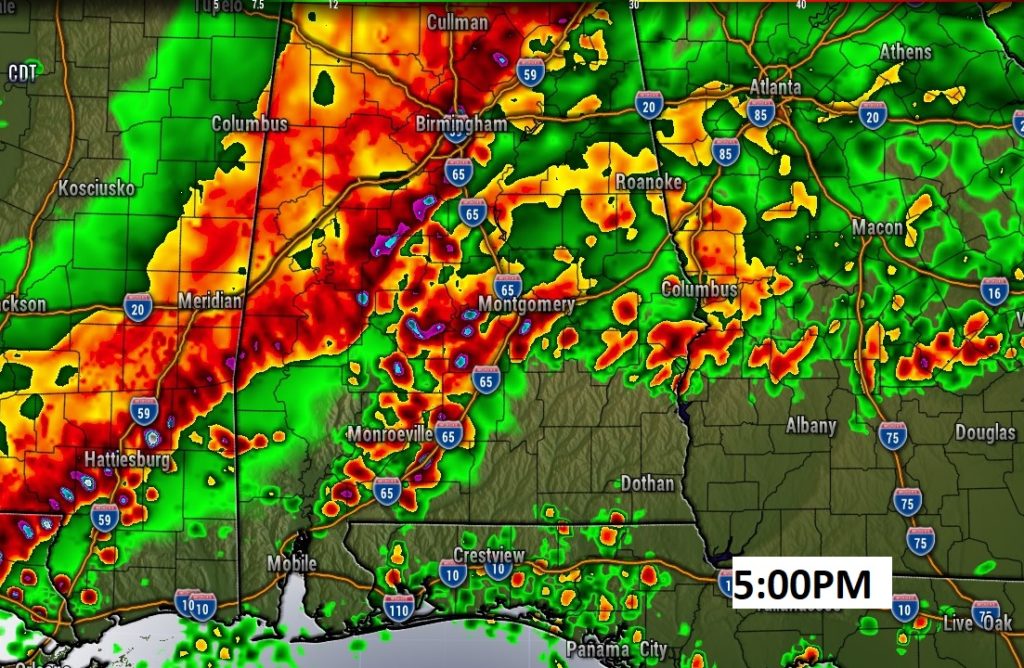
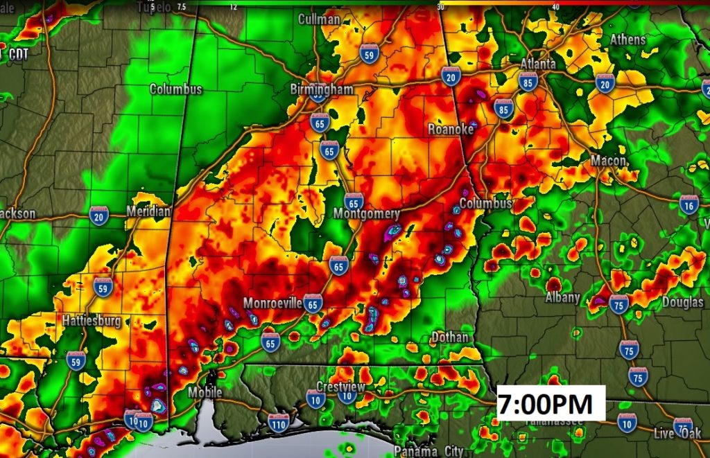
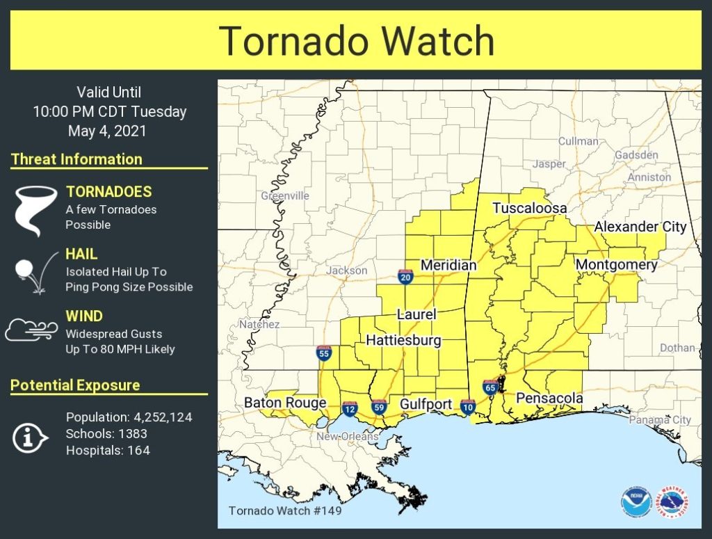
Tornado Watch till 10PM Risk of tornadoes, damaging wind gusts to 80 mph, ping pong size hail. Enhanced Severe Weather Risk. ALL of Alabama is included in the risk. A complex of thunderstorms will race through Alabama this afternoon and this evening.. The line will make it into southeast Alabama tonight. Along the leading edge of this storm complex widespread wind damage is possible, if not likely.
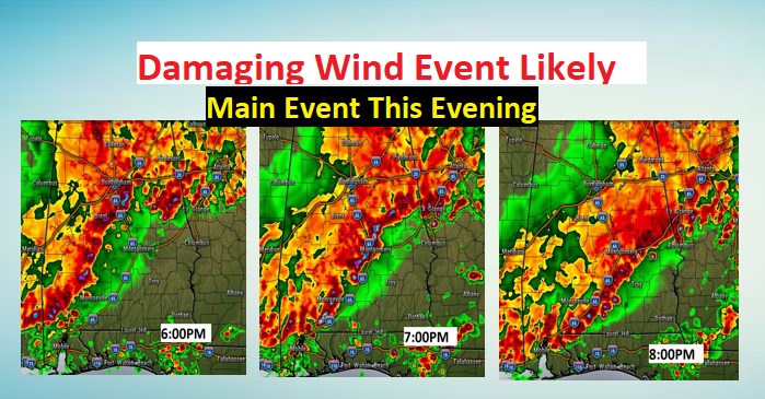
This may help your planning. A powerful squall line will rapidly sweep through central AL late this PM into the evening. All modes of severe weather are possible, especially widespread damaging wind gusts perhaps to 75 mph. The line reaches SE AL tonight. Be prepared For many of us, this would be between 6 to 9PM tonight. The line could accelerate to 50 mph as it sweeps through.
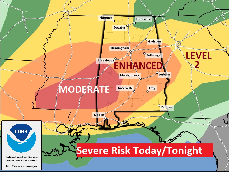
UPDATED Day 1 outlook from the Storm Prediction Center now includes an upgrade to Level 4 Moderate Risk across parts of Mississippi and West Alabama. #mswx#alwx
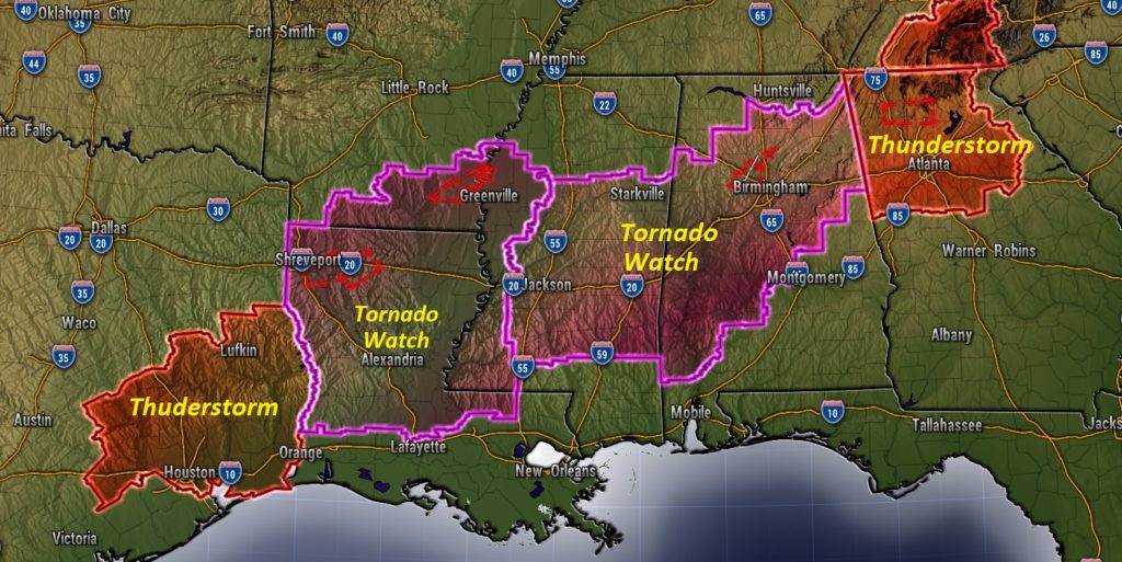
As of early this morning, weather watches already extended more than 1000 miles from Texas to Tennessee. Now watches extend as far NE as Washington DC.
EARLY MORNING UPDATE:
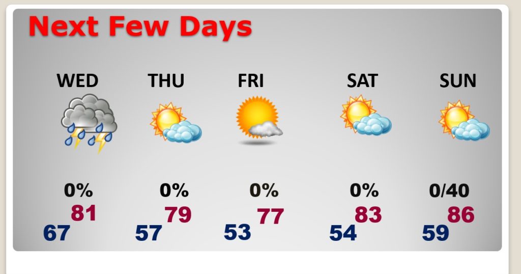
Are you ready for another round of big storms today? Be ready. The Storm Prediction Center has us in a Level 3 Enhanced Risk. There could be a couple of rounds of storms this afternoon and this evening. A massive of complex of storms will set the stage for the potential for widespread wind damage, localized flooding, large hail and the risk of tornadoes. This is ahead of a Cold Front which will sweep through the state overnight. Much nicer air will follow. Thursday and Friday will be nice days. We’ll look ahead to the Mother’s Day weekend. On today’s video I’ll outline the details of today’s severe risk. Wait till you see Future Radar.
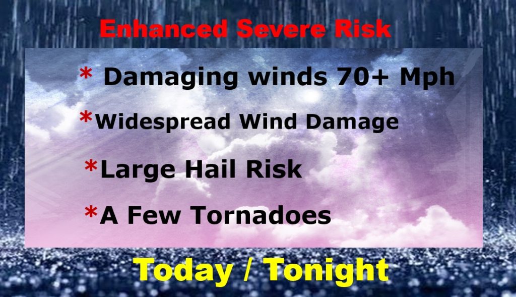
ENHANCED Severe Weather Risk today. This is a much more significant situation for the state than yesterday.
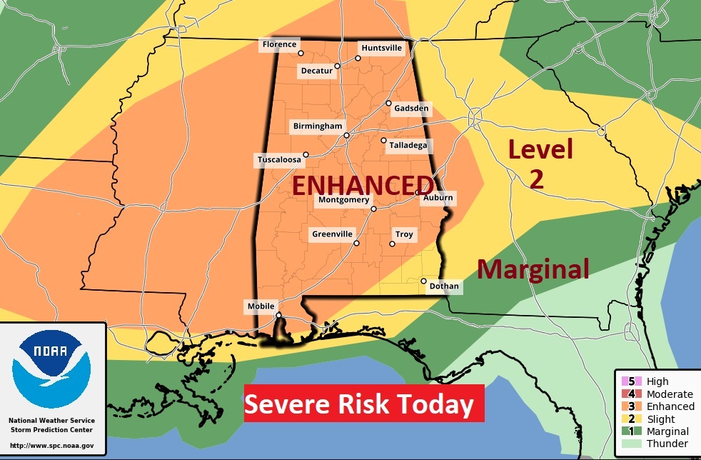
All modes of severe weather are on the table today. Be ready. Our Weather App will instantly alert you to a Watch or Warning for your location.
Here’s a sample of Future radar. There could be widespread wind damage across the area today
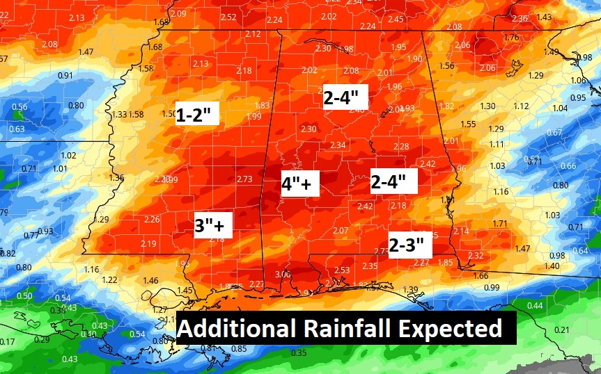
Like yesterday, there could be localized flooding in spots.
NICE air follows the storms. Thursday and Friday will be comfortable. Saturday will be warmer. Sunday will be warm & dry during the daytime.
