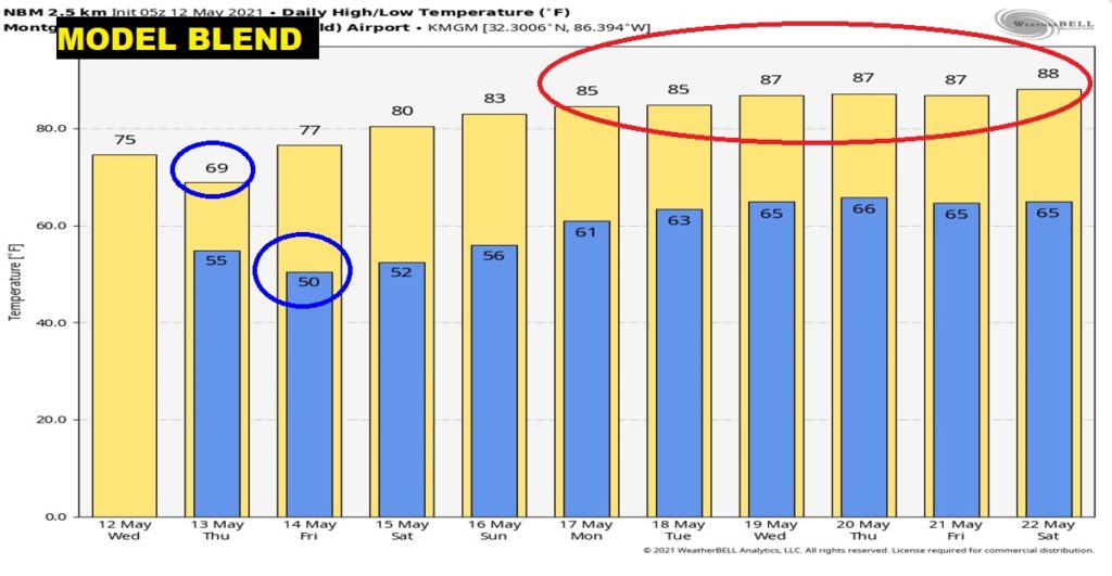
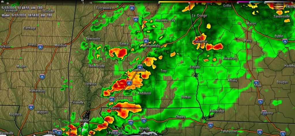
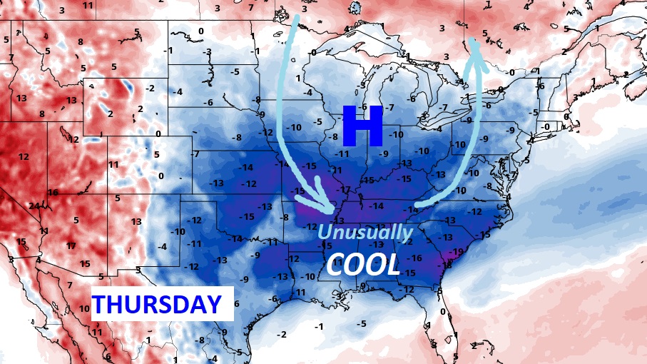
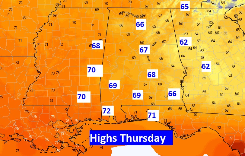
Good Morning! Radar is colorful early this morning. More widespread rain, and a few storms, is in the cards for much of the state today and tonight. But, the rain chances will start to taper off early in the day Thursday. Some very cool air for so late in the season will filter in Thursday. We will be close to breaking a record for the “coolest highs” in some spots. Jacket weather Thursday night. Near 50 by Friday AM. But, get ready. We are in for yet another beautiful series of days starting Friday. On this video, I’ll fill in the details…through the weekend and beyond for here and the Gulf Beaches.
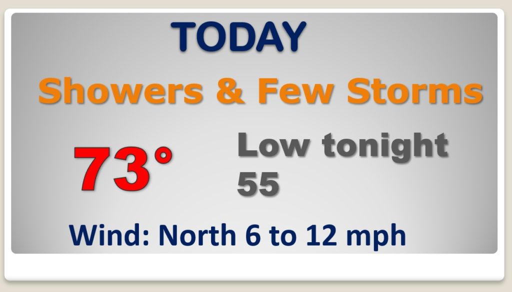
Periods of rain and a few storms today and tonight. A Little cooler.
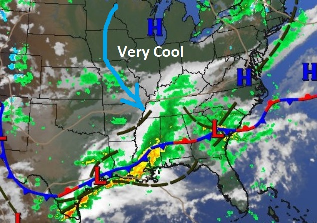
Massive High pressure in the Midwest will circulate some unusually cool air into the state Thursday and Thursday night. We’ll be teasing the record for the “coolest Highs” on Thursday. Jacket weather Thursday night.
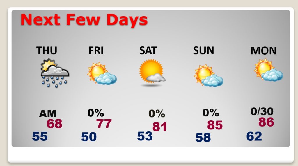
Very cool Thursday. Chilly Thursday night. Nice weather returns Friday. Warming trend Saturday and Sunday. Beautiful Weekend, Continued warm Monday. Risk of showers of showers returning Monday night into Tuesday. \
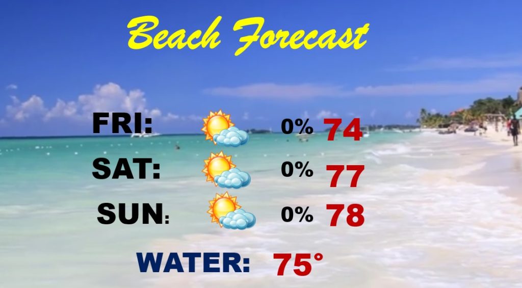
Looks like yet another GREAT weekend on the Gulf Coast!
Warming trends starts Saturday. Much warmer next week.
