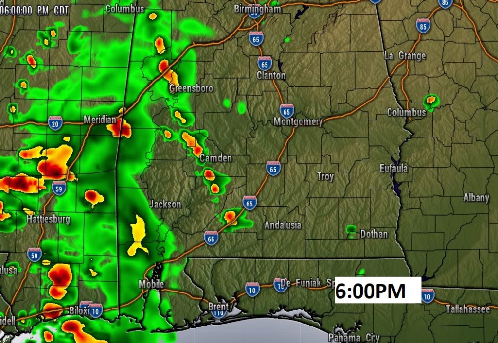
Good Morning! Today the shower threat will spill into West Alabama. Most of us will be high and dry. After today, the rain chance will vanish from the state for several days. As upper level high pressure grows stronger, Alabama will feel more and more like summer each day through the weekend and beyond. The risk of showers will be slim and none for several days. Could we be headed for mid-90 degree heat by next week? Get ready for and Extended Summer Preview. And, you’ll need to get out the garden hose soon.
Today the shower threat will spill into West Alabama. A disturbance will tease us with a tiny shower threat. The main shower threat will elude most of us. I have the rain chance under 20% for most of us. West Alabama will see a higher threat. After today, the rain chance vanishes for several days.
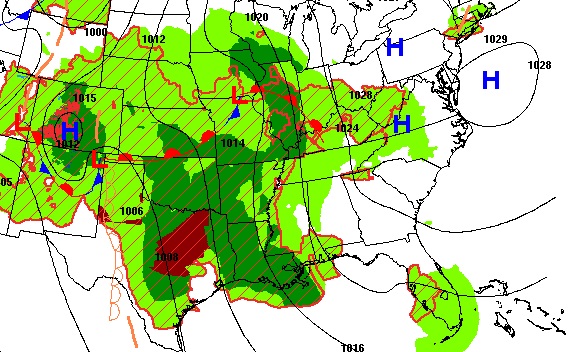
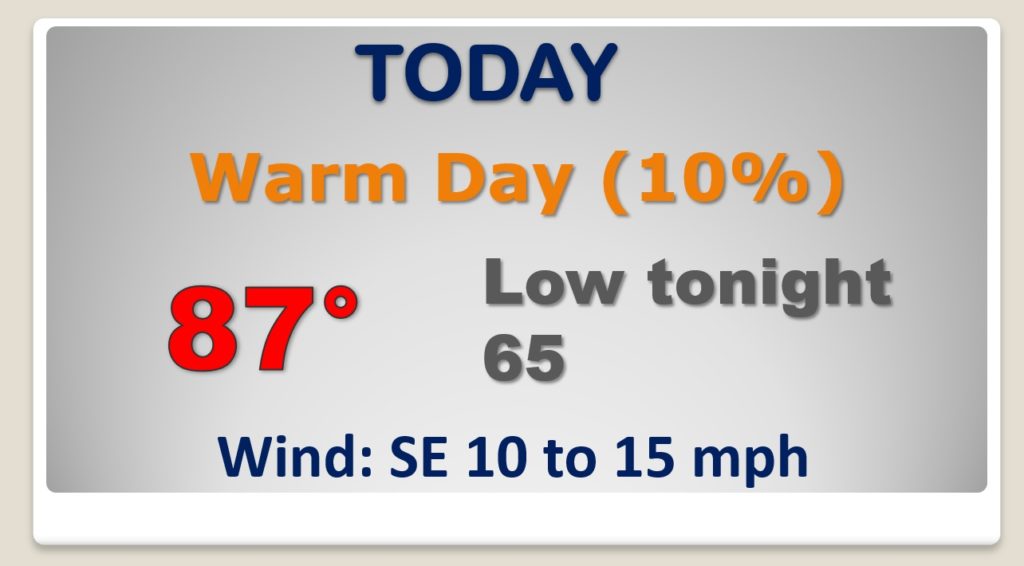
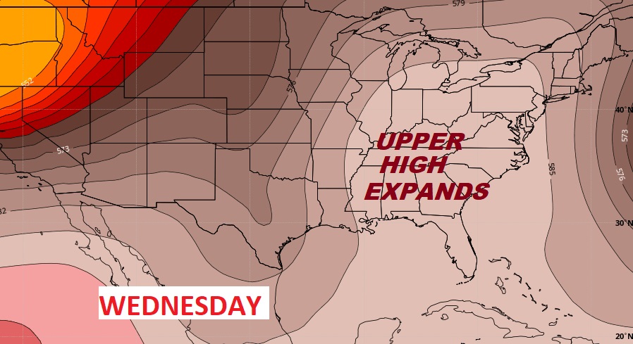
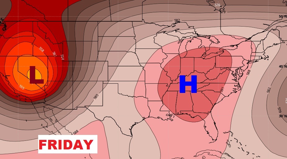
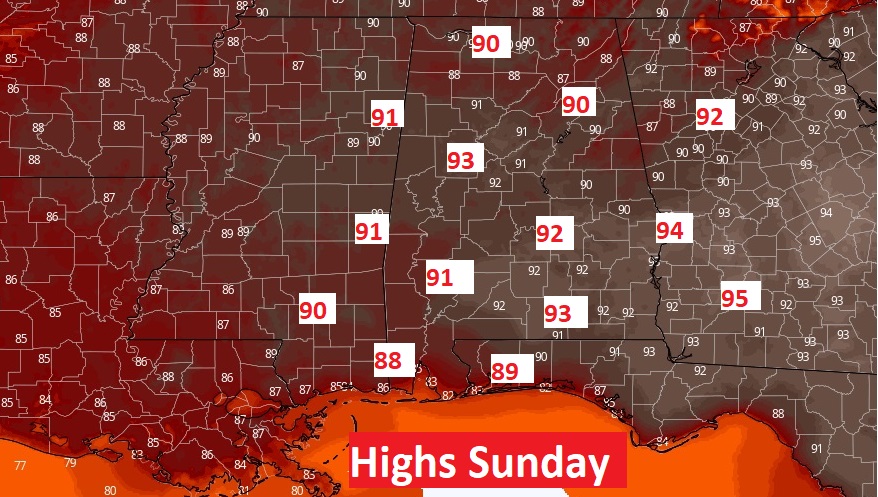
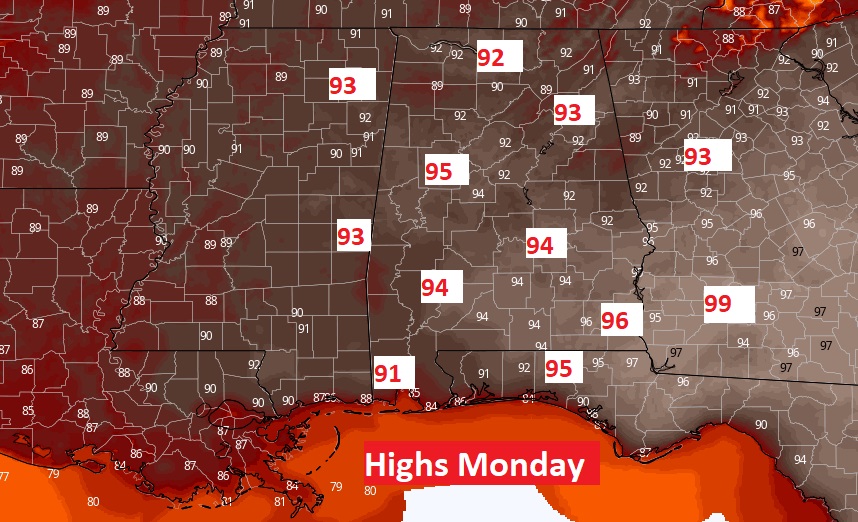
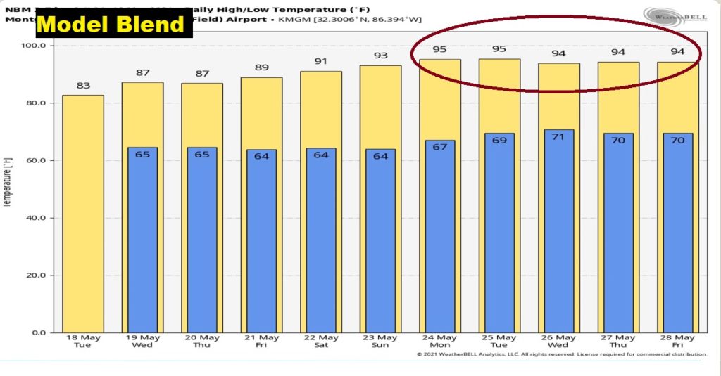
Upper Level high pressure will continue to expand and grow stronger. That will spell a prolonged period of hotter temperatures, We’ll be 90-92 Friday and through the weekend. And, we’ll be in the mid 90’s Monday through much of next week.
The calendar says May, but the forecast looks more like summer.
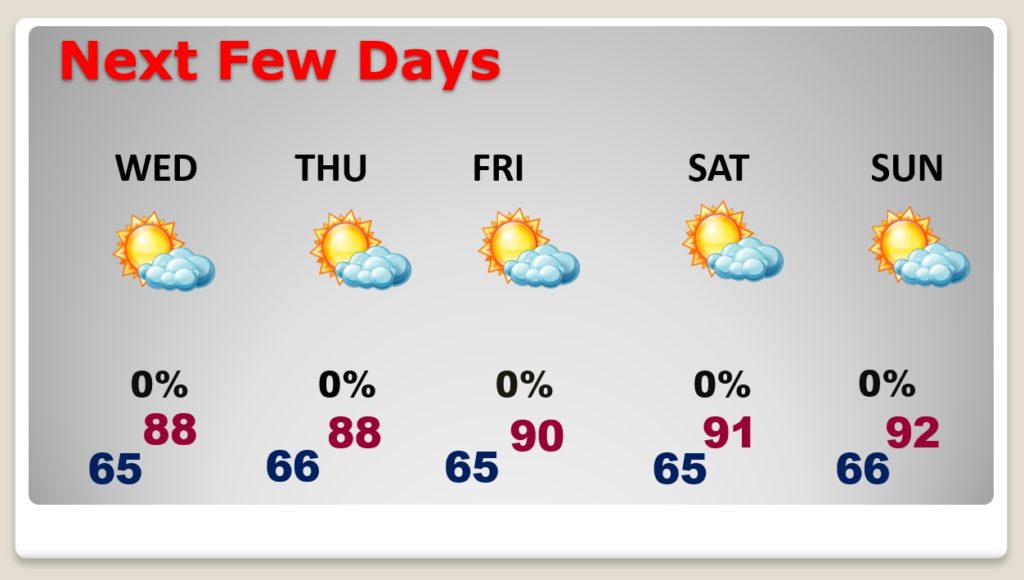
A sample of the heat the region is facing by Sunday and Monday and beyond.
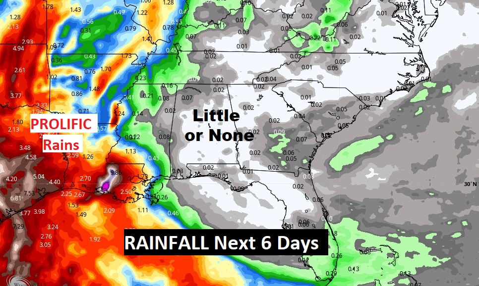
What a contrast on this map! Prolific Flooding Rainfall not to far west of our state. Yet for much of Alabama and the southeast the rain prospects for the next few days: LITTLE OR NONE.
