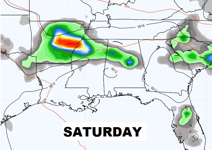
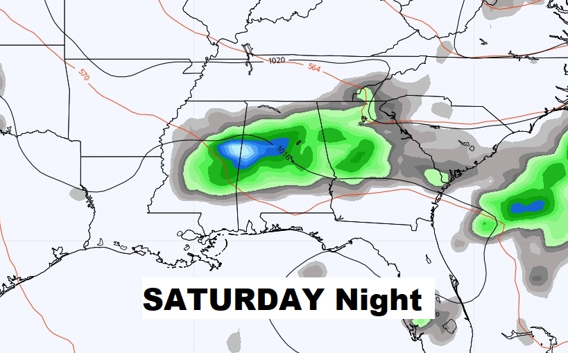
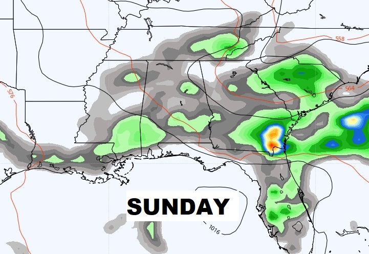
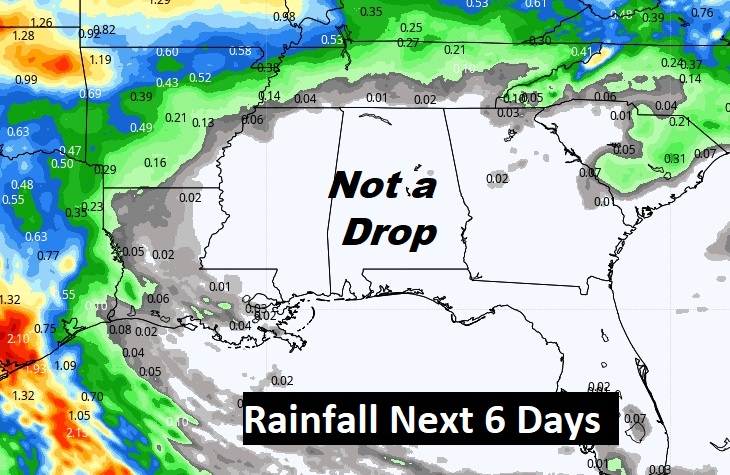
Good Morning! Talk about stuck in a pattern. It’s not a bad pattern to be stuck in…except we really need some rain, and that appears completely out of the question until sometime over the Memorial Day Weekend.
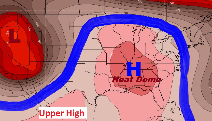
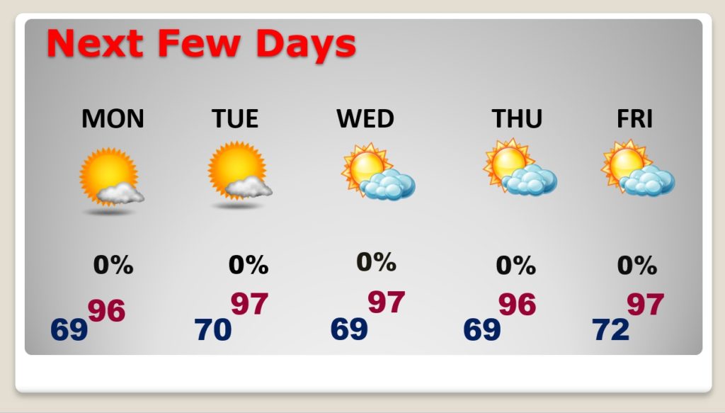
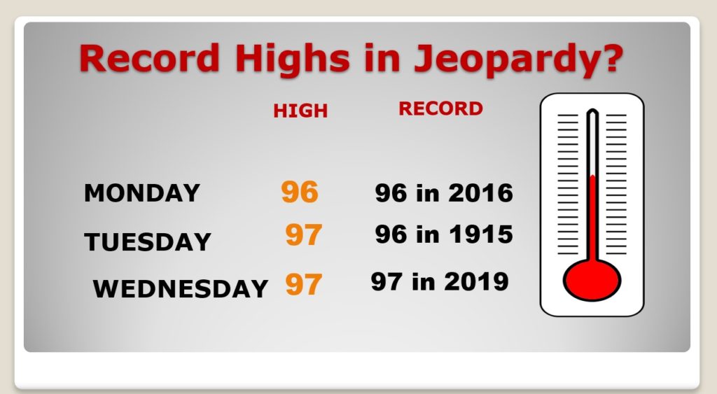
That huge upper level “heat dome” is in control. Not only are we getting hotter each day, storm systems continue to be diverted around us. The week ahead will be hot & dry. Not only that. It appears we could be “re-writing the Record Book” during this last week of May. Record highs will be threatened for several days in a row.
This map not only shows that Upper Heat Dome. It shows how much of the nation being dominated
TODAY: Abundant sunshine. Hotter. High 93 to 95. Tolerable humidity levels. Dewpoints in the 50’s is not bad. Unfortunately, the nice breeze of the last several days is gone. Today, expect a northeast breeze at 5 to 10. Nice tonight. Overnight low 66.
NEXT FEW DAYS: Hot & Dry for several more days. Highs well in the 90’s.
Record Highs will be threatened for several days next week.
NEXT CHANCE OF RAIN: Don’t bet the farm on it. But, the models are hinting that scattered showers could return to the area by sometime late Saturday, or Saturday night (Next weekend) and stick around Sunday. When you need rain, it doesn’t matter if it comes on a Holiday Weekend. We need rain drops.
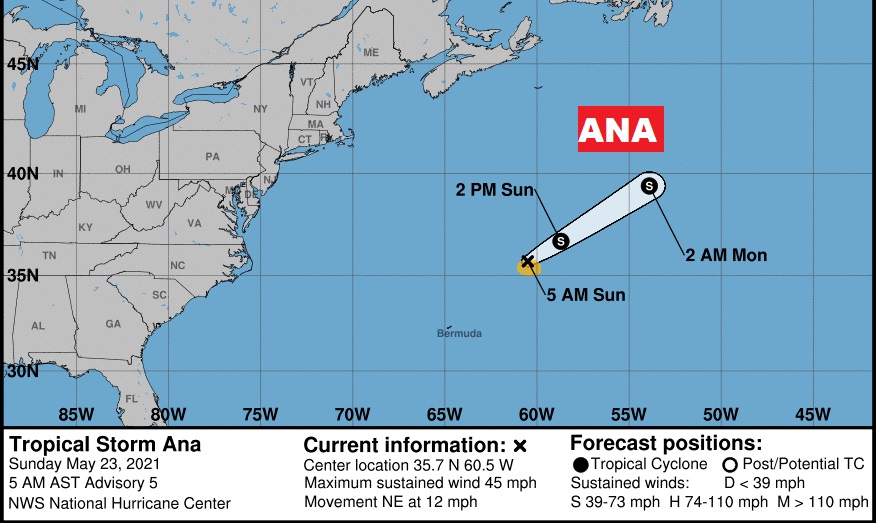
UPDATE ON THE TROPICS: In the tropics…pre-season Tropical Storm ANA is now the only show in town. Located in the central Atlantic, it will have a very short life. It’s what we call a “fish storm”. Hurricane season officially begins on Tuesday, June 1st.
I’ll have a complete video update tomorrow morning. Have a nice Sunday!
–Rich

