
There’s no depression YET in the Gulf. NO closed circulation, but the National Hurricane Center is confident enough to issue Advisory #1 on Potential Tropical Cyclone Three. That allows the issuance of potential, watches & warnings, and a forecast cone even before an official Tropical Cyclone forms. Air Force RECON has been investigating the system in the southwest Gulf for much of the afternoon.
NHC says:
Visible satellite images show that the cloud pattern associated with
the broad area of low pressure located over the southwestern Gulf of
Mexico is gradually becoming better organized.  Deep convection is
beginning to form a broad curved band over the eastern portion of
the system, similar to what one might see in a developing
subtropical cyclone.  Although the upper-level winds are not
particularly favorable for development, with lots of westerly shear
over the area, the global models do suggest tropical/subtropical
cyclogenesis within the next 12 hours or so.
The System is expected to have a circulation and become a depression later this evening or tonight and reach Tropical Storm status in the Gulf Friday before landfall late Friday night along the Louisiana coast late Friday night.
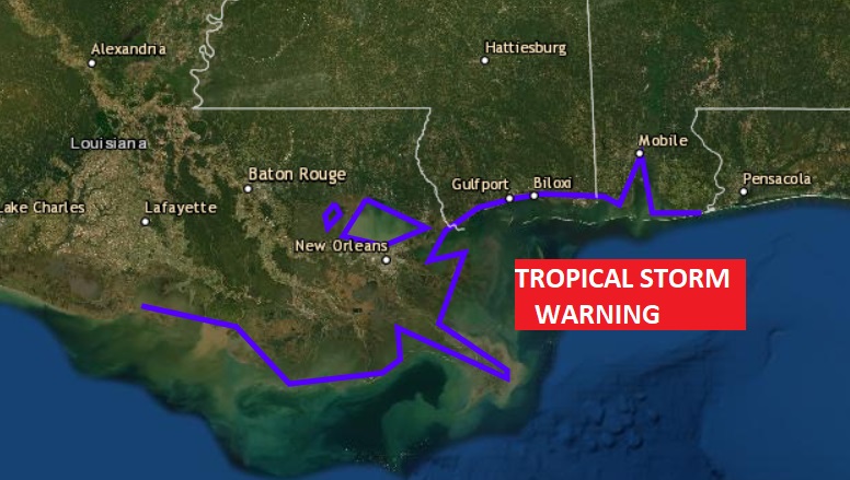
A Tropical Storm Warning has been issued from Intercoastal Louisiana through the Alabama coast to the Alabama/Florida line effective immediately.
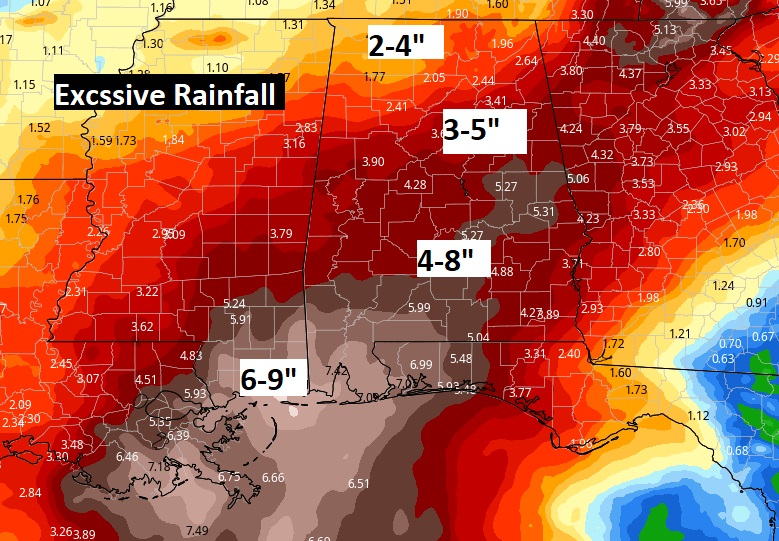
Excessive rainfall totals are expected over a large part of Louisiana, Mississippi and Alabama. Even here in central Alabama, amounts of 4 to 8″ are a good bet. Closer to the coast 6 to 9″+ are possible. Flash Flood Watches are in effect.
ALSO the threat of spin up tornadoes, east of the system’s patch will begin to increase on the coast Friday evening and spread northeast into Alabama on Saturday. I’ll have much more for you in my morning updates. Stay Weather Aware and Download our Weather App.
–Rich