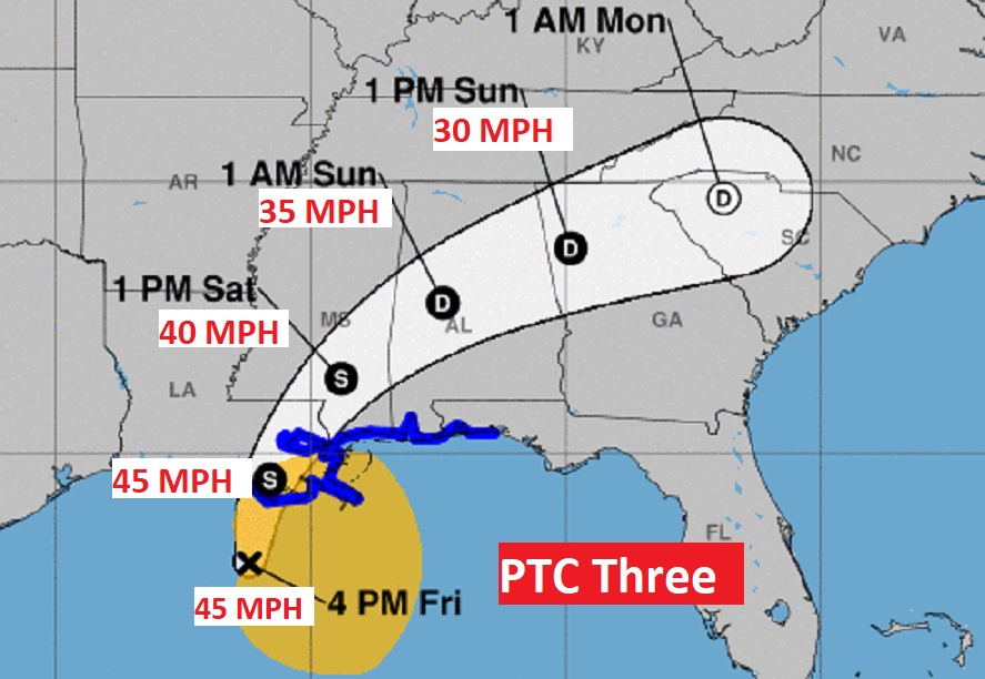
PTC 3 has not been promoted to Tropical Storm Claudette YET, even though it has 45 mph winds…Tropical Storm Intensity. It will have a huge impact on Alabama’s Weather tomorrow.

NHC says: “Although the disturbance has wind speeds of tropical
storm intensity, it has not been named a tropical storm yet since
its center is ill defined and broad as evident in the Air Force
Hurricane Hunter data and surface observations. Regardless of its
status, heavy rains and tropical-storm-force winds are spreading
across portions of the northern Gulf coast, and these conditions
will spread inland through tonight.
There has not been much change to the track forecast reasoning. The
cyclone is moving northward at about 16 mph, and a general north to
north-northeast motion is expected through landfall, which is likely
to occur overnight or early Saturday morning.”
PTC 3 is located 270 miles SW of Mobile moving north at 16 mph. Tropical Storm Warning still in effect from Morgan City, Louisiana to near Destin, Florida.
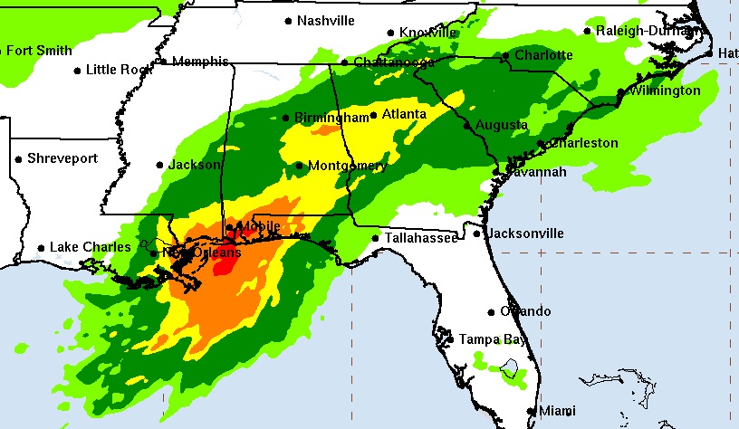
Biggest threats in central and South Alabama will be extremely heavy rainfall. Easily 4 to 6”+ in central Alabama with much heavier amounts near the coast. There will also be a low end threat for Tropical Tornadoes. The worst of the weather for most of us will be Saturday and Saturday night. There will be a lingering chance of rain Sunday, but mainly during the morning hours, with improvement in the afternoon.

