12:30 Update:
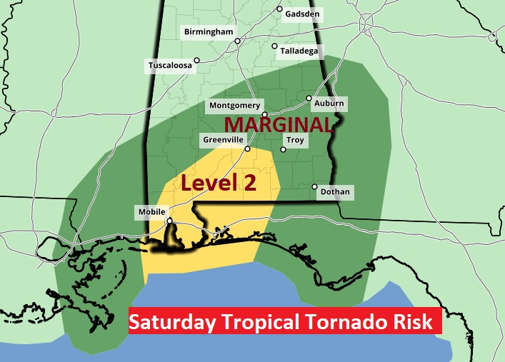
Along, and just east of the track of the Tropical System (whatever it’s status tomorrow – Claudette?) the tropical tornado threat is mainly low from about Clanton southward. But, SPC has now gone up a notch in parts of south and SW Alabama, south of Greenville for Saturday #alwx
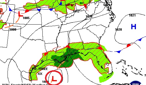
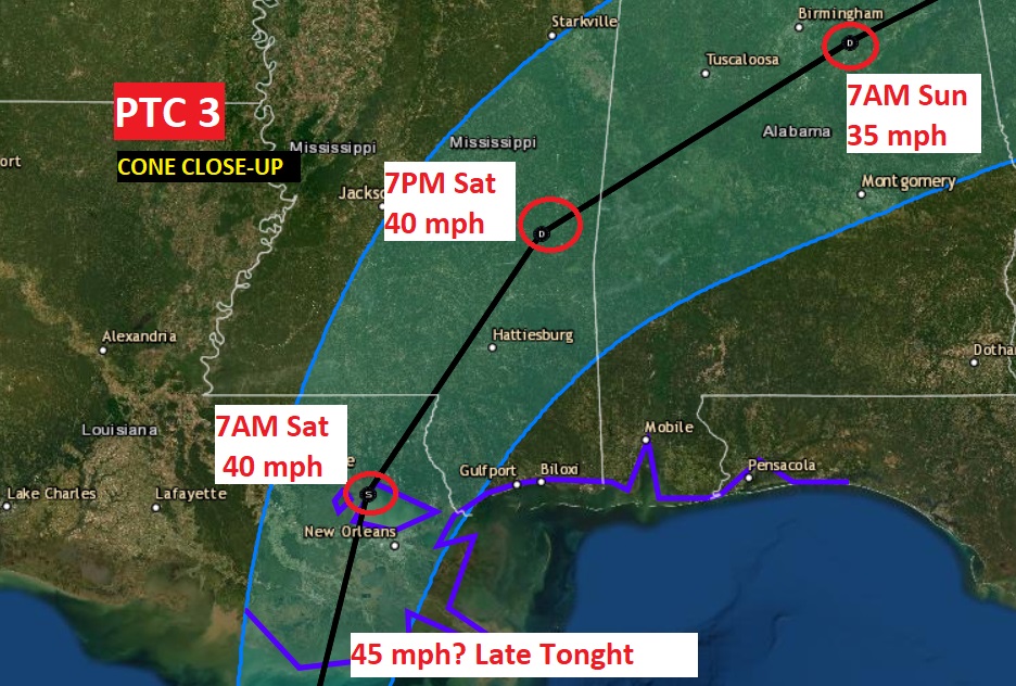
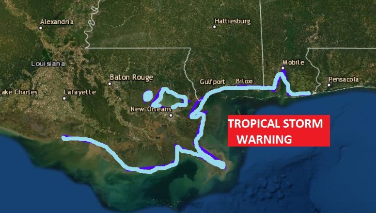
PTC 3 expected to come ashore later tonight on the LA coast as Tropical Storm Claudette, with perhaps 45 mph winds, then curving NE through MS Saturday and through Alabama late Sat. Nt. & Sunday. Trop. Storm Warning changed from Morgan City to near Destin. Excessive rain threat
EARLY MORNING UPDATE:
Good Morning! Our nice stretch of days is coming to a close. That tropical system we’ve been talking about for several days will dominate weather across the Gulf South all weekend, and that includes us. The system will be rather disorganized and “lopsided”, but it could produce Flooding rainfall in spots Flash Flood Watch for all of us. Will system be just a depression, Tropical Storm Claudette, or some high-bred tropical system? What about the updated timeline? I’ll you up to date on the very latest information on this Special Friday Morning tropical update
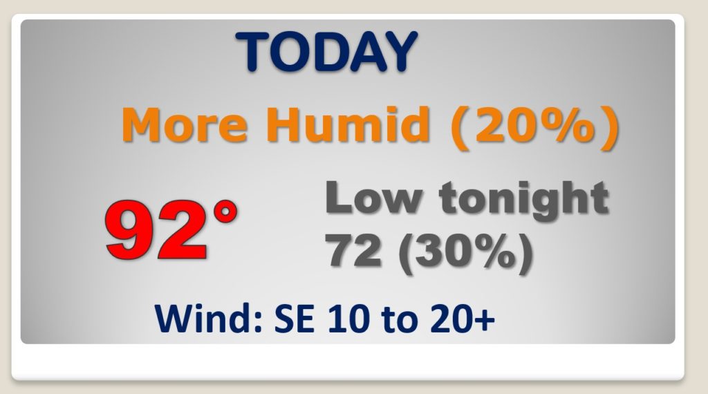
More Humid Today, as Gulf moisture returns.. High in the low 90’s. Maybe some widely scagttered storms by letr this afternoon or tonight.
Here’s the latest cone from NHC on
Tropical storm warnings continue from the Louisiana coast all the way eastward to the Alabama/Florida line.
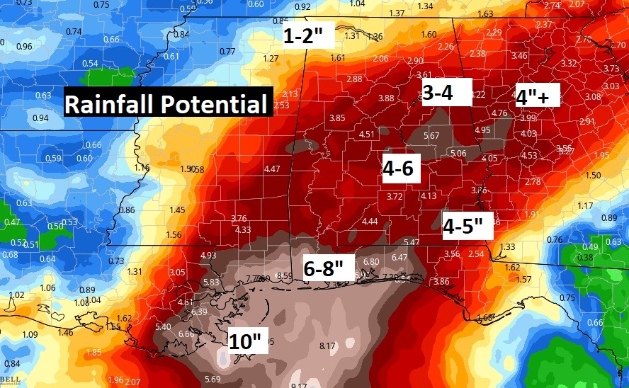
Flash Flood Watch due to the potential for excessive rainfall totals from 6-9″ on the coast to 4-8 inches in Central Alabama. Tropical downpours.
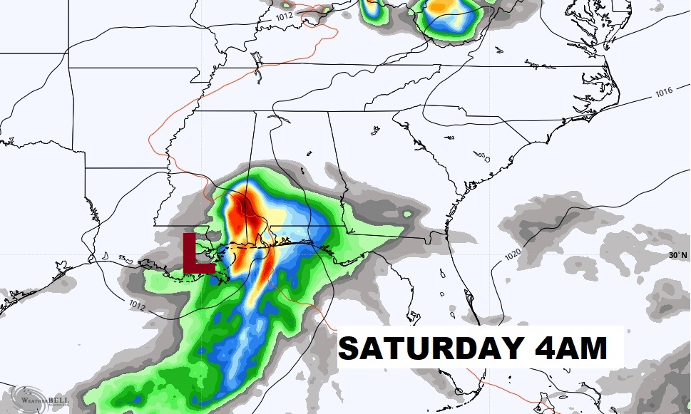
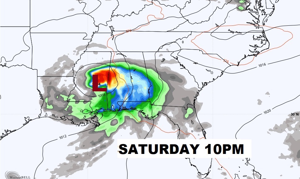
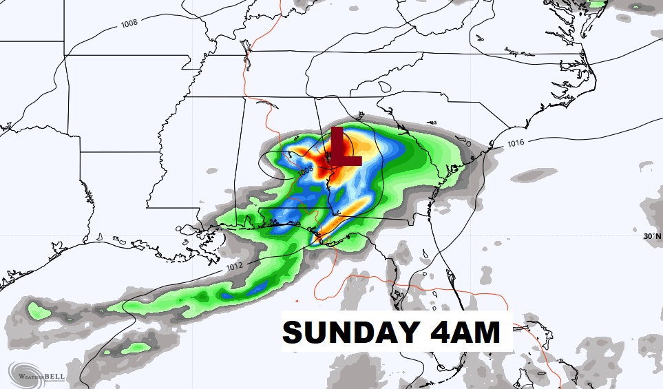
Here’s the Euro models idea on how the system could move through Saturday and Saturday night.
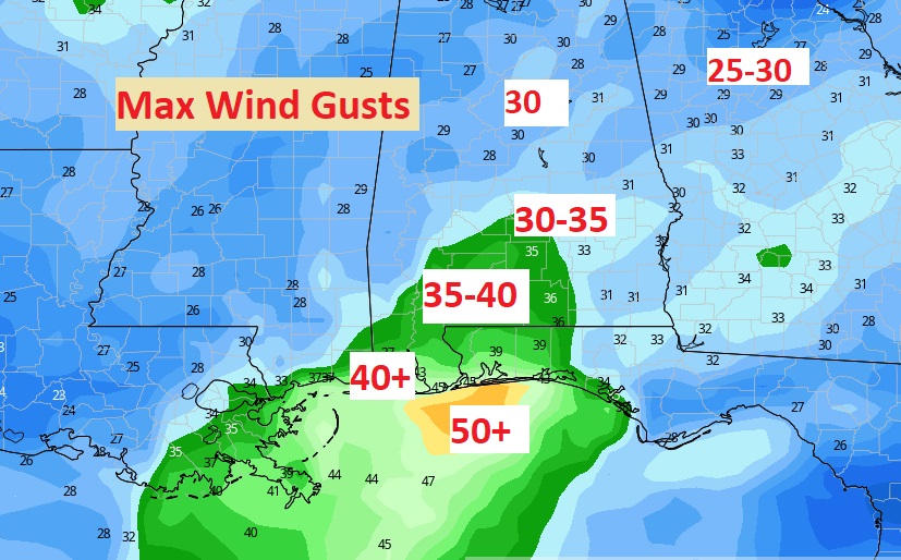
What about Max wind speed? Some of us could see 30 to 35 mph gusts in central Alabama by late Saturday/Saturday evening. Maybe 40+ on the Bama coast. The 50 mph gusts stay just offshore south of Pensacola. (according to the Euro model)
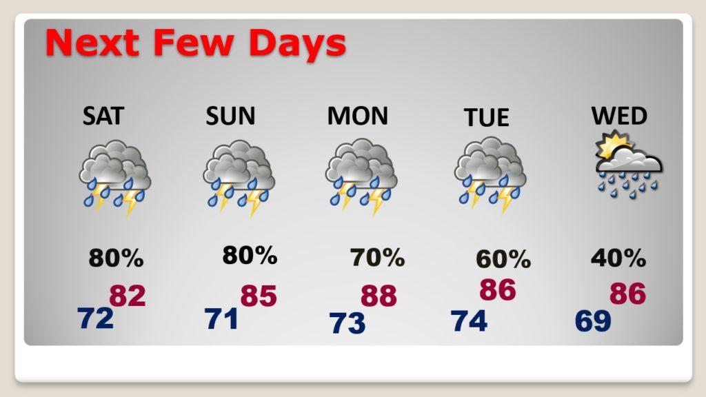
Even after this tropical system drenches our Father’s Day weekend, more showers and storms will drench the state Monday and Tuesday. A few leftover showers continue Wednesday. Summer officially begins Sunday night at 10:32 PM CDT.
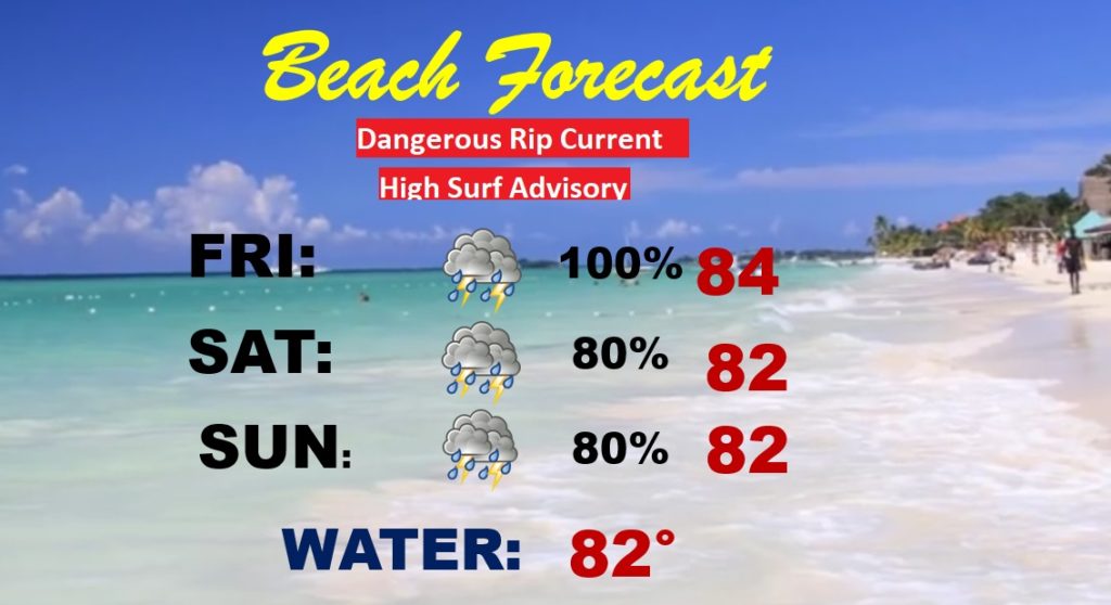
Trust me. This is NOT a weekend you want to be at the beach. Excessive rain, high surf, dangerous rip current, etc. etc.
