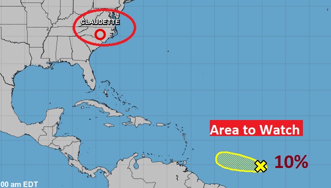
Good Morning! Welcome to the first full Day of Summer. It will certainly feel like summer. Hot & humid with an increasing risk of afternoon storms. An approaching frontal system will be the big weather maker in our weather tonight and Tuesday, as the front makes its way southward toward the Gulf Coast. The front may “haunt” the coast for a few days, which will keep at least the risk of spotty daily storms for several days. I have adjusted the rain chances through next weekend. So, after Claudette, is there anything else brewing in the tropics?
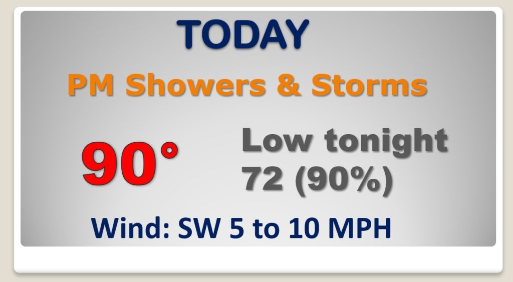
Much of this day will be dry, but the risk of showers & storms will escalate quite a bit by late this afternoon and overnight tonight.
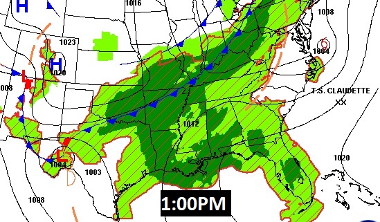
The front will moves southward through the state Tuesday and it will be parked on the coast Wednesday morning, where it will reside for a few days.
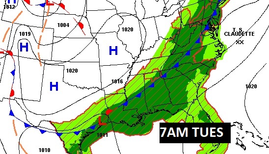
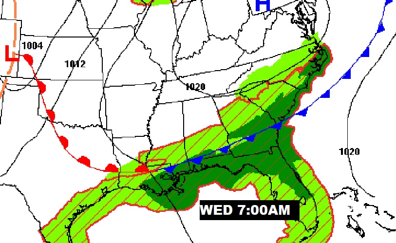
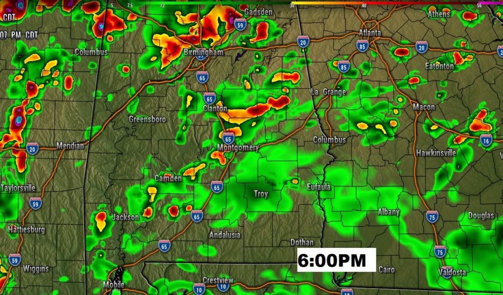
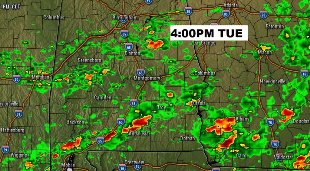
Here’s a couple of Future Radar snapshots for tomorrow. The front will be in central Alabama tomorrow morning and into South Alabama tomorrow afternoon.

The Risk of showers and storms will be in the forecast for the next few days.
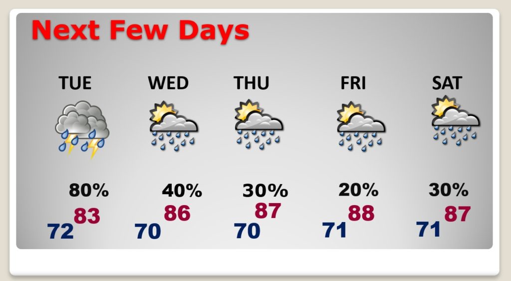
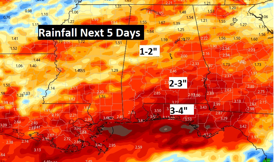
Once again, some towns could see some impressive rainfall totals over the next few days.
Besides Claudette in the Carolinas. There’s a new X on the map in the Caribbean. An Area to Watch,