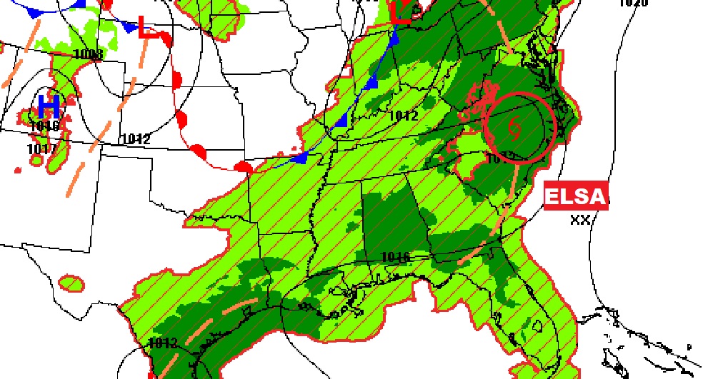
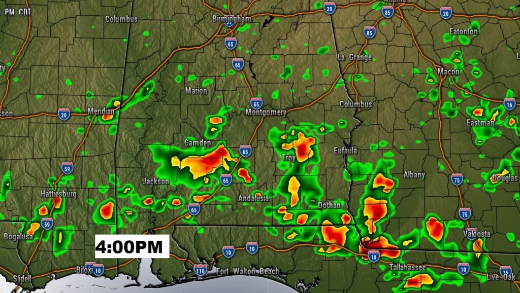
Good Morning! Showers and storms have been quite numerous over the last several days. Today and tomorrow, once again, radar will be busy. Expect a better than normal chance of those random afternoon & evening storms. However, over the weekend, our forecast will be easing closer to a normal summertime patterns, which means fewer storms, hotter days and the Heat Index will be edging closer to the triple digit range. I have adjusted the rain chance through the weekend and beyond for here and the Gulf coast beaches. As Elsa moves through the Carolinas this morning and up the U.S. East Coast over the next two days, we’ll check the rest of the tropics for any potential mischief.
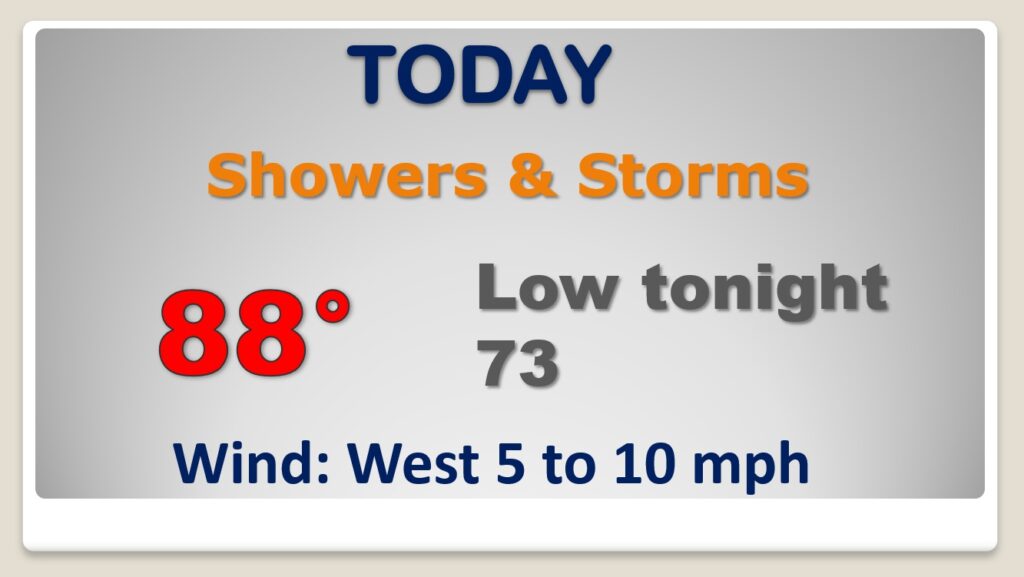
Routine forecast. Still a better than normal chance of PM showers and storms. Very humid. Upper 80’s.
Over the weekend, the number of daily Random storms will ease back closer to a summertime normal. Highs will reach the lower 90’s. Rain chances will be a little higher Monday. Not much change Tuesday.
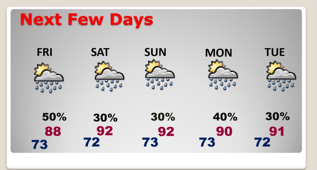
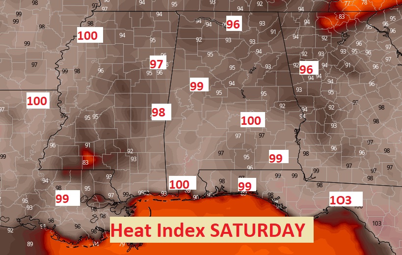
‘Tis the season. With fewer storms this weekend, there will be more sun. With highs in the lower 90’s and dewpoints well into the 70’s the Heat Index will reach near of above the Triple Digit Level. Slow down and take it easy. Drink plenty of liquids.
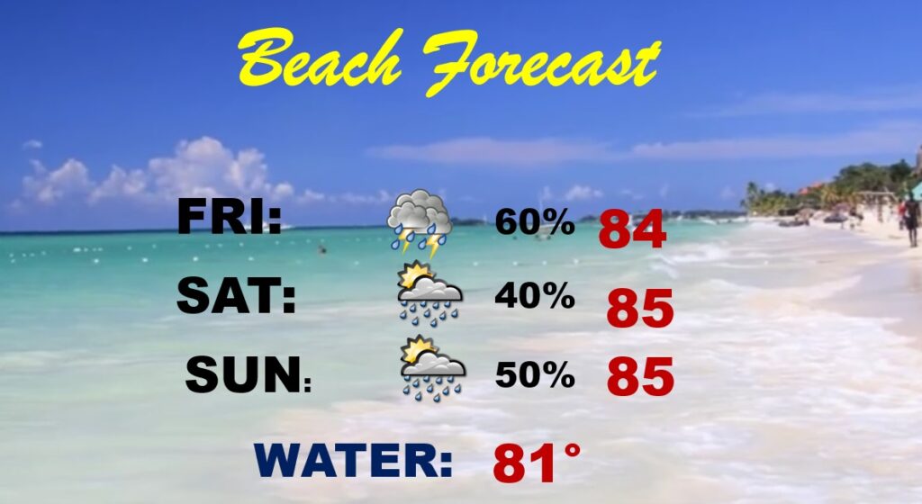
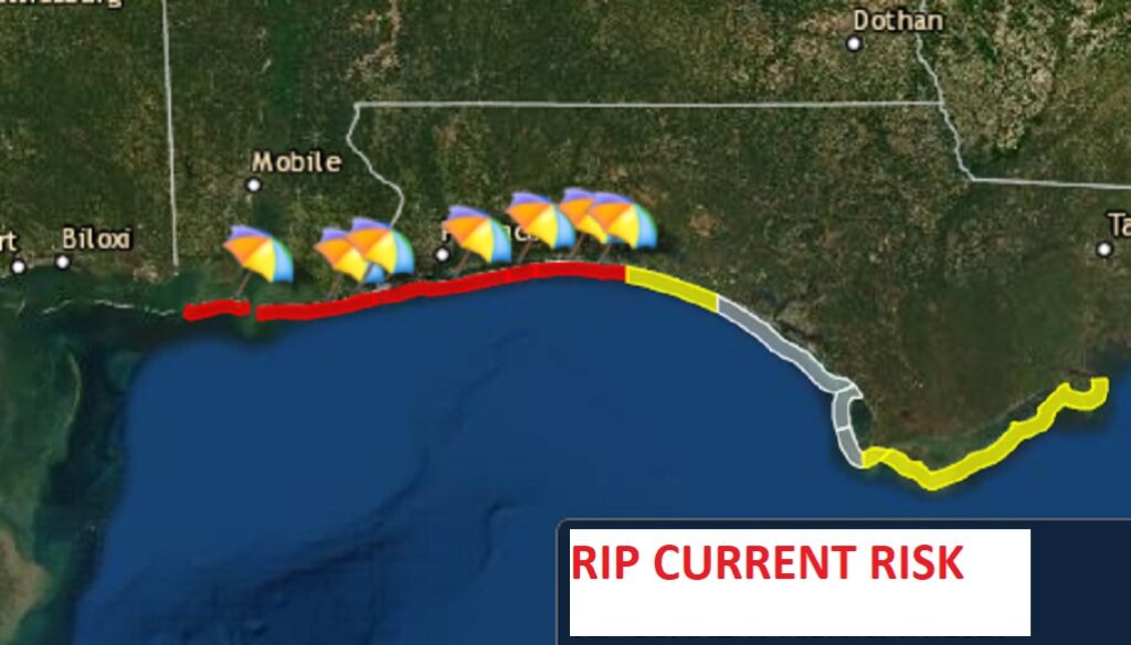
Once again this weekend, the Beach rain chances will be running higher than the seasonal normals. BUT, still better than last weekend. Watch out….High Rip Current Risk today. Moderate Rip Current Risk through the weekend.