
Good Morning! Yesterday was an interesting summer day. There was lots of thunderstorm drama with tropical downpours, lightning and gusty winds. Yet, most towns were storm-free. Outside of thunderstorm areas, the story was relentless heat & humidity with triple digit heat indices. It was a typical summer day.
Rinse and repeat. There’s no reason to think today will be much different. Unlike earlier this week, storms are becoming less frequent and fewer in number. That will continue to be the case this weekend and well into next week. The bigger story will be the heat. Triple digit heat indices will be a big factor for the next several days. Monday in particular, heat indices may exceed the 105 danger level. But, even today and Sunday, the heat is going to be rough.
TODAY: As mentioned above, storms will be fewer in number on the radar today. But, understand, the ground is moist. Any storms that do develop will produce tropical downpours, abundant lightning and gusty winds. Not only that. Storms will be slow movers, which could lead to flash flooding. Having said that, most towns will stay dry today. With high the temperature near 94, and dewpoints in the 70’s, the heat index will soar into the 100 to 105 range. Storms will eventually fade out overnight. Steamy tonight. Low 74.
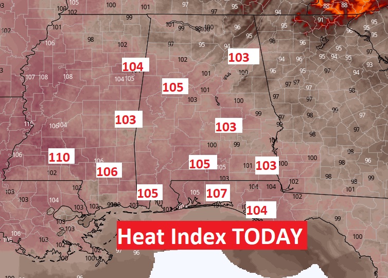
Here’s the Heat Index Map at mid afternoon. Welcome to summer in Alabama.
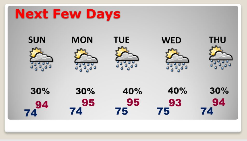
NEXT FEW DAYS: While storms will be few and far between for the next few days, any storms that do develop will produce much drama. Extremely heavy downpours, intense lightning, and gusty winds. Storms will be slow movers, which means areas of flash flooding are possible. And, yet, most towns will get completely skipped by the storms. The relentless heat and humidity will rule. Highs in the 90’s. Low in the steamy mid 70’s. Heat index past 100, and closer to the 105 danger range. Little day to day change. We are now sixty days till the first day of Fall.
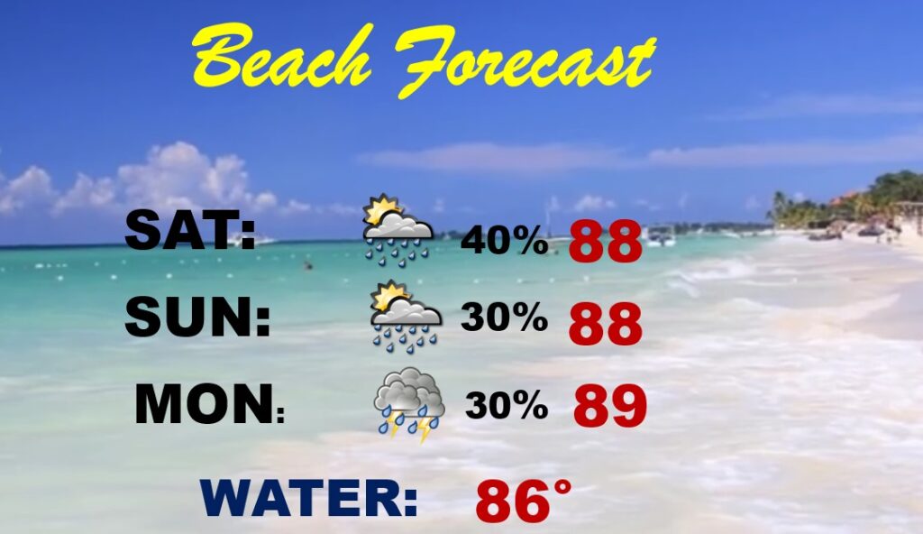
BEACH OUTLOOK: Routine weekend forecast. Spotty storms. Upper 80’s. Heat index 100+. Watch the flags on the Beach. Right now, the Alabama coast is listed as a Low Rip Current Risk, however, yesterday officials in Orange Beach put up yellow flags anyway. Right now Destin eastward is in the Moderate Rip Current Risk. It has been an awful summer for Rip Current Rescues. Be careful. Respect the flags. Obey the lifeguards.
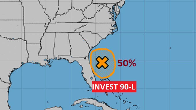
TROPICS: That “Area to Watch” off Florida coast now has a number. Say hello to Invest 90-L. It now has a 50% chance of developing into a Tropical Depression over the next 2-3 days. The next available name on the list is Fred…in case Invest 90-L becomes a Tropical Storm.
I’ll have another Blog update tomorrow morning. Enjoy your weekend!
–Rich