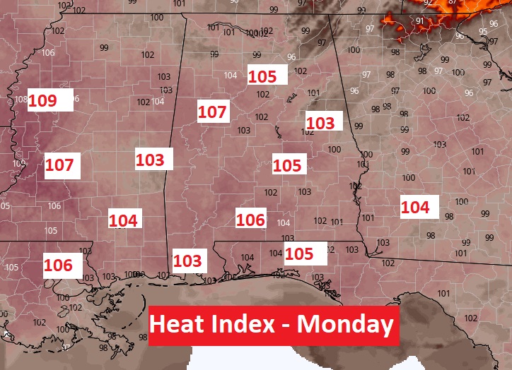
Good Morning! There weren’t many storms on the radar on Saturday. The big story continues to be Big Heat. The Heat Index, once again, was into triple digits. Today will be very similar. Heat index 101 to 105. There won’t be many cooling storms around. The heat index will be a little higher Monday…very close, if not exceeding the 105 danger range. A Heat Advisory may be required on Monday. NWS is monitoring the situation.
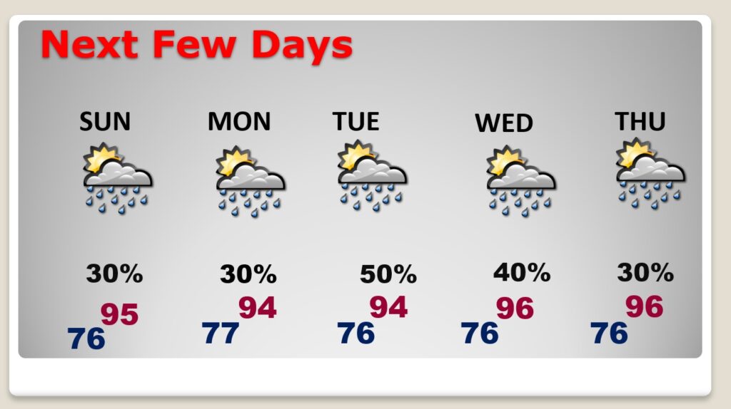
There will be little day to day change through mid-week. I have the rain chances a tad higher on Tuesday.
TODAY: Patchy early morning fog. A good but of sun today, mixed with clouds. High 94. Heat index 101 to 105. Scattered Random storms, mostly in the afternoon & evening. Low tonight.
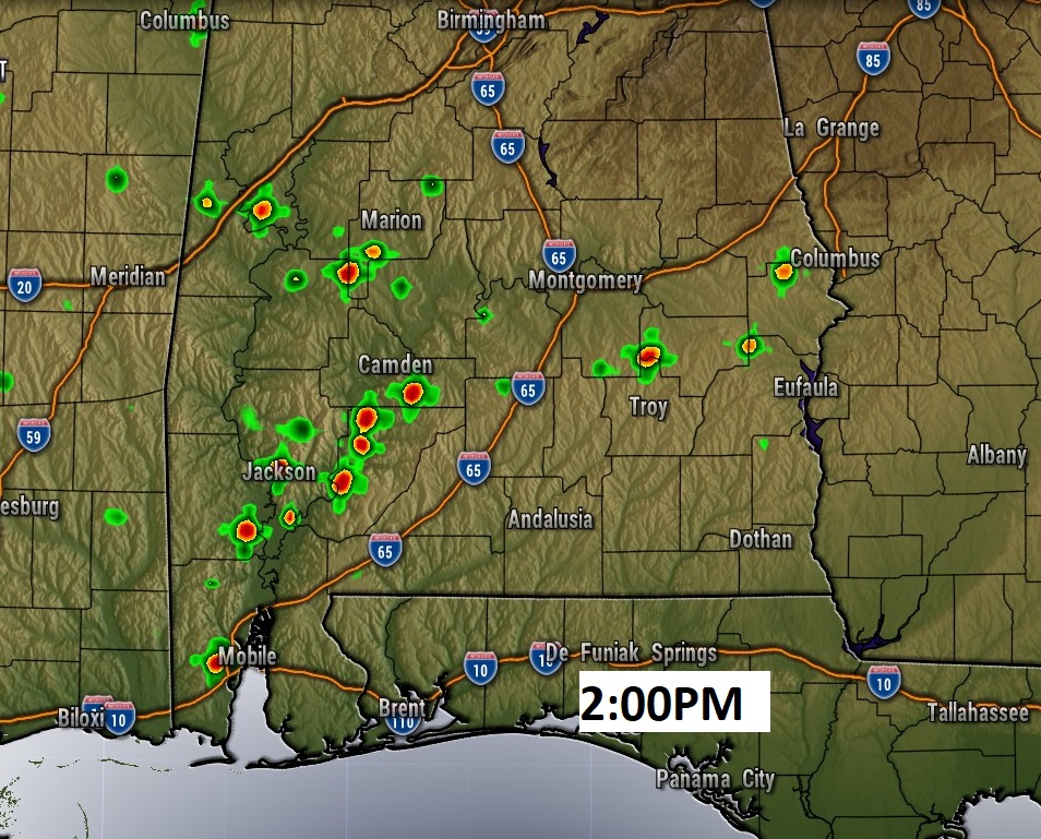
Here’s a sample of Future Radar at 2PM on the HRRR model. Widely scattered storms.
NEXT FEW DAYS: Right now, I have the rain chances a little higher on Tuesday as a surface boundary slides southward in the state. I may have to bump up the Tuesday/Wednesday rain chance in future forecasts.
The Heat Index will be highest on Monday and it may require a Heat Advisory from NWS.
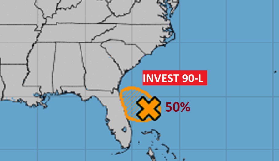
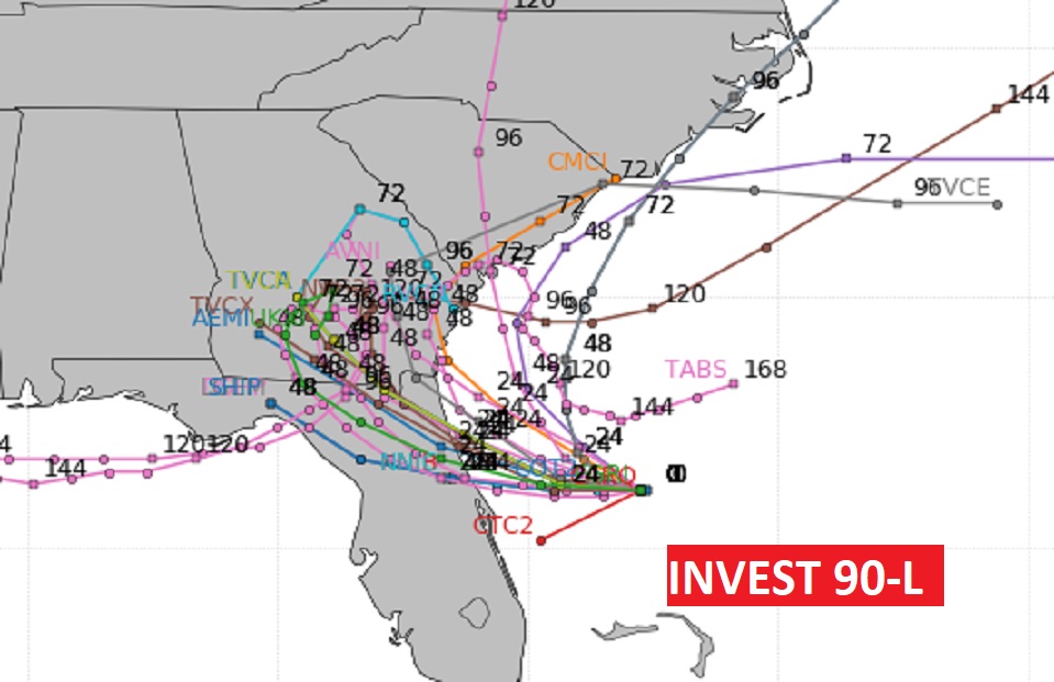
INVEST 90-L: National Hurricane Center now says there is a 50% chance that Invest 90-L could become a depression later today or tomorrow off the Florida east coast. An Air Force RECON will investigate the area later today if necessary.
Here’s what the models as doing with Invest 90-L, as far as potential future tracks.
I’ll have a complete video update tomorrow morning. Have a great Sunday!
–Rich
