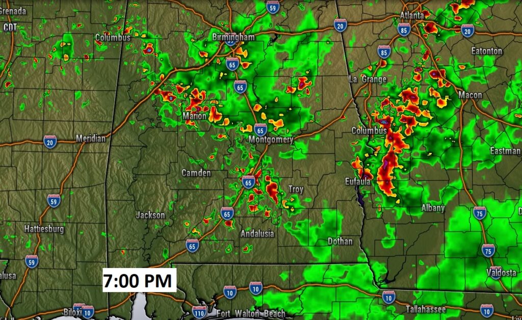
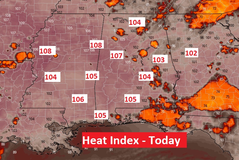
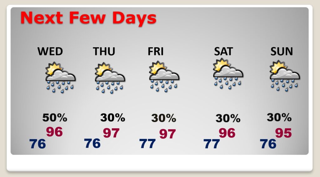
Good Morning! No doubt about it. Your odds of encountering one of those random storms are a lot better today, for several reasons. Meanwhile, it will be another day of excessive heat indices. Big Heat can produce Big Storms. Many storms will feature lots of dangerous lightning and gusty winds. Outside of thunderstorm areas, the heat index will soar to 102 to near 105 in spots. Wednesday will be another day of better than normal rain chances. But, the number of storms will start to taper down by Thursday & Friday. The intense heat will continue. I wouldn’t be surprised if we see a Heat Advisory at some point, especially later in the week.
All signs point to a very active thunderstorms day by this afternoon and this evening. The intense heat continues.

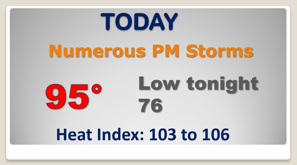
Once again today, the Heat Index will approach the 105 danger level in spots.
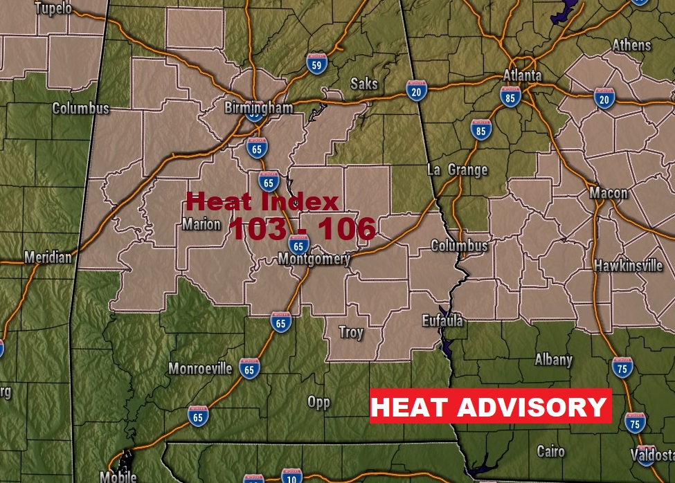
By later in the week, the number of storms will “thin out” again. Intense heat this week. Even some upper 90’s late week. The heat index will be near the 105 danger level some days. A Heat Advisory is not out of the question, at some point.

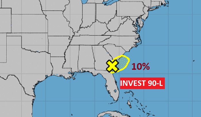
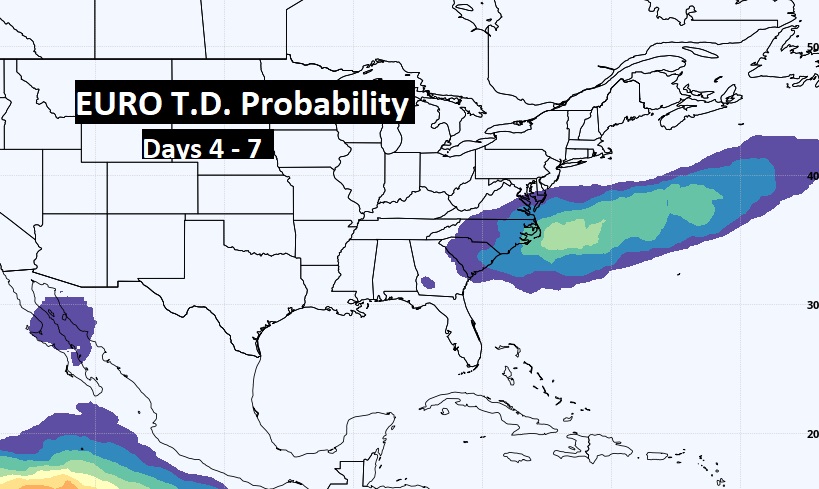
NHC now says INVEST 90-L, inland over SE Georgia has only a tiny chance of hanging on and developing next 5 days. But the EURO model is a little more optimistic. It gives the system a decent chance of developing into a Depression beyond 4 days.