
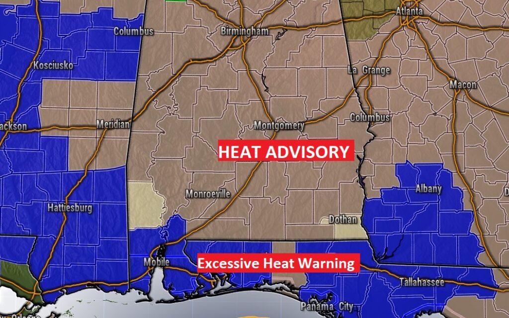
Good Morning! The hottest week of the summer so far rolls on, but hang on. Looks like much more reasonable temperatures are in our future starting Monday. This last day of July will be very hot. The Heat Advisory Continues in effect for most of Alabama through Sunday. Closer to the coast, it only gets worse. An Excessive Heat Warning covers the Alabama and Florida coastal counties. Dangerous heat.
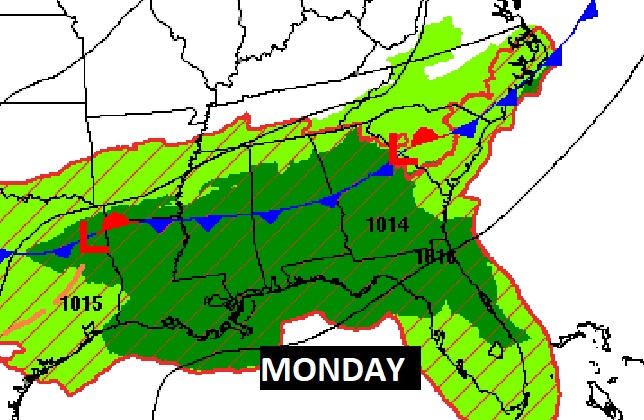
Spotty PM storms return to the forecast today. Storms will become much more numerous starting Sunday afternoon and especially Sunday night and Monday as a front approaches.
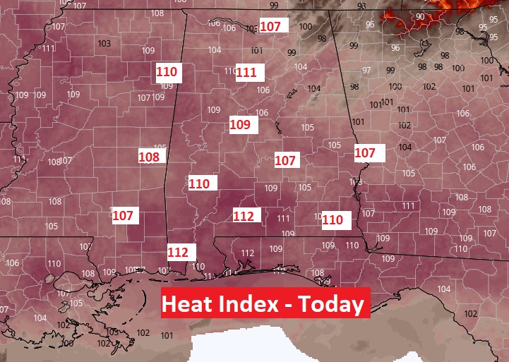
TODAY: Heat Advisory. Heat index as high as 107 today. Locally, a few towns could exceed that level. Actual high temperature mid to upper 90’s. Scattered thunderstorms will develop this afternoon and this evening, and fade out tonight. Tonight’s Low 79.
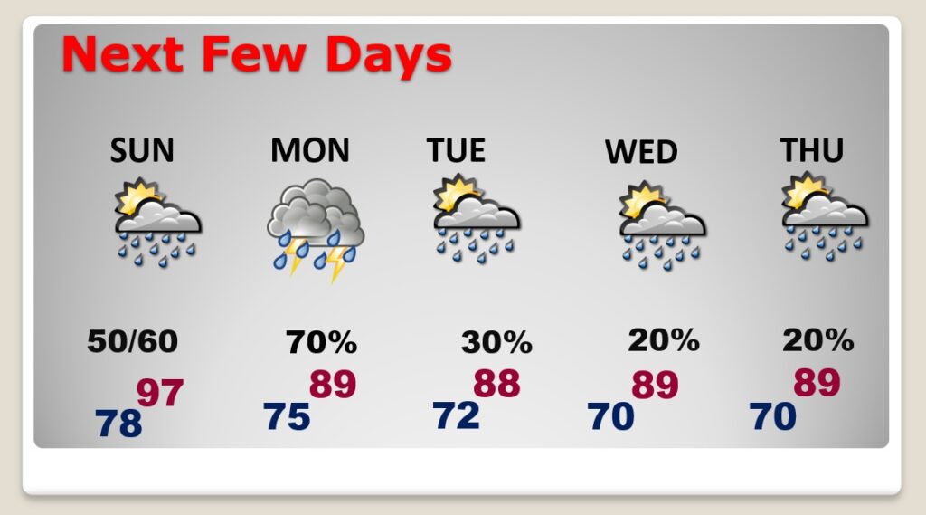
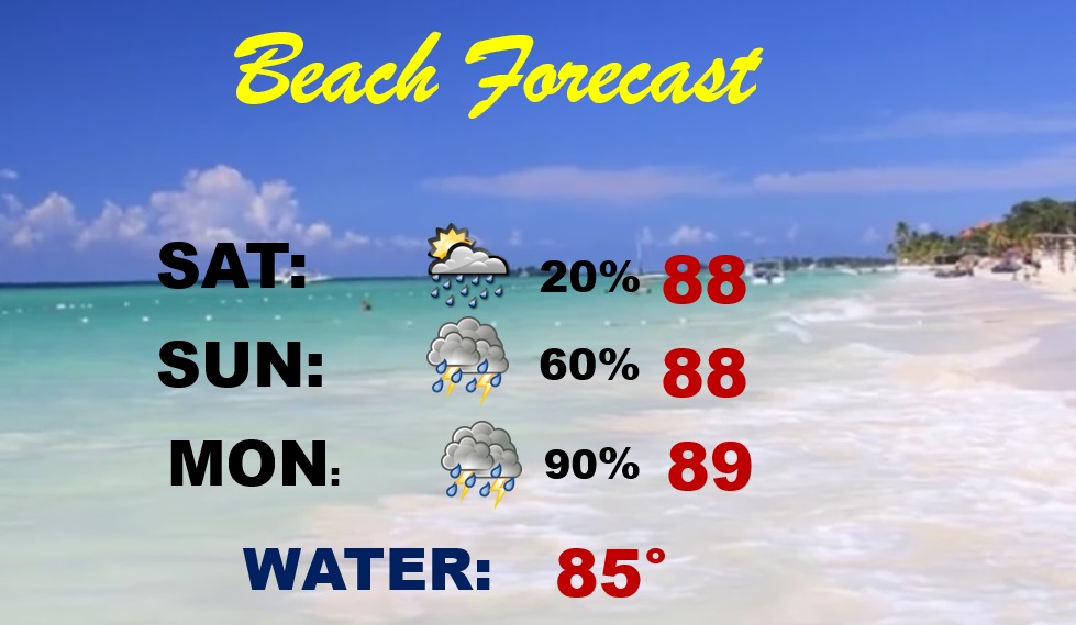
NEXT FEW DAYS: Sunday, the heat advisory continues. Heat index as high as 106. Showers and storms become much more numerous by Sunday afternoon and Sunday night. An approaching frontal system will be the catalysts for widespread showers and thunderstorms by Sunday night and Monday.
Temperatures will come down to a more reasonable level. Upper 80’s appear likely Monday through Thursday. Storms will thin out Tuesday as the front stalls near the coast. Only widely scattered storms area expected Wednesday & Thursday.
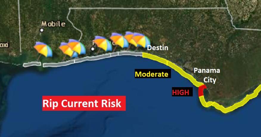
BEACH OUTLOOK: Excessive Heat Warning. Heat index as high as 111 today. Only scattered storms today, but showers and storms will become numerous Sunday and Monday and beyond. Moderate Rip Current Risk from Destin eastward. High Rip Current Risk near Panama City.
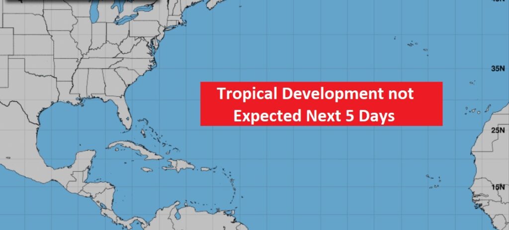
TROPICS: Although the tropics are as quiet as a mouse right now, there’s increasing clues that August will be a very busy month. Enjoy the quiet.
I’ll have another Blog update tomorrow morning. Stay hydrated! Enjoy your weekend!
–Rich