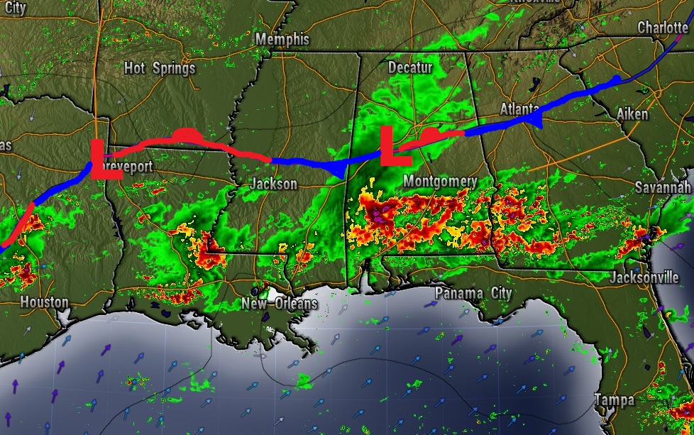
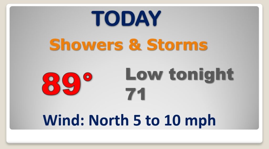
Good Morning! A frontal system will move southward through the state today. Showers and storms will become rather numerous today and tonight as the front heads south toward the coast. The best news is, temperatures will be much more reasonable. The intense heat will finally ease. Highs will be held down to the upper 80’s for about the next three days. The best rain chances in the week ahead will be in south Alabama and closer to the coast. Spotty storms are still possible in central Alabama each day. On this video, I have the forecast details for the week ahead and through the weekend. And, we’ll check the tropics. The Tropical Atlantic could become active soon.
A southward moving front will be the focus for widespread showers and storms, especially by this afternoon and into tonight.
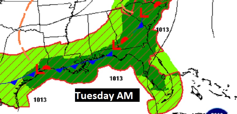
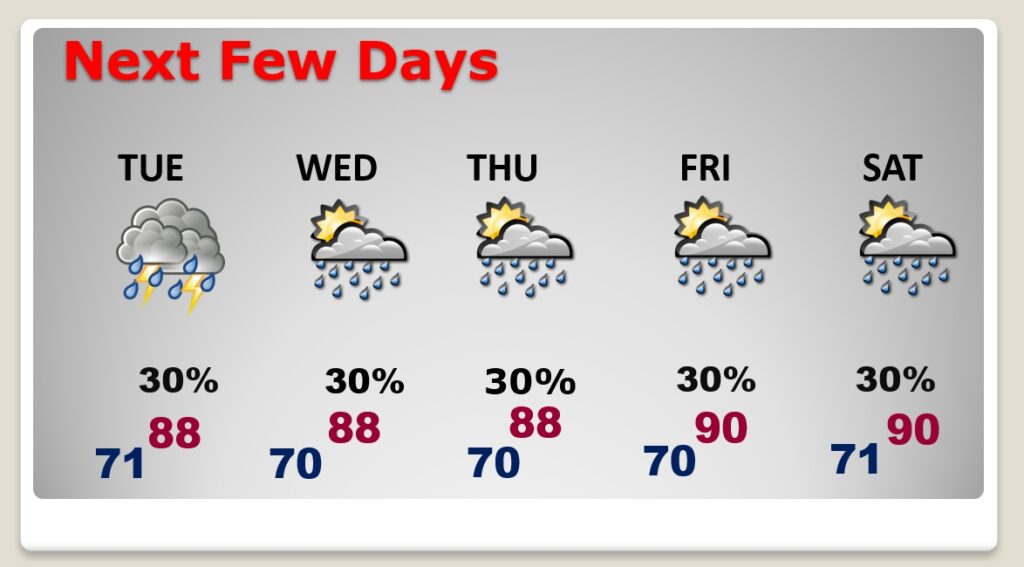
By Tuesday morning, the front will be closer to the coast, where it will stall for several days. The best rain chances over the next few days will be in south Alabama and on the coast.
Fortunately the Heat Advisory is gone. Highs in the upper 80’s today through Wednesday will be much more reasonable. Highs 90 or above will return late week and this weekend. Random scattered showers and thunderstorms.
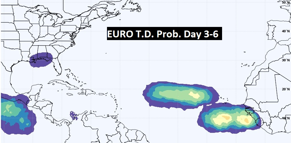
NHC says no tropical development is expected in the next 5 days. However, the EURO continues to suggest that the Tropical Atlantic may start to get active in a few days.