
9:00AM: Within about an hour we will find out of we have Tropical Storm Nicolas in the SW Gulf of Mexico. Air Force RECON inside Invest 94-L are finding some impressive winds. We may see Nicolas named pretty soon. #Nicolas
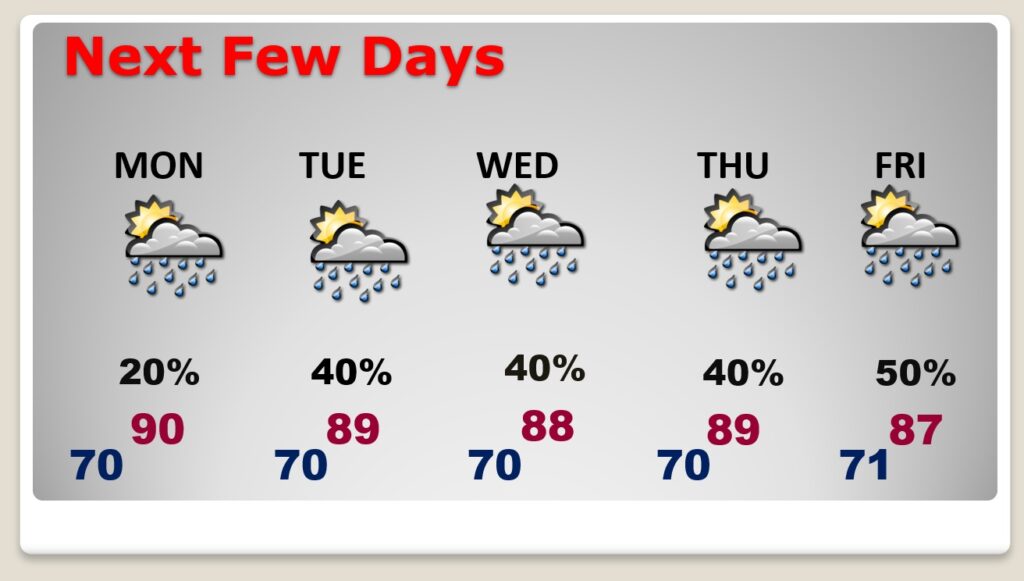
Good Morning! Friday was absolutely perfect. Saturday was more than acceptable. Today, though, we are easing into hotter and more humid territory. Our brief little Fall preview is now in the rearview mirror. I think the rain chance today is remote, but not zero. Spotty storms will dot the radar Monday. And, the number of storms will increase Tuesday through Friday. We have a very humid summer week ahead of us.
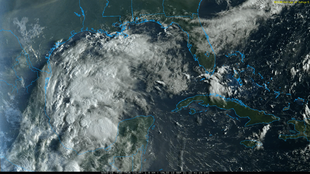
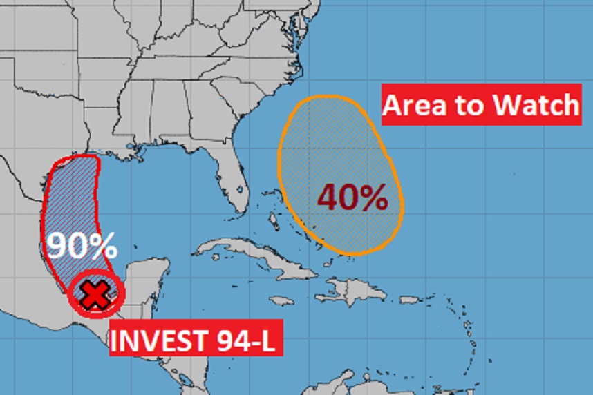
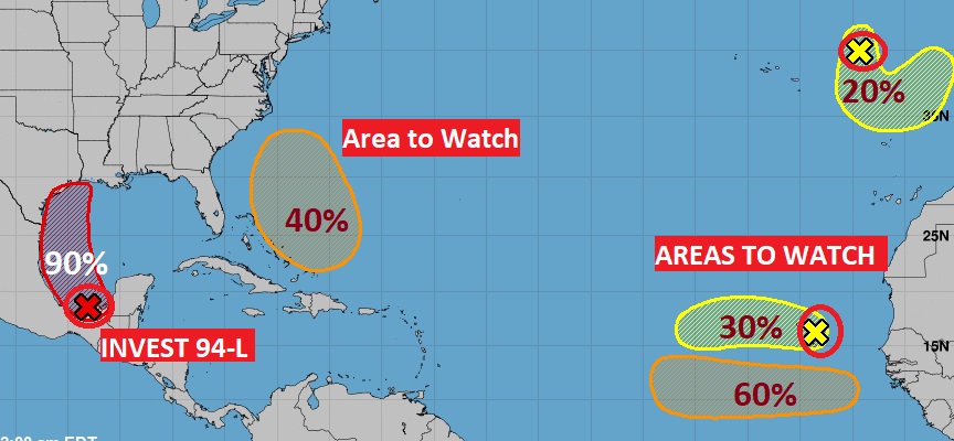
I think we will have a Tropical Depression in the Gulf before this day is over, and I truly believe this system will become a named Tropical Storm. Although, it appears Texas and Louisiana will probably be the target, we care about everything in the Gulf. It’s our backyard. That’s not the only disturbance with potential implications for the United States. The tropics are getting busy.
TODAY: Lots of sun mixed with clouds. By this afternoon the Dewpoint will be near 70. (See dewpoint comfort level chart below. Friday dewpoints were in the 50’s) High today 91. Hot and Humid. Rain chance is remote, but not zero. Maybe 15%? SW wind 5 to 10. Low tonight near 70.
NEXT FEW DAYS: Back to regular summertime business as usual. Scattered random afternoon and evening storms every day. Hot & humid. Upper 80’s to near 90 daytime. Lower 70’s at night. Dot dot dot.
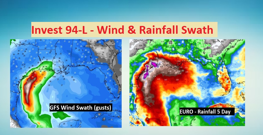
TROPICAL TROUBLE IN THE GULF: That system we’ve been tracking for days is now in the Bay of Campeche. It’s VERY likely we will see a Tropical Depression form today.
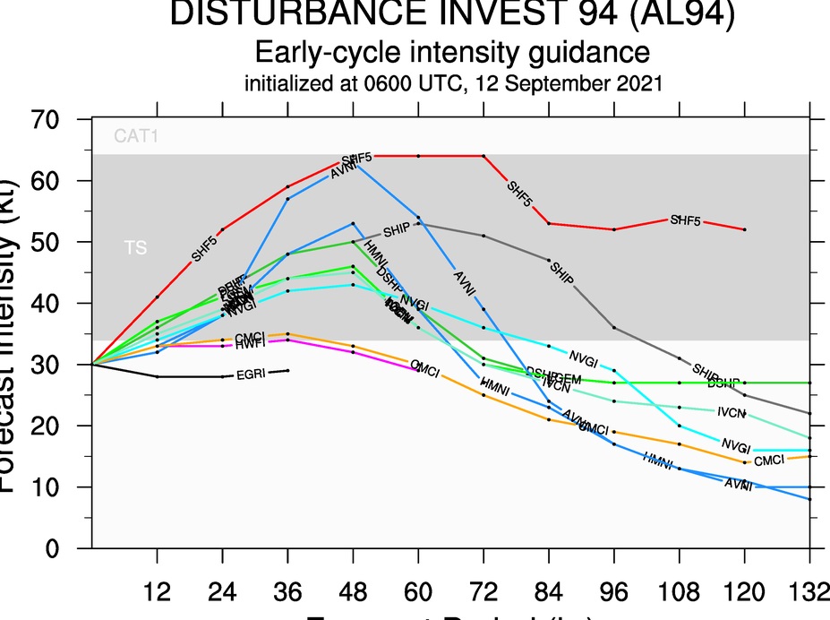
Here’s the intensity forecast from multiple tropical models. This system is likely to become a Tropical Storm. The next two names are Nicolas and Odette. The upper Texas coast or Louisiana are the likely target. I have included the GFS wind swath and the EURO projected rainfall corridor.
There’s Another Area to Watch with potential implications for the Southeast United states. I think there’s a good chance of a Depression or Tropical Storm this week. The long range models indicate one of those disturbances in the far east Atlantic could be a big deal in the next 15 days.
This is a BIG week for Hurricane Anniversaries on the Alabama coast. On this date in 1979 Category 4 Hurricane Frederic absolutely devastated southwest Alabama. It cut Dauphin Island in half. Near-total property damage occurred along the Alabama coastline between Fort Morgan and Gulf Shores, the latter seeing 80% of its buildings completely destroyed. The causeway link Dauphin Island to the mainland was swept away. Mobile had severe damage.
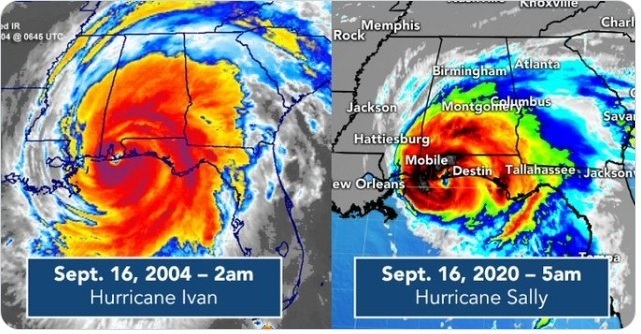
Thursday is a double anniversary. Major Category 3 Hurricane Ivan in 2004. And STRONG Cat 2 Hurricane Sally last year. Same day. September 16. Same landfall location near Gulf Shores.
I’ll have a complete video in the morning. Enjoy the rest of your Weekend.
–Rich