
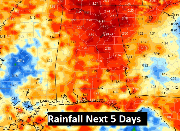
Good Morning! The Remnants of Nicholas have faded to just a broad wave of low pressure, close to the Mississippi River. Since we are on the wet east side, it’s overall effects linger. Our much higher than normal rain chance will remain in place through the weekend and through the first half of next week.
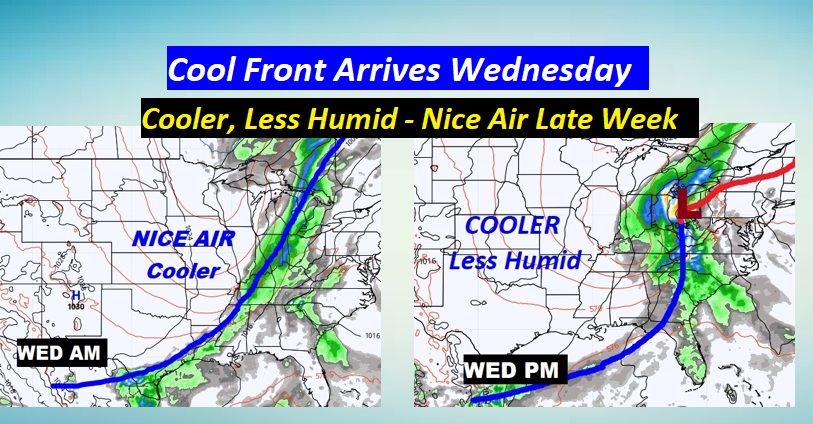
But, hang on! There’s good news about a cool front which will sweep through the state Wednesday. It will wipe out the tropical air. Get ready for cooler and drier air. Next Thursday and Friday should be remarkable. So far, next weekend looks nice!
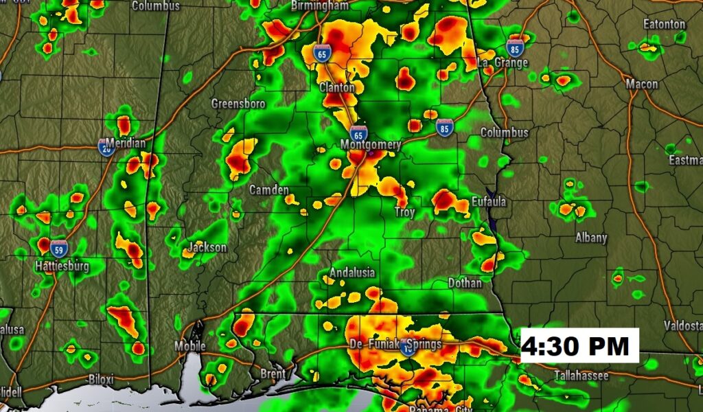
TODAY: It’s not going to rain all the time. There will be a lot of dry hours. BUT, like the last few days, the rain chance if very high. Numerous showers and storms. Tropical downpours in spots. High in the low 80’s Low tonight in the low 70’s.
Here’s a Future Radar snapshot at 4:30PM …just to give you a sense on the potential coverage.
NEXT FEW DAYS: The ELEVATED rain chances will stay with us at least through Tuesday. Then, a nice cool front moves through Wednesday, wiping out this tropical air. By Thursday & Friday, we’ll be enjoying cooler, less humid air with blue skies and sunshine.

Locally heavy rainfall amounts in spots with the tropical downpours.
Here’s that NICE front that will be our savior on Wednesday.
TROPICAL UPDATE: Odette is a Tropical Storm, well off the US Middle Atlantic coast. With winds of 45 mph, Odette is a highly sheared tropical storm. Most of the “weather” is shared to the east and NE of the center. It doesn’t have much of a future as a tropical system. Expected to lose it’s Tropical characteristics in the next 24 hours as it moves into the open Atlantic.

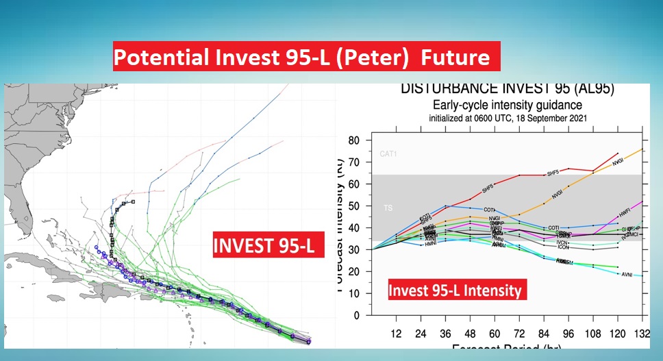
Elsewhere in the Atlantic…we have Invest 97-L way out there. But, let’s talk about Invest 95-L. Although still disorganized but could become a Depression, maybe today, and eventually Tropical Storm Peter.

Will PETER ever be a threat to the Bahamas or the SE US? The jury is out. Here’s some of the potential model tracks and intensity forecasts.
FOOTBALL: The two biggest games of the season so far happen today. Bama is in Gainesville and Auburn is in State College, PA for the first time.
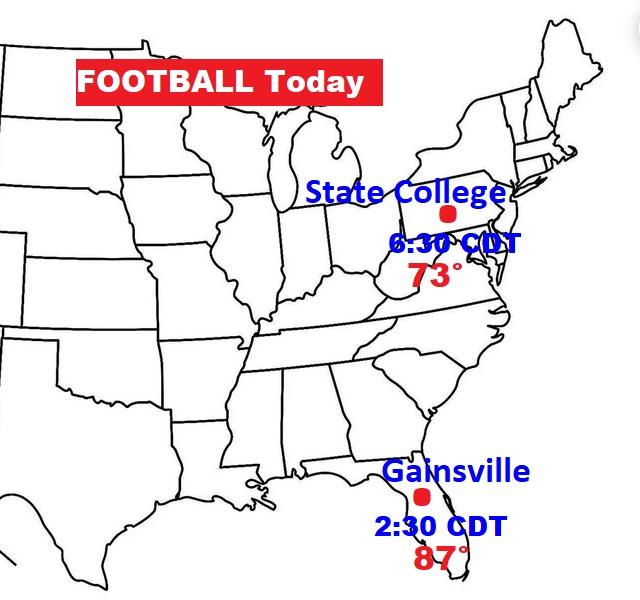
BAMA – FLORIDA: 2:30 CDT Kick on CBS. Very humid. 70% chance of showers & storms. Gametime temp 87. Light wind.
AUBURN at Penn State: 6:30 CDT Kick on ABC. Rain chance 20% or less. High today 82, Low tonight 54. Gametime temp. 73. NW wind at 6. Partly cloudy.
ESPN Gameday is in State College this morning.
I’ll have another Blog update tomorrow morning. Have a great FOOTBALL SATURDAY.
–Rich