Good Morning! What can I tell you? This dismal, tropical pattern which has been in place for the last several days, continues for the next few days. Like yesterday, showers and storms will be widespread today. Be flexible with your plans. Like yesterday, radar will be busy.
The elevated rain chance continues tomorrow and Tuesday, too. BUT…hang on. I have great news about a very important cool front that will swing through the state Wednesday. By Wednesday night, you will feel a big difference. Get ready for a nice change. By Thursday & Friday, and through next weekend, the weather will be absolutely spectacular. Blue skies. Comfortable temperatures. Low humidity.
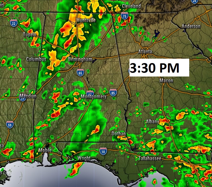
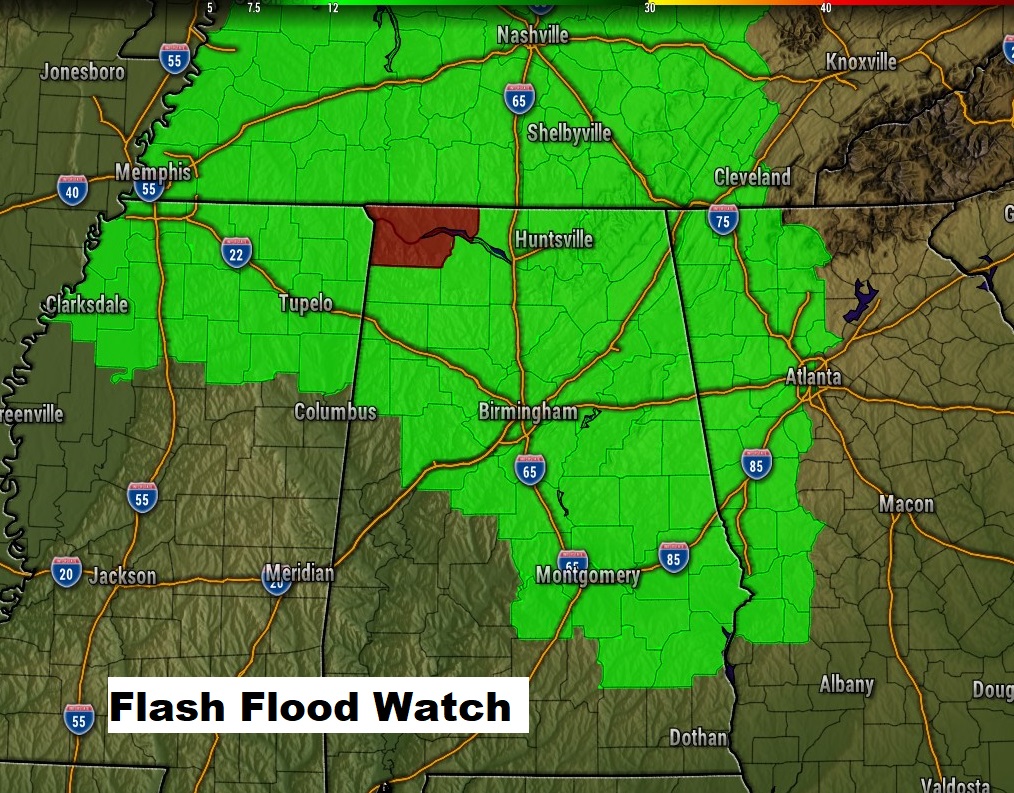
TODAY: Same deal I told you yesterday. It won’t rain all the time, but there will be numerous showers and storms. Tropical Downpours at times. High in the lower 80’s Tonight’s low in the lower 70’s. Here’s a Future Radar snapshot at 3:30 PM, just to give you an idea on potential coverage. Flash Flood Watch continues.
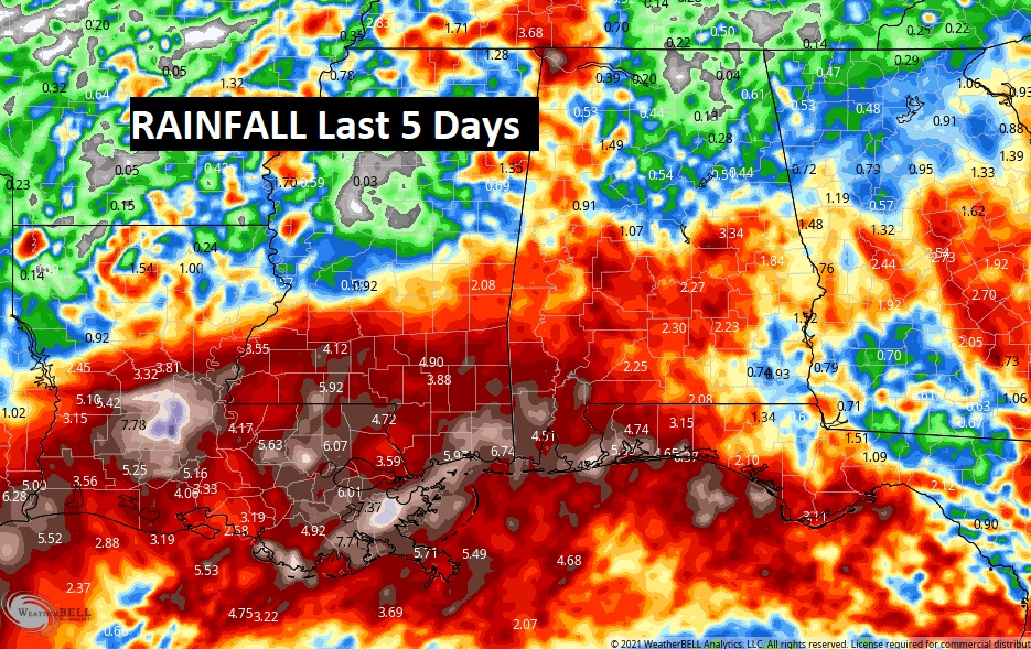
RAINFALL: If you were watching my videos, earlier in the week, on Monday & Tuesday, before Nicholas made landfall, I told you that Alabama and neighboring states would see some crazy rainfall totals over the next several days. Take a look at this map. These are rainfall totals from the last 5 days. By the way Montgomery’s Dannley Field has had 3.77” so far. On the coast, 5 inches plus.
Are we done? NOPE. Here’s a look at the next 4-5 days before that nice front pushes the rain out mid-week.
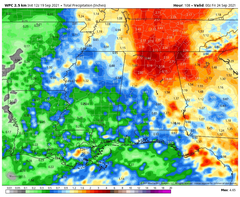
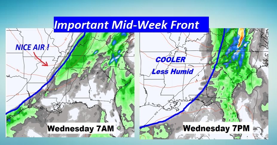
NEXT FEW DAYS: The much higher than normal rain chance are locked in through Tuesday. On Wednesday, an important cool front will move through the state. Showers and storms ahead of the front, then NICE relief. In fact, it’s possible we will fall to the upper 50’s, perhaps by Thursday morning. Thursday and Friday will be sparkling. Low humidity, Fall-like temperatures. 70’s daytime. 50’s at night. Blue skies. And guess what? That very nice pattern continues next weekend…and beyond. HANG ON! We are almost there.
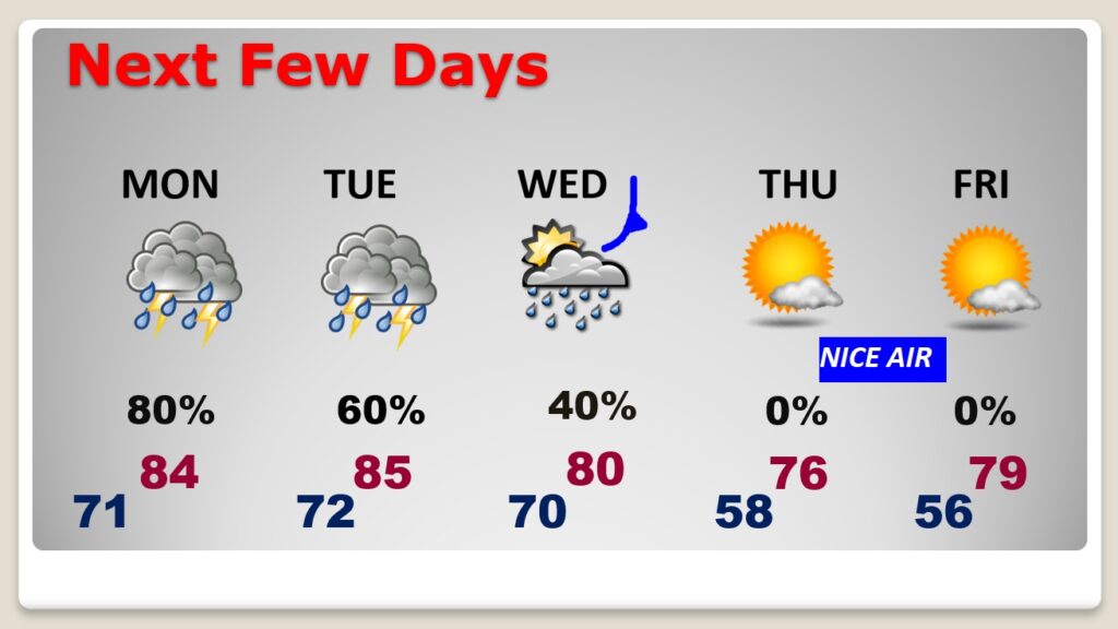
The front swings through the state Wednesday. Risk of storms ahead of the front. Much nicer air follows.
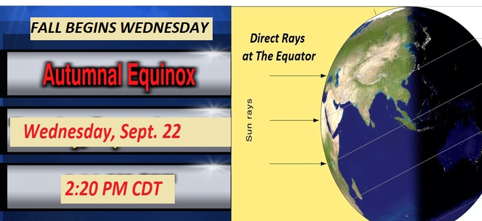
And, how ironic? The nice Cool Front moves through on the First Day of Fall.
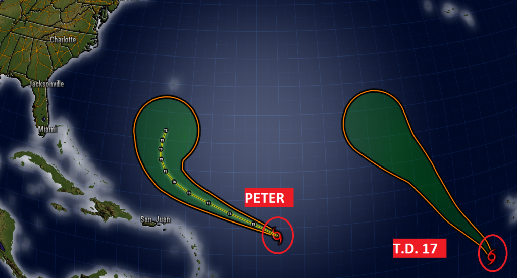
TROPICAL UPDATE: New developments in the Tropical Atlantic. We’ve had the birth of PETER, finally, well east of the islands. It looks like it will be an Atlantic “curver”. Then , there’s Tropical Depression 17, in the far east Atlantic. Looks like we will soon have Tropical Storm Rose. This will be a Fish storm. The rest of the tropics are quiet. Tomorrow will be the 3 week anniversary if the IDA landfall in Louisiana. Simply awful.
I’ll have a complete video in the morning. Enjoy the rest of your Weekend.
–Rich

