
**Technical issues this morning. Got a 90 minute late start. No time to produce your video. Forgive me if I write you a blog update instead. Everything will return to normal tomorrow morning, I promise. Thanks! 🙂
Good Morning! Today will be the last day of the Elevated Rain chance. Rainfall totals since last Wednesday have been crazy. Some of you have had over 5 inches. Today the showers and storms will be in ample supply again, BUT, things are a lot of get better.
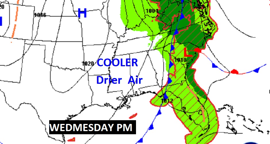
On the First Day of Fall tomorrow, a nice cool front will swing through our state, delivering cooler drier air which will remain in place for several days. It will be a NICE change from this dismal Tropical Pattern, set-up by Nicholas. Hang on. Our Nice Change begins very soon.
TODAY: Like yesterday, there will be some sun, mixed with clouds. Scattered, random showers and thunderstorms will pop up in the daytime heating. High upper 80’s. Low tonight low 70’s.
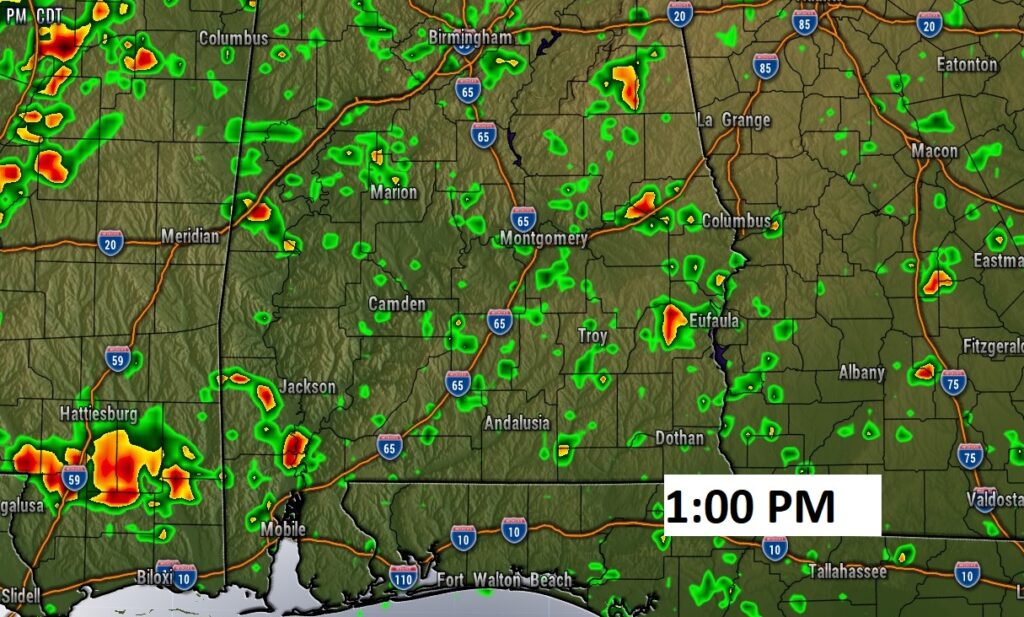
Here’s the map set up today and a look at Future Radar at 1PM. See that cool front near Memphis?

WEDNESDAY: On Wednesday, first day of Fall, that important cool front will swing through our state. There will be showers/storms ahead of the front. For most of us, by about lunchtime, the rain chance wil1 end as the front passes through. You will feel noticeable improvement by evening.

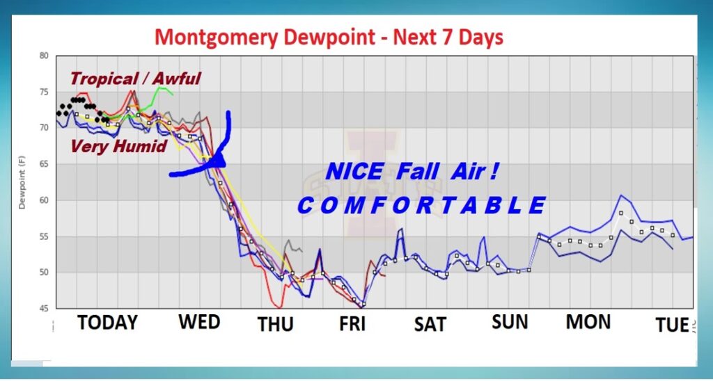
DRAMATIC IMPROVEMENTS: This graph says it all. Today will be extremely humid. High dewpoints in the awful 70’s. Look at what the cool front does tomorrow! The Dewpoint will drop like a rock. Nice Fall Air is on the way with comfortable, days and lower humidity.
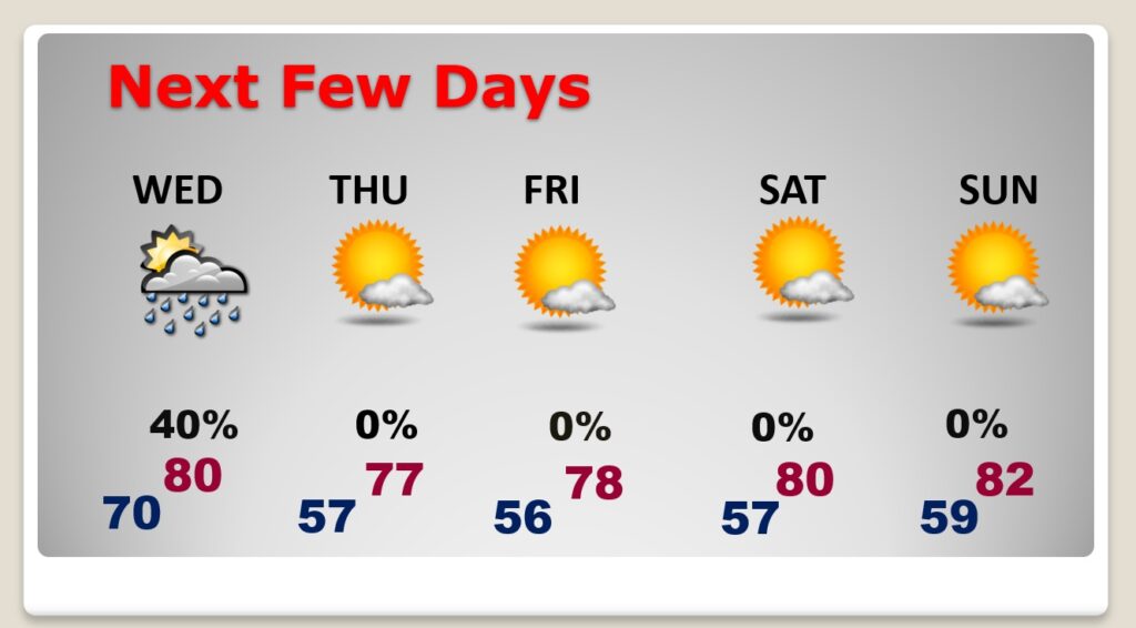
NEXT FEW DAYS: Thursday …through the weekend, look for a series of very nice Fall Days with sunshine, low humidity, comfortable days and cool nights. Just what the doctor ordered.
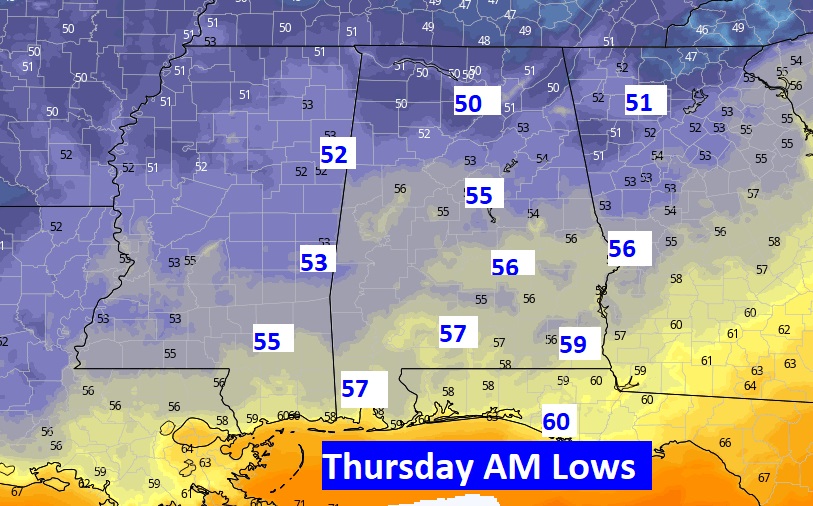
Check out some of these morning lows around Dawn Thursday & Friday morning. NICE!

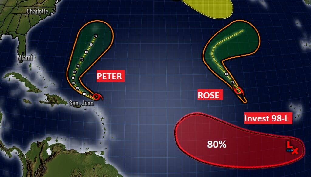
TROPICAL UPDATE: Busy in the Tropical Atlantic. Tropical Storms Peter and Rose are “curving” storms with no threat to North America. Invest 98-L in the Far East Atlantic could someday become Tropical Storm Sam.
Have a Day! I Promise there will be a complete video update in the morning..
–Rich