
Good Morning! Our beautiful pattern continues, on this First weekend of Fall. This morning will start off mostly in the pleasant mid 50’s at Dawn. (Yesterday’s 53 in Montgomery was the coolest since May 8th, 141 days.) This afternoon will be warmer than yesterday, but still very comfortable with low humidity.
Although, we will gradually start to get warmer, our beautiful weather pattern will continue for several more days. On this blog update, we’ll look well into the future. How long could this possibly last?
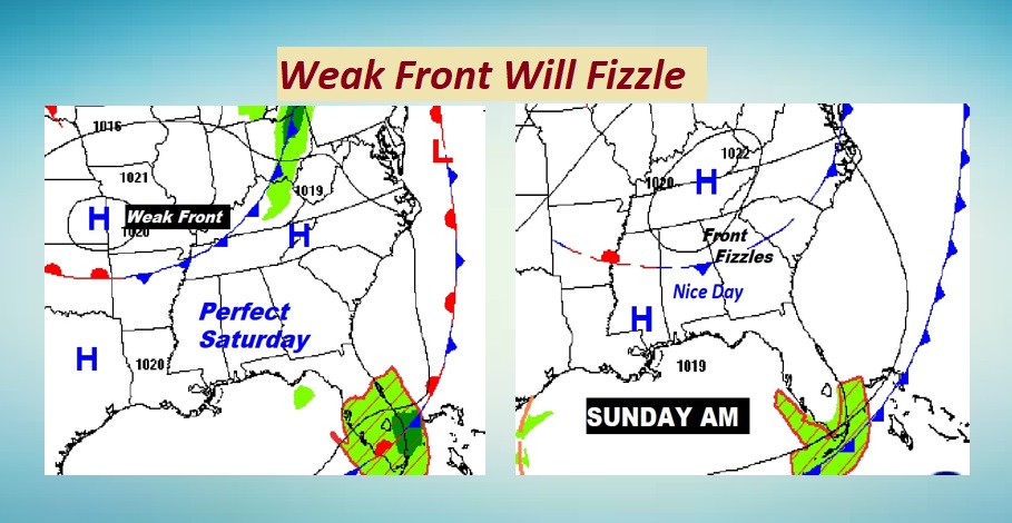
On the map, a weak front approaches from the north approaches the state, but fizzles. It will have no impact on our weather.
TODAY: Abundant sunshine. Low humidity. High 80-82. Light NW wind 4 to 8 mph. Clear and cool tonight. Jacket weather late. Low 56.
Great Football Weather. Auburn is home…3PM. Bama is home…6:30 PM. ASU and Tuskegee is also home. Troy is on the road. MUCH nicer for football than las weekend across the Southeastern U.S.
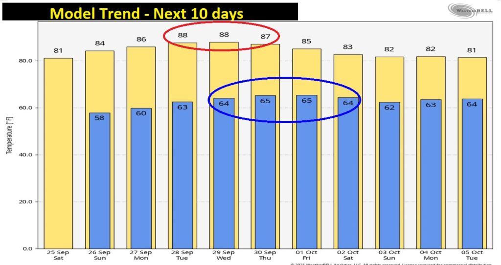
NEXT FEW DAYS: Days and nights are getting warmer. Mid 80’s Sunday and Monday. Upper 80’s Tuesday through Thursday. Lows at night back into the 60’s most of next week. Humidity still low. Sunshine. Storm-free for several more days.

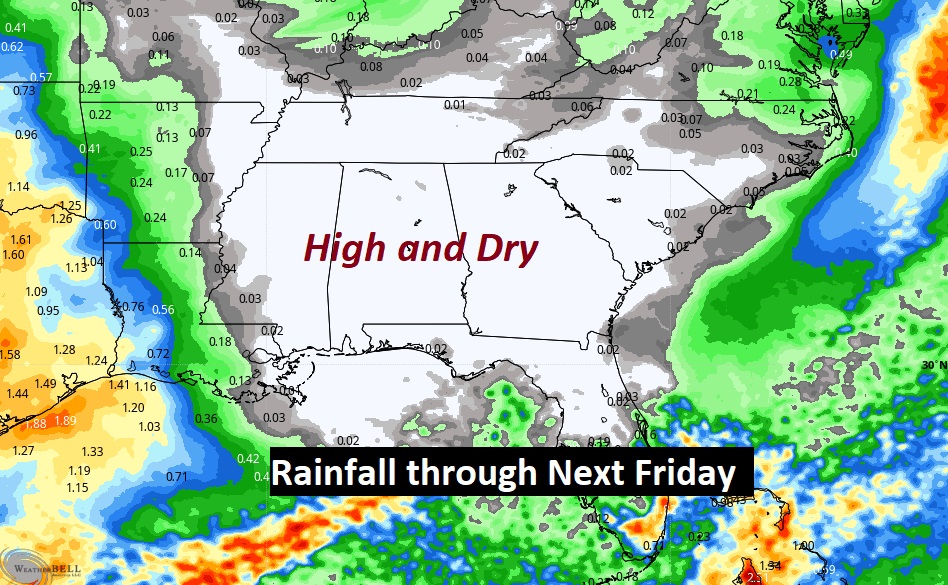
WARMER, BUT DRY FOR SEVERAL DAYS: The rainfall may through at least next Friday still shows bare ground over Alabama. NO RAIN. And, I’m even optimistic about next weekend, too, at this point. No major fronts or storm systems, and no Tropical Trouble effecting Alabama.
Temperatures will peak mid to late week, but then, they may come down just a tad by next week, following the passage of a dry “backdoor” cool front late next week.
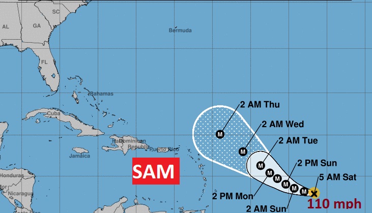
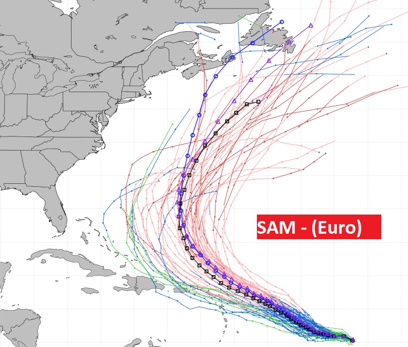
TROPICAL UPDATE: Since yesterday, there is a new name in the tropics. Tropical Storm Teresa, well off the U.S. East coast, is expected to have a short life. The Area to Watch off Africa, could some day get the name Victor. Guess what? There’s only one name left on the list after that….Wanda. So, it looks to me, that we are going to use the new alternative list. This will be the third year in a row we ran out of names on the main list. The BIG deal in the tropics, by far is Sam. More on Sam below.

Hurricane Sam with 110 mph winds is just 1 mph away from becoming a Major Category 3 hurricane. It is forecast to peak late tonight as a powerful Category 4 storm with 140 mph winds. Thankfully, it will make a right turn before reaching the Leeward islands. They will get powerful swells. What about the potential threat to North America? Well, now the EURO model ensemble members have trended eastward. It appears the threat to the Northeastern United States has eased quite a bit. But, the Canadian Maritime providences may have to deal with Hurricane Sam. It’s been a Hurricane year for Canada.
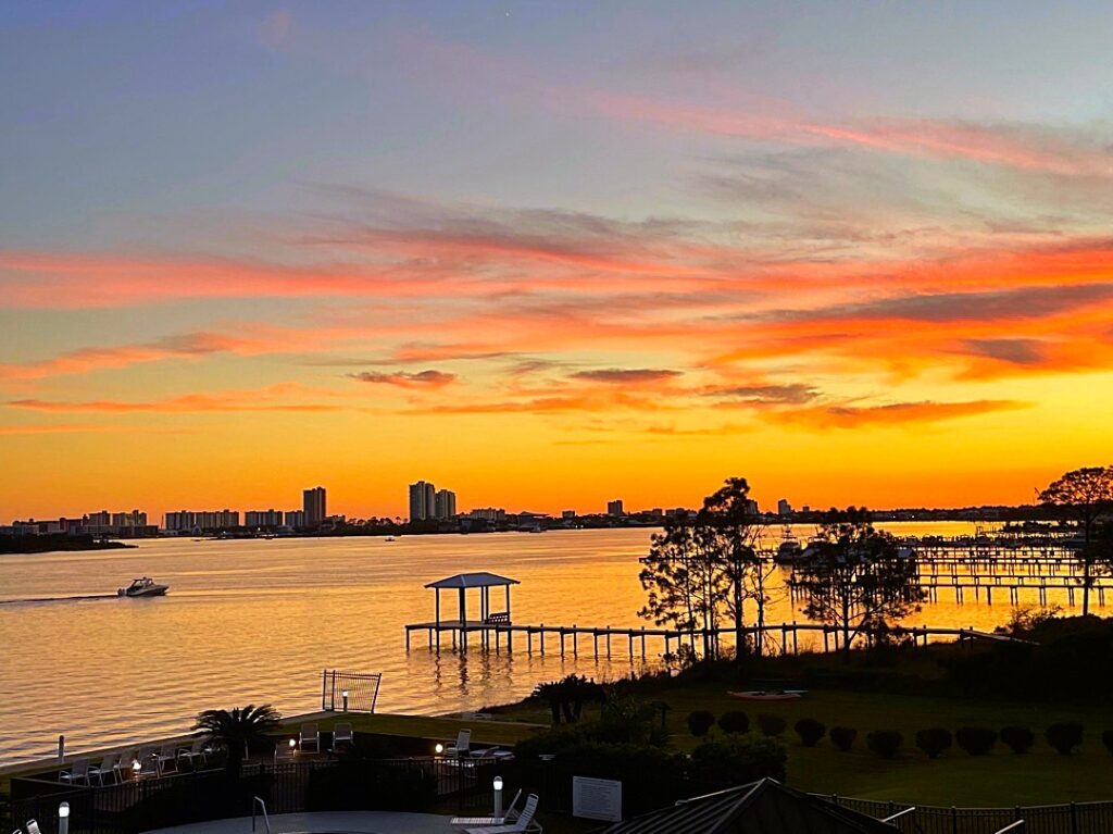
GOOD MORNING FROM ORANGE BEACH!: Beautiful sunset here on the coast last night, as the First Weekend of Fall begins.
.
Chase and I are still having a great time. I have never seen this dog smile so much. He’s so happy to get away. So is Daddy!


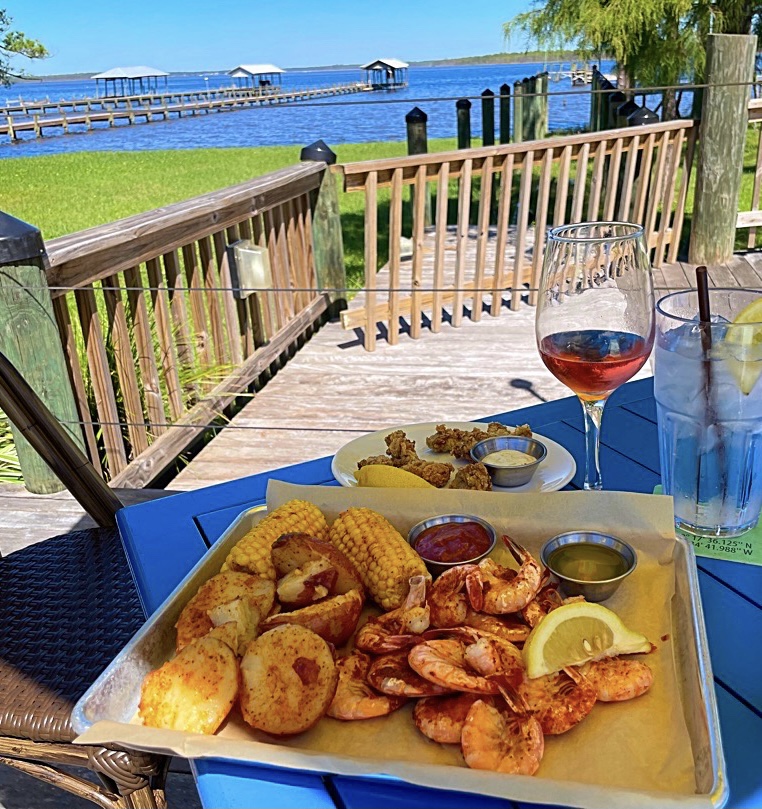
Yet another great seafood lunch…this time at GT’s on Wolf Bay.
One more day to hang out today, and explore before heading back home tomorrow.

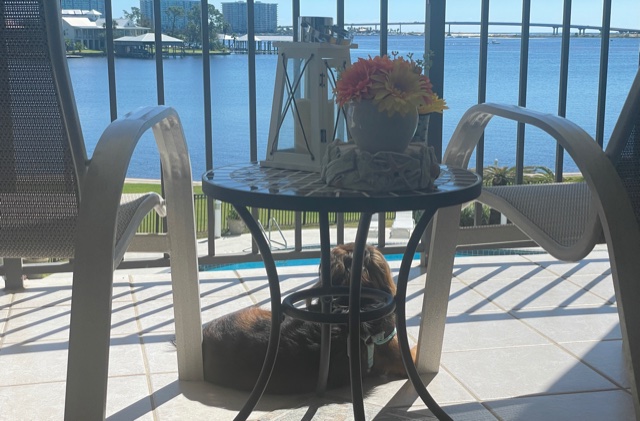
Chase loves sunning himself on the Condo balcony overlooking the pool. 🙂
.
I’ll have another Blog update tomorrow morning. Have a great FOOTBALL SATURDAY. Enjoy this beautiful First weekend of Fall.
–Rich