Good morning! After a nearly perfect weekend, our sunny & dry weather pattern continues. It appears that we may stay dry for several more days. Meanwhile, we’re getting hotter and hotter. It may be September but we should be back to 90 degrees plus by Wednesday/Thursday. On this video, we’ll look ahead. How long will the extended storm-free pattern last? Plus, it’s busy out in the Atlantic. Are we about to run out of names again?
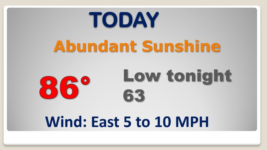
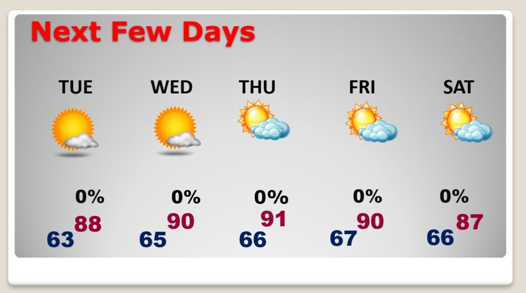
Not too humid, but today will be a sunny, hotter day. Not quite as cool tonight.
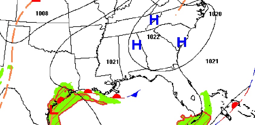
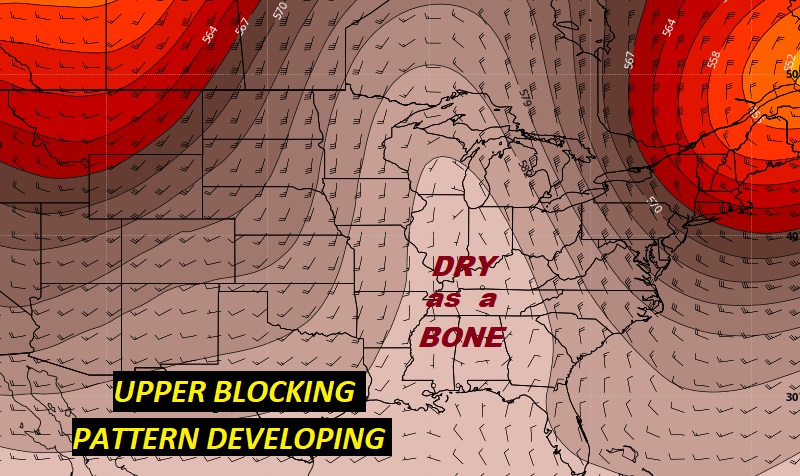
A narrow “blocking pattern” in the upper atmosphere will keep us dry & storm-free for several days and we continue to heat up.
Hotter and hotter the next few days..starting to feel more and more like summer again. And..the coolness at night is gone. Several days of dry weather ahead.
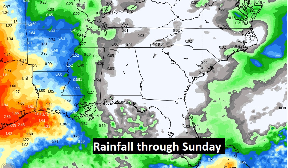
This map speaks volumes. Dry for several more days.
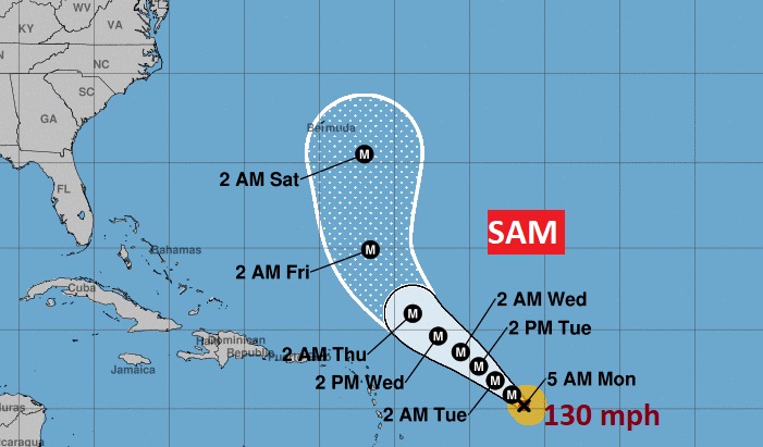
Things are still very active in the Tropical Atlantic. We are about to run out of names again. Victor and Wanda are the only names left.
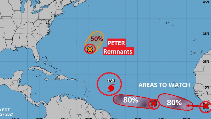
Extremely Dangerous Major Hurricane Sam is still the star of the show. Once a 145 mph storm, it’s still Cat. 4 with 130 mph winds. Expected to miss Bermuda, but it will be trouble down the road for the Canadian Maritime providences.