Good Morning! Today is the 12th day with no measurable rainfall at the Montgomery airport. This could be the last day. Showers and thunderstorms are about to make a big comeback to our forecast.
Rain chances are particularly higher starting Sunday and Monday, but the risk of showers and a few storms will be in the forecast daily, through the week ahead. Showers could arrive by late tonight.
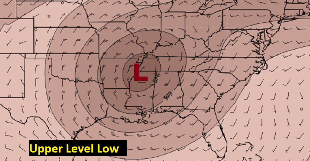
Here’s the set-up. An upper Level Low will set up, not far from Memphis. A series of disturbances will rotate around the Low, like spokes on a wheel. These upper disturbances, rippling through the area, combined with tropical moisture and daytime heating will be ideal for showers development.
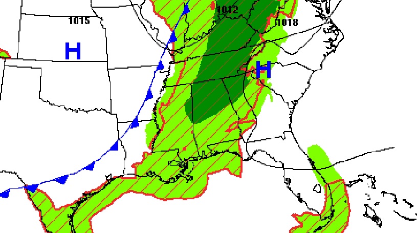
At the surface, a frontal boundary will be approaching, which will also enhance the rain chance especially Sunday afternoon through Monday.
TODAY: There will be more clouds than yesterday. I’ll call it Partly Sunny. High upper 80’s to near 90. Fairly humid (Dewpoints 66 to 69). Southeast wind 5 to 10. Mostly cloudy tonight. Could be some showers and by late tonight after 10PM. Low tonight 69.
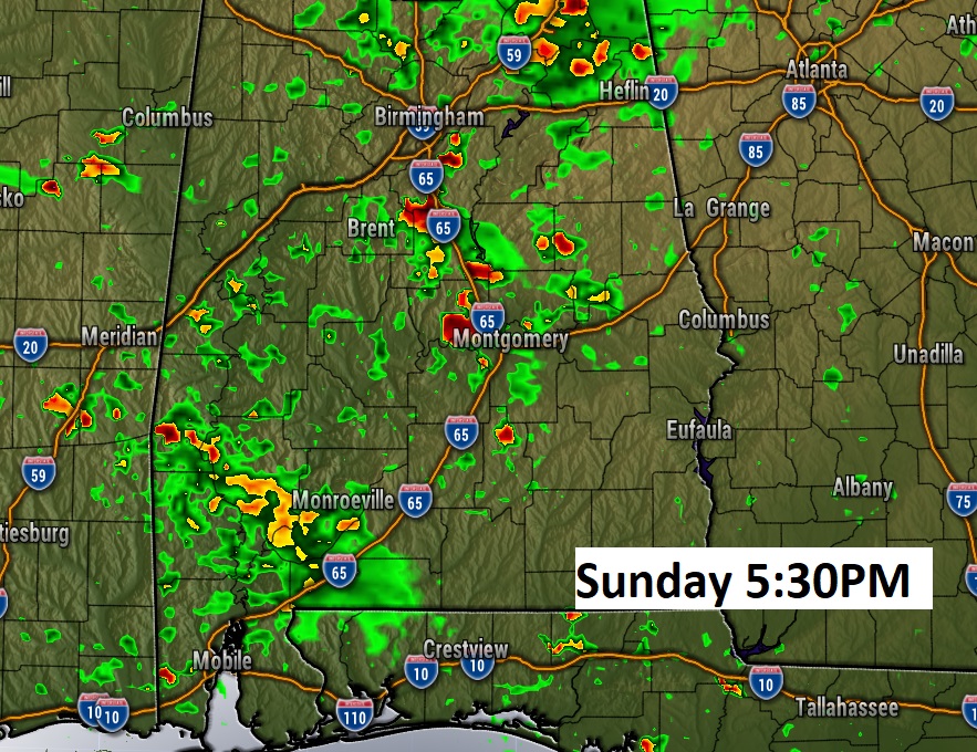
SUNDAY: Showers as storms will be possible anytime. But showers and storms will be much more numerous in the afternoon & evening. High in the mi 80’s.
Here’s a “flavor” of Future radar late Sunday afternoon, to give you a sense of the potential coverage.
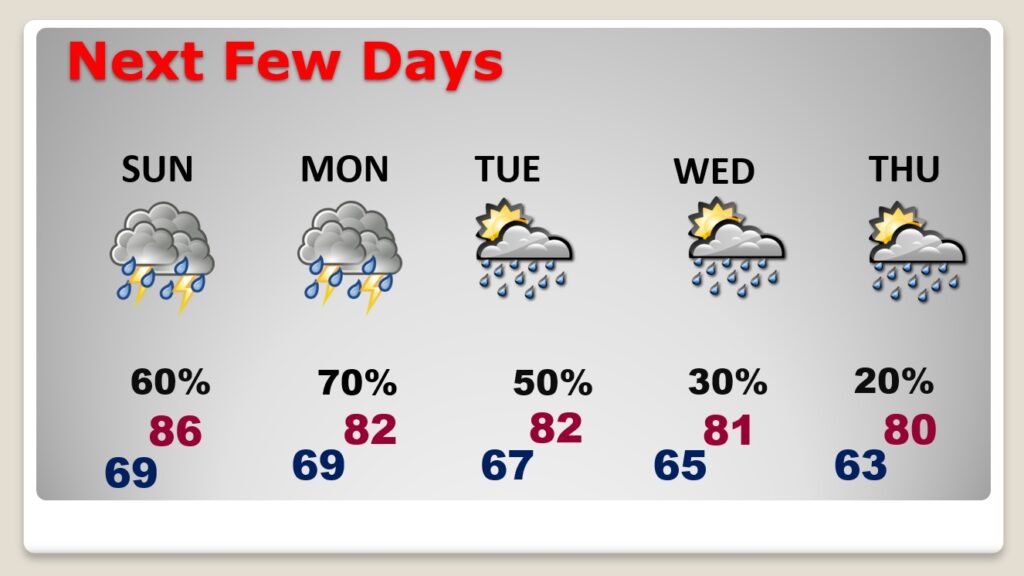
NEXT FEW DAYS: Showers and thunderstorms will be most numerous Monday. But, there will be showers and a few storms each day, especially in the afternoon and evening. By, the way, it looks like next weekend (Oct. 9/10) looks dry to me, right now. That would be good news for the Fair.
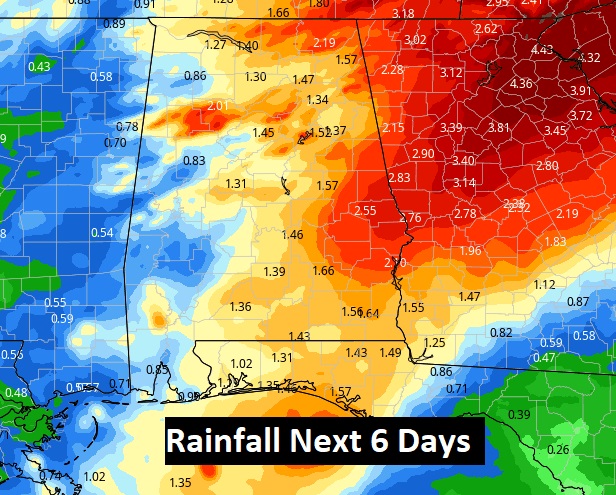
RAINFALL THIS WEEK: The next six days could be rather wet at times. As you look at this map, keep in mind, these are “average” rainfall totals. Rain totals from town to town will vary quite a but. Showers and a few thunderstorms will be most numerous in the afternoon and evening hours. Notice the eastern half of the state is favored for the heavier totals.
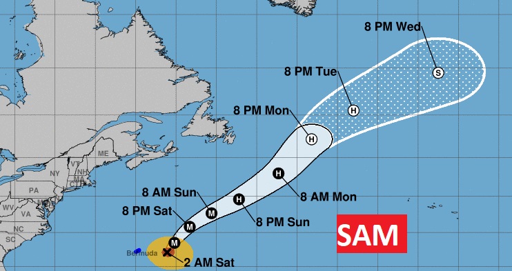
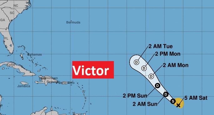
TROPICAL UPDATE: There are only players in the Tropics at the moment. Sam and Victor.
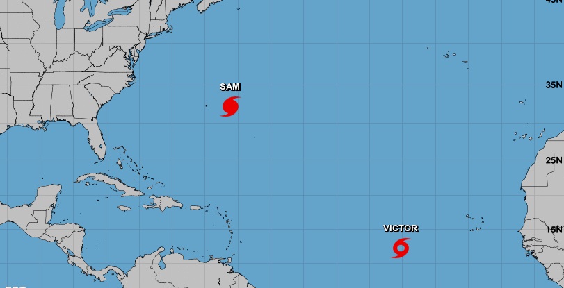
Sam is still a major hurricane with 140 mph winds, east of Bermuda. It will be curving into the North Atlantic. Tropical Storm Victor will probably not be a big deal. Many models eventually curve Victor into the eastern Atlantic.
.
I’ll have another Blog update tomorrow morning. Have a great SATURDAY. Lots of good games today. Happy first weekend in October.
–Rich

