
Good morning! It’s going to rain. Take it to the bank. In fact, as you are going to see on this video, rainfall amounts could be excessive over the next few days in some area. Flash Flood Watch has been issued. Already parts of our state have had flood issues in the past 24 hours. On this video, through, I also have good news. I’ll tell you about some really nice weather on the way. We’ll look at the updated timetable. Plus, could there be a nice Mid-month cool front?
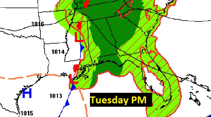
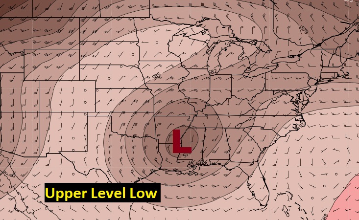
Here’s the set-up. We’re on the wet side of a front that’s not going to move much in the next 36 hours. We’re also on the west side of an upper level low.
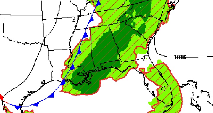
Once again today, there will be waves of showers and a few thunderstorms. Rainfall will be widespread.
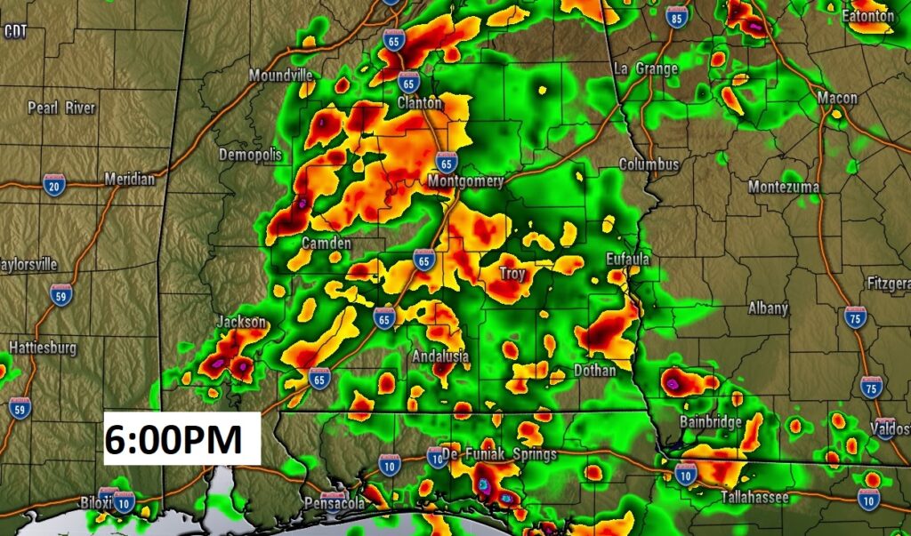
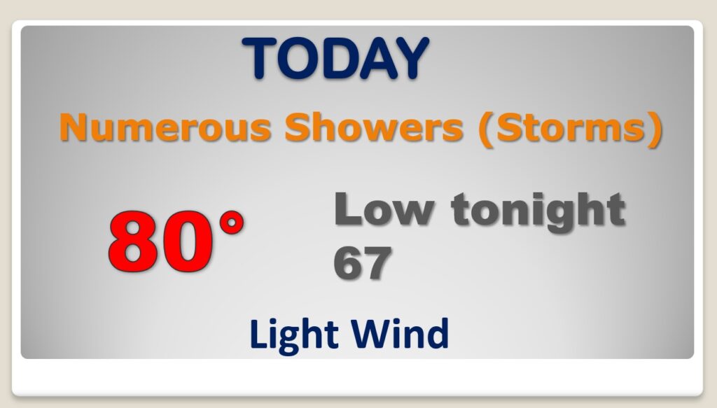
Rainfall over the next 3-4 days could be rather excessive in spots. FLASH FLOOD WATCH. Already, there have been flooding issues in parts of our state.
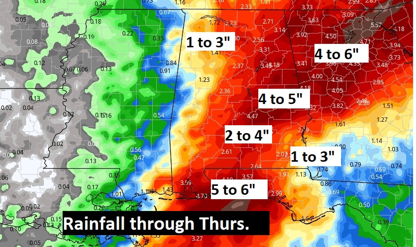
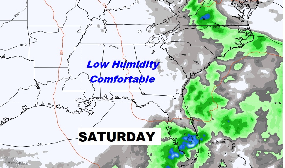
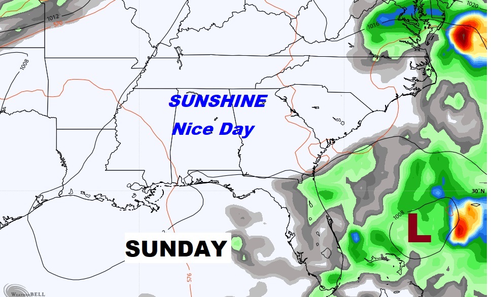
The excessive rain chances will continue through Wednesday. Thursday is the beginning of the ends. Leftover showers. Big improvement Friday. Nice weekend ahead.

Timing is everything. I’m very optimistic about the weekend weather scenario. The Fair begins. Huge Football Saturday, including a key game in Auburn, Alabama.

The only thing worth monitoring in the tropics is that Area to Watch approaching the Bahamas. Possible future implications for the United States. Next name on the list is Wanda.

On this date in 1995…Cat 3 Hurricane Opal came shore on the Gulf coast around Destin, 115 mph winds around 4pm. It was a Wednesday just like today. Opal moved straight north into Alabama. It was still a Full Fledge Hurricane when it came straight up through and over Montgomery. NHC listed to top sustained winds at 75, but wind gusts to over 90 mph recorded at Dannely field and Maxwell.
