
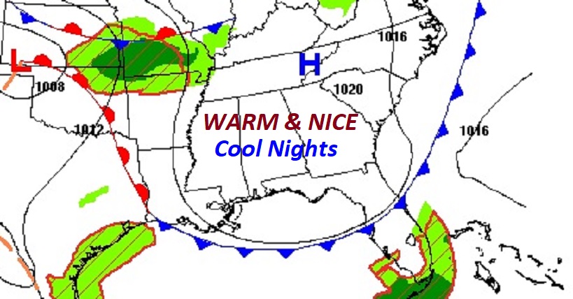
Good Morning! I’m happy to say we have yet another nice October Weekend in-store. Expect very warm days, a cool Jacket Weather nights. Enjoy this quiet pattern. Looks like it could be an active weather week ahead for Alabama.
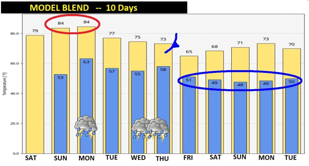
Normal high is 78, normal low 52. Today and Saturday, highs will be warmer than normal, nights will be closer to normal (or average). Enjoy the sunshine. We may be starting our Fall secondary severe weather season a tad early.
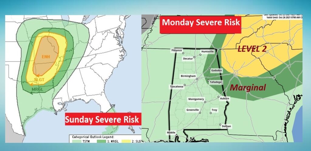
Parts of our state could deal with strong/severe storms with a Monday storm system. I’m a but more concerned with the second storms system toward Wednesday Night into Thursday. Perhaps a more concerning severe weather threat. It’s rare when the Storm Prediction Center mentions a severe threat five days out.
TODAY: Cool start in the low 50’s. Abundant sunshine. Big temperature re-bound. Yesterday’s high was 81. I think we’ll be near 80 today. Mainly clear and cool tonight. Mid 50’s. Light wind today and tonight.
MONDAY STORM SYSTEM: November begins our Secondary Severe Weather season here in Dixie Alley. Parts of our state could see some strong to severe storms on Monday, as the first of two frontal systems approaches. Look at the SPC outlooks for Sunday & Monday. They indicate a rather significant Severe Risk in the mid-Mississippi valley Sunday, affecting parts of Alabama on Monday. Looks like the northern and east central counties have the greatest risk at the moment. As you look at the threat maps below, keep in mid that the threat area will almost certainly be adjusted as we get closer to the event.
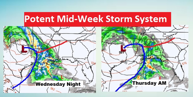
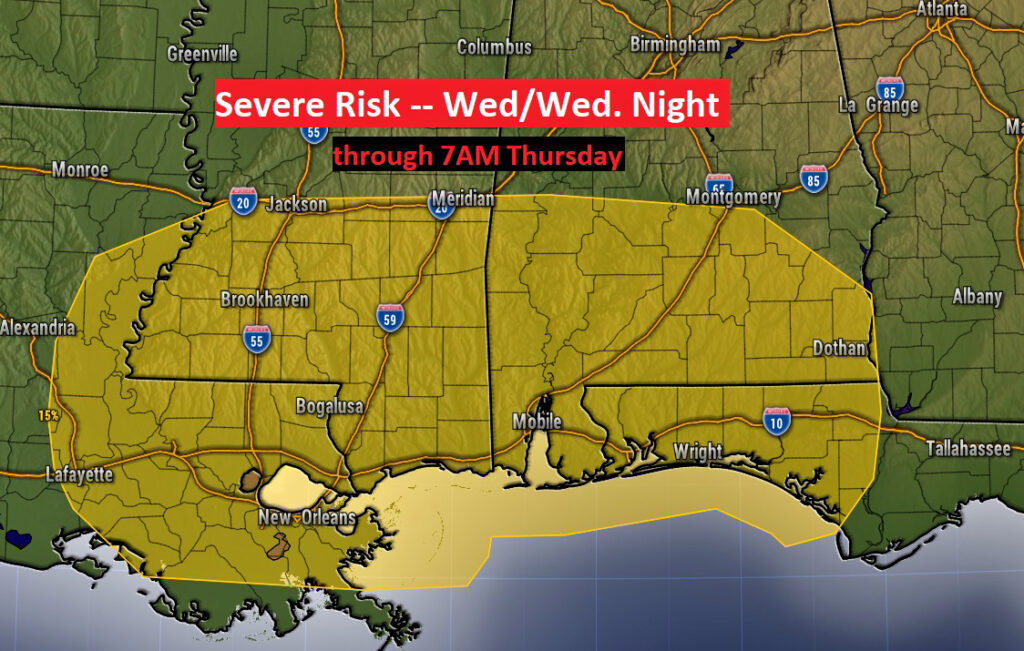
WEDNESDAY NIGHT/THURSDAY STORM SYSTEM: The mid-week storm system looks a bit more concerning to me. The current time table takes the brunt of the weather with this system into Alabama Wednesday night into Thursday.
Even this far out, the Storm Prediction Center has indicated a Severe Risk. Currently that covers most of the southern half of the state. Almost certainly the threat area will be adjusted as we get closer to the event. Tornadoes are possible in a situation like this.
NEXT FEW DAYS: Nice through Sunday. Scattered thunderstorms Monday. Dry Tuesday. Potential big deal storm system by Wednesday night through Thursday.
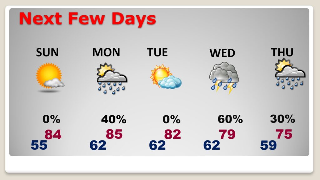
After the Wednesday night/Thursday storm system, much cooler Friday, through Halloween. That Halloween weekend looks storm-free right now.
TROPICS: Fortunately, the tropics are as quiet as a mouse.
Remember this week last year? We’re getting ready to deal with ZETA. That’s the one that caused localized flooding, and LOTS of power outages through the heart of Alabama, Georgia and way up through the middle Atlantic coastal states.
.
I’ll have another Blog update tomorrow morning. Have a great SATURDAY. Enjoy this nice weekend.
–Rich