
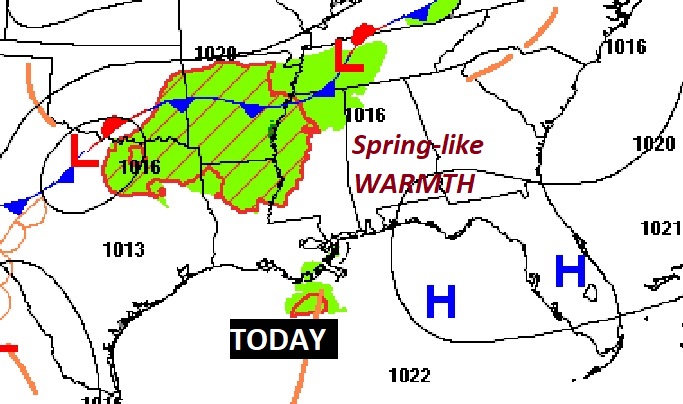
Good Morning! Once again this morning, DENSE FOG will be widespread problem across much of Alabama. But, after the fog lifts, we should have yet another very nice Spring-Like day. It’s a great day for a host of Christmas festivities in many cities and towns, including parades and tree lightings. This remarkable string of warm, tranquil Springlike days will end soon. But, even Sunday will be another comfortable, day.
But, get ready for a radical change in the week ahead. The risk of rain will be in the forecast each day, through Friday and quite possibly beyond. We certainly need some rain. But, the expected rainfall amounts could be rather excessive in spots. See below for details.
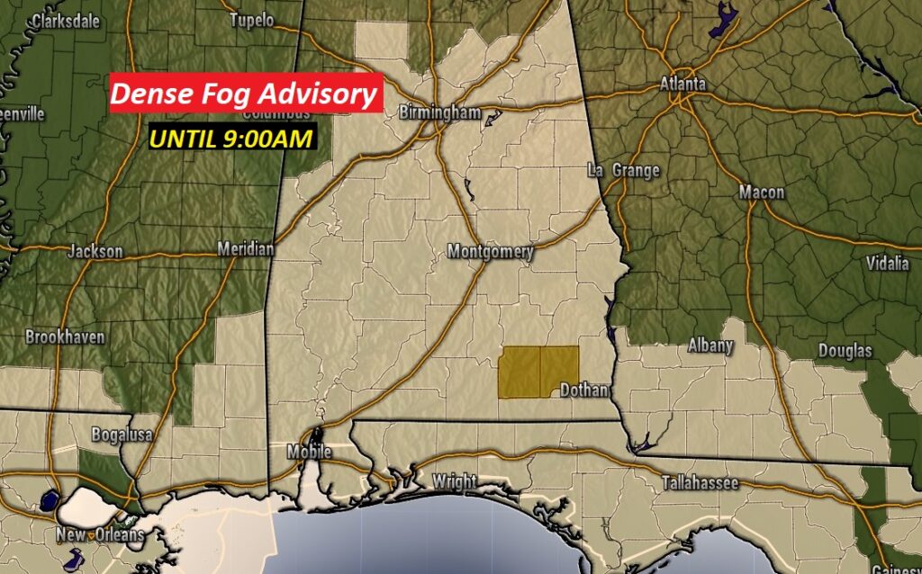
DENSE FOG ADVISORY: Once again this morning, DENSE FOG will be widespread problem. Dense Fog Advisory until 9AM. Visibility will be below ¼ mile in spots.
TODAY: After the fog, expect another warm & dry day, much like yesterday. There will be a lot of high cloudiness with sunshine filtering through. Milky skies, but quite comfortable. Yesterday’s high was 75. We’ll be in the mid 70’s tonight. Not as cool tonight. Low 53.
.
SUNDAY: Patchy dense fog again. Should be another warm & mainly dry day. I guess there could be a stray shower during the day, but I have the daytime rain chance under 20%. High 75. Not much sunshine, but some. Sunday night will be cloudy. Widely scattered showers late Sunday night. 20% chance.

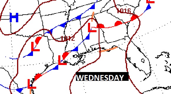
THE WEEK AHEAD: A frontal system will move through the state Monday with showers and thunderstorms likely. I don’t expect any severe weather at this point.
The frontal system will stick around much of the week ahead. A number of low pressure areas will move along the front. The risk of showers will be in the forecast every day, at least through Friday. Some days will be wetter than others.
Rainfall amounts could be rather impressive across the Gulf South. This, of course, will be a radical change from the weather of the last several days.
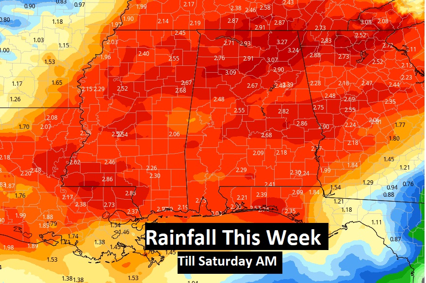
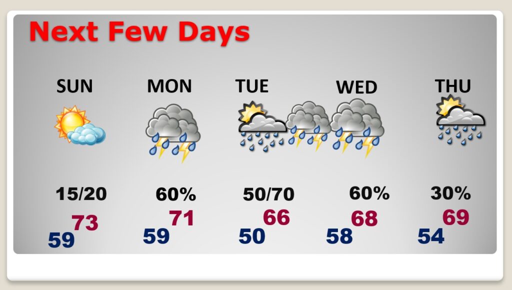
NEXT FEW DAYS: The risk of showers will be in the forecast every day, at least through Friday. Some days will be wetter than others. Thunderstorms are also possible. At the moment, I don’t anticipate any clear-cut severe weather threats, but ‘tis the season. Temperatures will continue very mild. I don’t see any arctic air in our future anytime soon.
DISTANT CONCERNS?: It’s far too early to speculate on the weather set-up around Saturday 12/11. But, the mere fact I have mentioned it, means I am watching the situation closely. We have several days to watch it.
.
Greg Budell and I will be in the Bluewater Sprinter van in the Millbrook parade today at 2PM. It’s a great day for a host of Christmas festivities in many cities and towns, including parades and tree lightings. Thankfully, today’s weather will cooperate in a big way.
I’ll have another Blog update tomorrow morning. I Hope the rest of your Weekend is good. Enjoy the last couple of days of our tranquil, Spring-like pattern.
–Rich