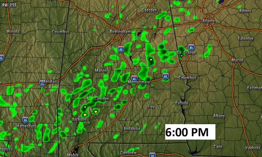
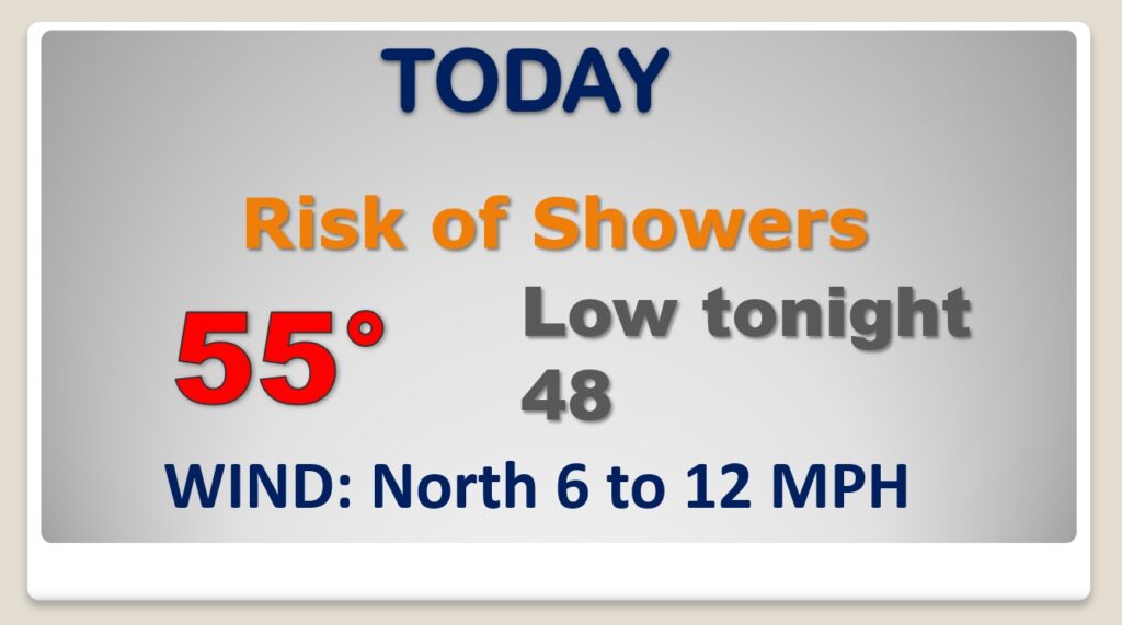
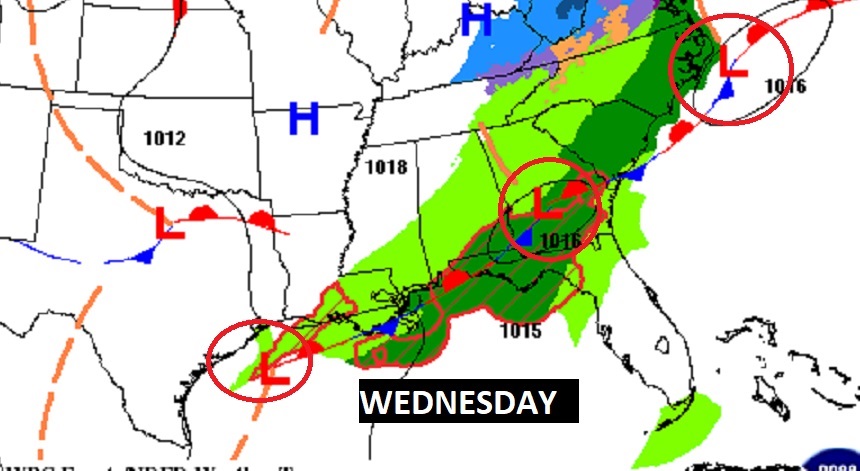
Good Morning! What a change in climate. After upper 70’s yesterday, we’ll only be in the 50’s today. The Cold Front that brought the drenching rain, is now parked on the Gulf Coast. Waves of low pressure will move along the front. There will be a daily risk of showers through the end of the week. Another Strong Cold Front on Saturday will bring more drenching rain to the state Saturday, and perhaps a low-end severe weather threat. We’ll be teasing 80 degrees by Friday. On this video, I’ll bring you up to date on the ups and downs.
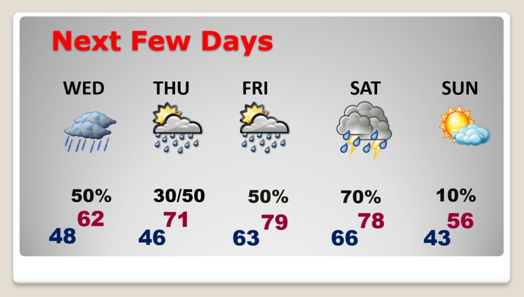
Dramatically cooler today. Risk of showers from time to time. Chilly tonight.
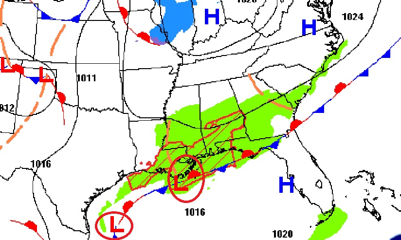
Waves of low pressure moving along the front near the coast will keep the chance of rain in the forecast daily.
Risk of showers each day. Rain chance will vary. Warmer late week. Strong front bring thunderstorms back to the state Saturday. Much cooler Sunday.
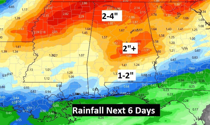
Additional potential rainfall over the next 6 days.
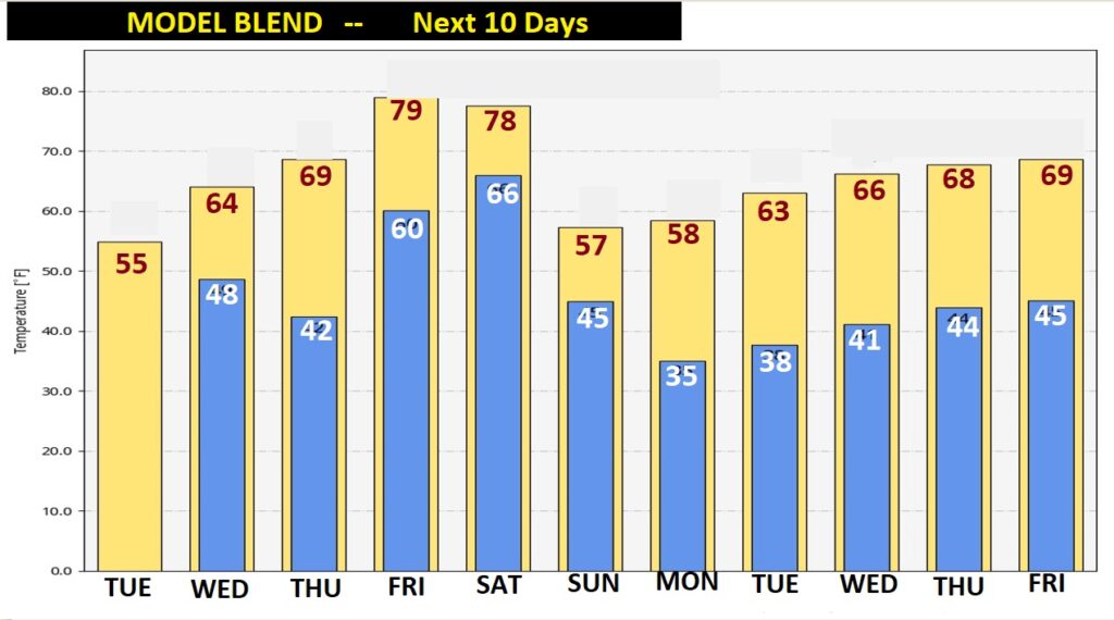
Here’s the model blend on the temperature ups and downs over the next ten days through Friday December 7th.