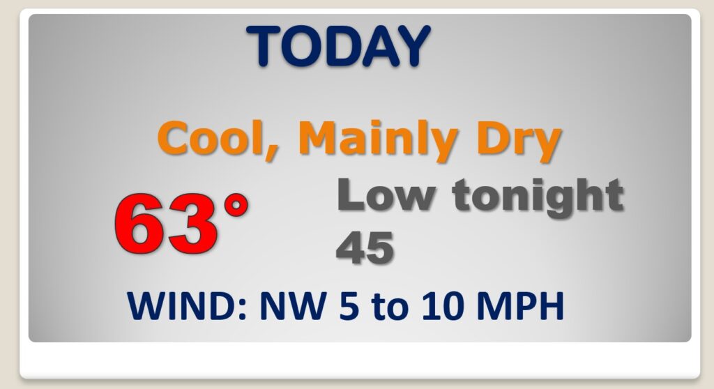
Good Morning! The latest disturbance, bringing showers to the state early this morning, will depart the state early. Much of this day will be dry. But, there’s more scattered showers, and maybe some thunderstorms in our future by late week, along with a rather significant warm-up. We could tease 80 degrees by Friday. The next “Big Deal” Frontal System could affect a lot of outdoor plans on Saturday. On this video, I have the latest of timing, and potential rainfall amounts. We’ll also look ahead. After the Saturday storm system, we could be in for several days of “Clear Sailing”.
Risk of showers mainly this morning. Much of this day will be dry. Even a little bit of sunshine this afternoon. Chilly tonight, but dry.
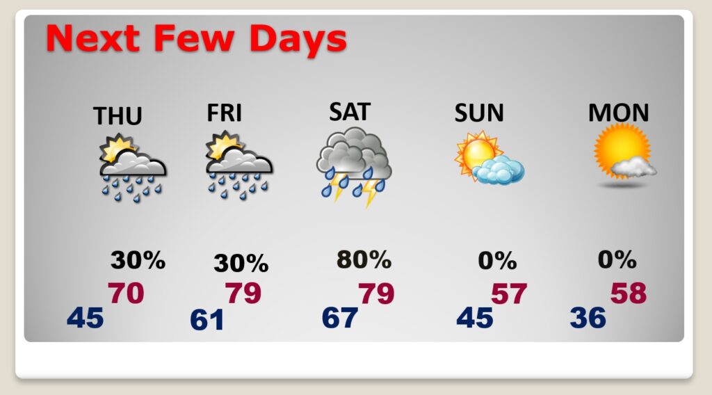
More scattered showers & thunderstorms return by late Thursday into Friday. Warmer. We could tease 80 degrees Friday. Another strong Cold Front will bring showers & Thunderstorms back to the state Saturday. Sunday will be much cooler, but it’s the start of several storm-free, quiet days.
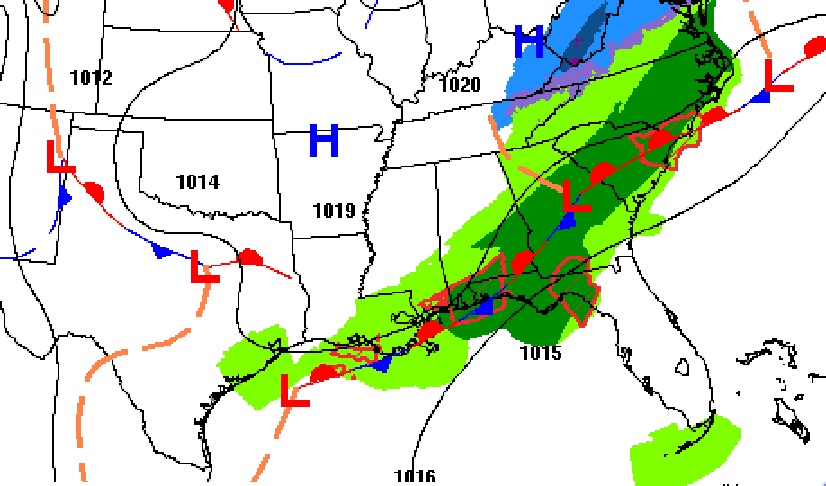
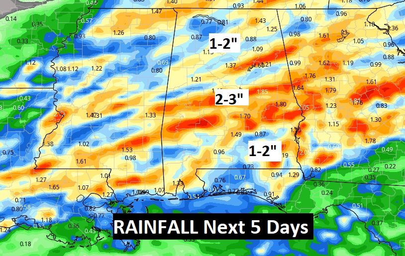
Here’s the projected rainfall for the next few days. The wettest day, by far, will be Saturday.
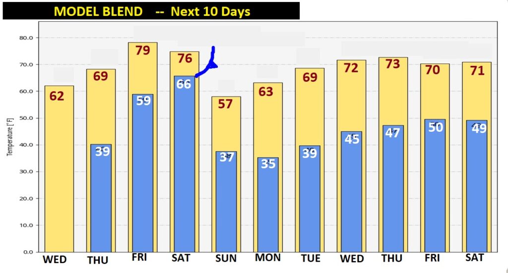
Here’s the Model Blend, showing temperature trends for the next 10 days. Look at the big warm-up late week. Then much cooler Sunday & Monday. There will be another modest warm-up next week.