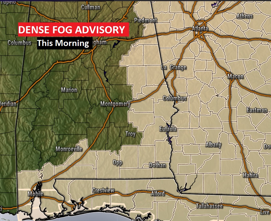
Good Morning! Many folks are returning to work today. Patchy fog will be an issue in some towns, especially in east & southeast Alabama.
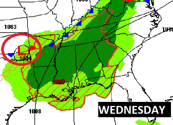
Otherwise, expect yet another dry, warm Spring-like day. But, stand-by for changes. Showers are returning to the forecast. And, more than that we could have some strong to Severe storms by Wednesday and Wednesday Night. We have an active week ahead. Could se see more severe weather over the New Years weekend?
DENSE FOG ADVISORY: Dense fog advisory remains in effect for much of eastern, and southeast Alabama. Visibility a quarter of a mile or less in spots. Be careful! Things should improve after 8AM.
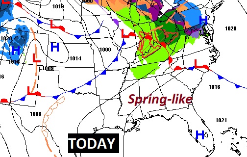
TODAY: After the Fog…. Otherwise, expect another very Spring-like day. Breezy, dry and warm. A lot of clouds, a few sun breaks. SW wind 5 to 15, gusty. Very mild overnight tonight. Low 62.
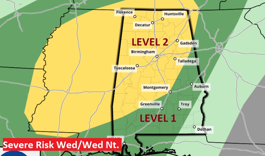
WEDNESDAY SEVERE THREAT: An approaching storm system will bring a threat of strong to severe storms by Wednesday afternoon & Wednesday night. The main threat appears to be damaging wind gusts. But tornadoes can’t be ruled out. A level two “slight” risk covers a large chunk of the state. SPC has not ruled out increasing to a level 3 enhanced risk, in future outlooks, in some of the level 2 area.
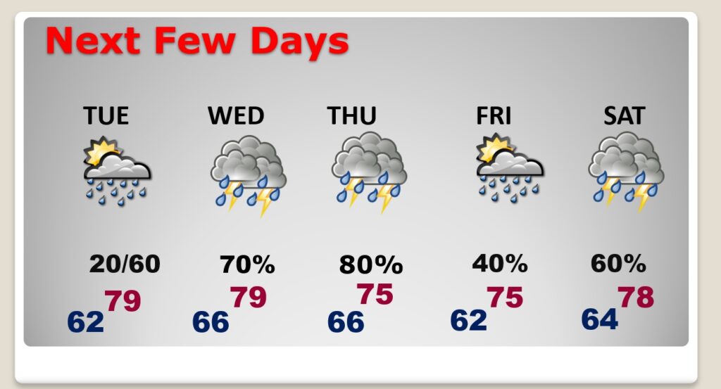
NEXT FEW DAYS: Very warm Tuesday. Widely scattered showers daytime. Showers and storms become likely Tuesday night through Wednesday & Thursday. Severe threat begins Wednesday afternoon & night. More scattered showers on New Years Eve Friday.
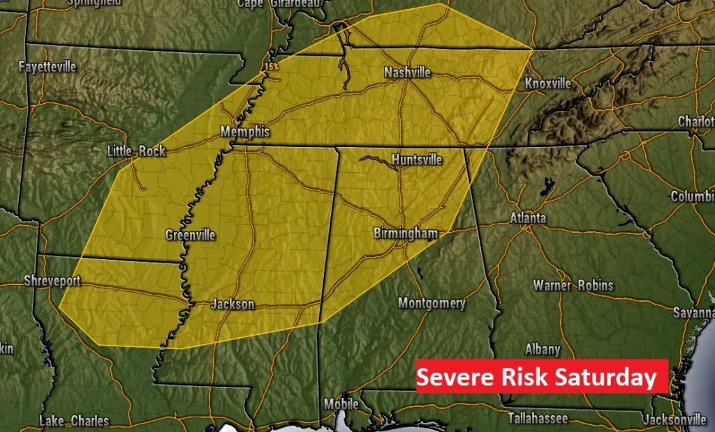
LONGER RANGE: Looks like an important New Year’s Weekend storm system. Looks like yet another potential Severe Risk on Saturday, Saturday. The fact that the Storm Prediction Center is issuing this outlook 6 days ahead of time is significant.
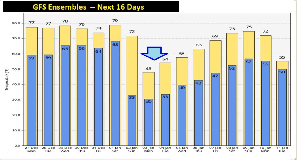
Could we see a big temperature crash early NEXT week, following the New Year’s Weekend storm system? Some of the models suggest we could. Here’s a peek at the GFS Ensembles.
Tomorrow is normal. I’ll be back on the air. There will be a complete video update in the morning.. Enjoy this spring-like weather. Have a nice Day!
–Rich

