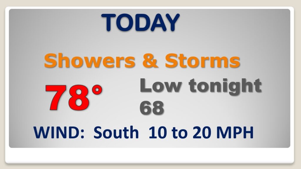
Good Morning! Yesterday we had a near record 81 degrees. Today’s record of 77 is in jeopardy. With the spring-like warmth, showers & storms are on the menu today & tonight. A few severe storms are possible. It will be stormy at times for the next few days. There will be another Severe Weather Risk by New Year’s evening/night. Get ready for a big change of climate. Sunday will be a day of falling temperatures. We’ll be in the 20’s by Monday morning. We’ll in for quite a ride over the next 5+ days. On this video, I’ll fill in the details.
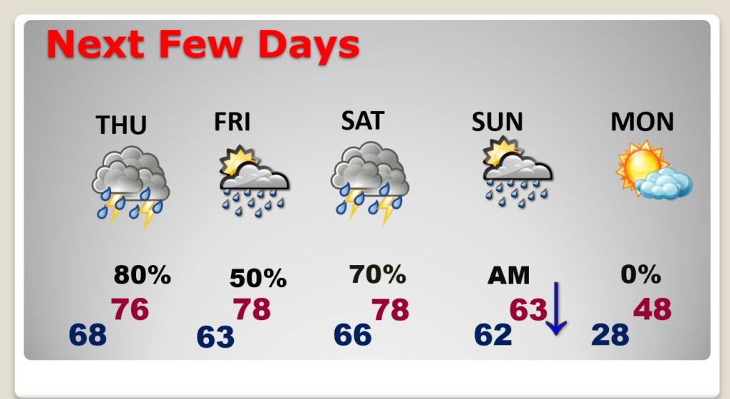
Near record warmth again today. Upper 70’s. Breezy. Showers and thunderstorms. Some of the storms could reach severe limits especially this evening and tonight.
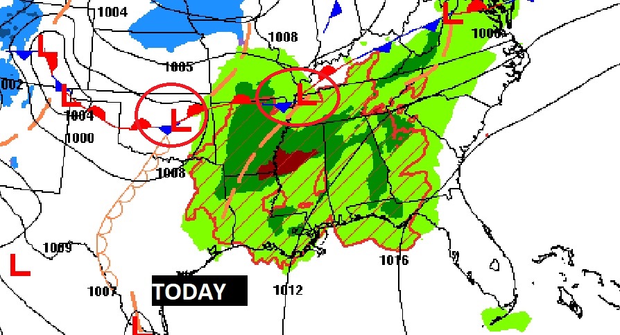
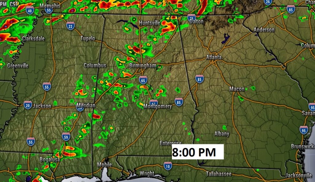
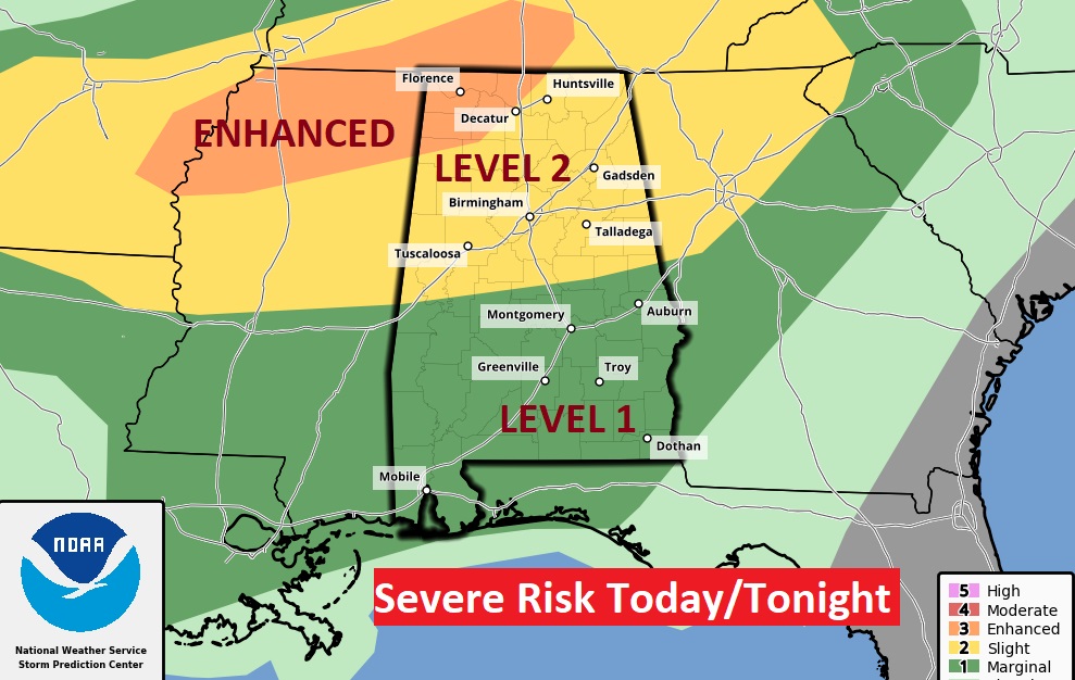
The greatest severe weather threat will be across north Alabama today & tonight. But, even in the Level one marginal risk area, some storms could produce damaging wind gusts. The tornado risk in this situation is small but not zero.
Next Severe Weather Threat is setting up for New Years Day and a better chance by Saturday evening and night ahead of a strong cold front.
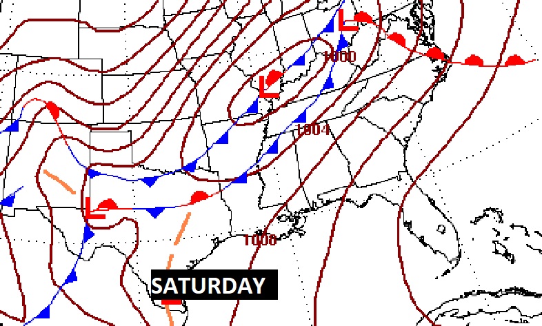
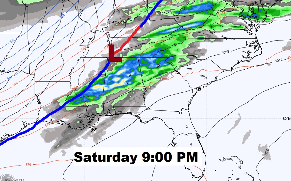
The Storm Prediction Center continues to highlight a Severe weather Risk Saturday and Saturday night. ALL modes of severe weather are possible, including Tornadoes.
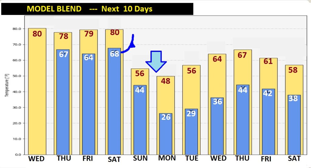
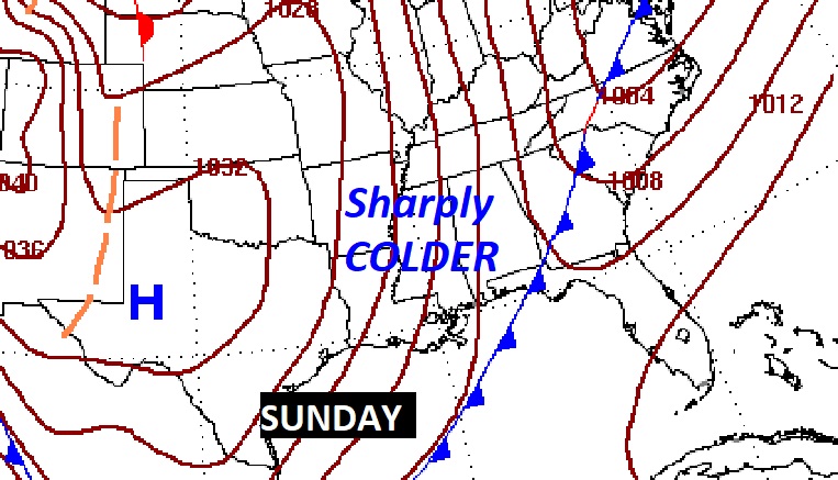
It will turn sharply colder Sunday. We’ll be in the 20’s by Monday morning.
Stormy at times next 4 days. Spring-like warmth. Sunday, the rain moves out early. The warmest temperature will be early in the day. Sunday will be a day of falling temperatures. Monday will be cold Winter’s Day.