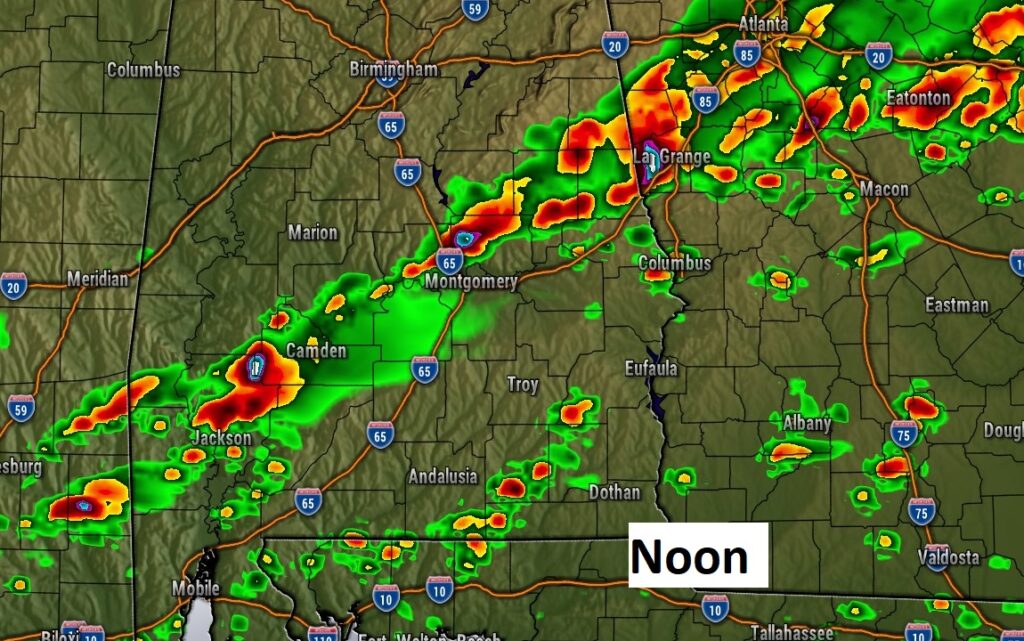
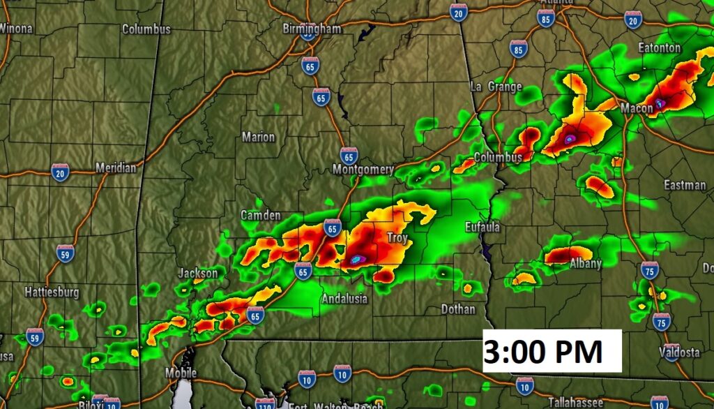
1PM UPDATE:
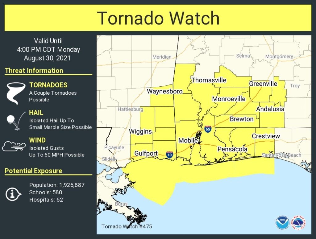
A Severe Thunderstorm Watch now covers much of central and south Alabama until 8PM tonight. Thunderstorm wind gusts up to 70 mph, quarter size hail. A couple of tornadoes are possible. #alwx
EARLY MORNING UPDATE:
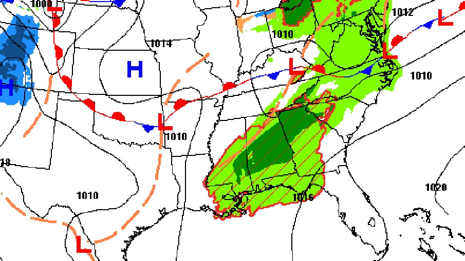
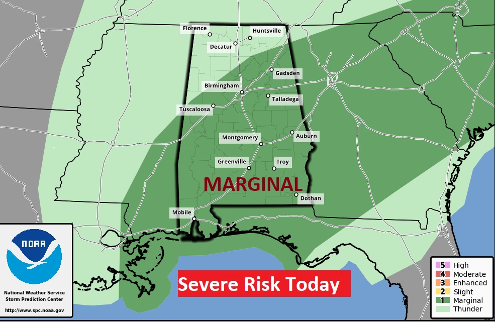
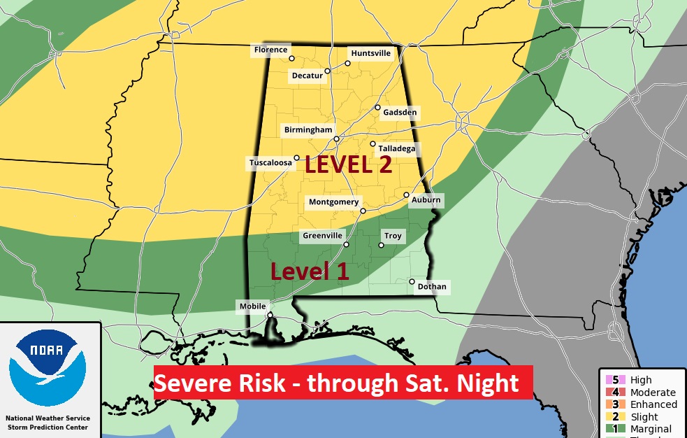
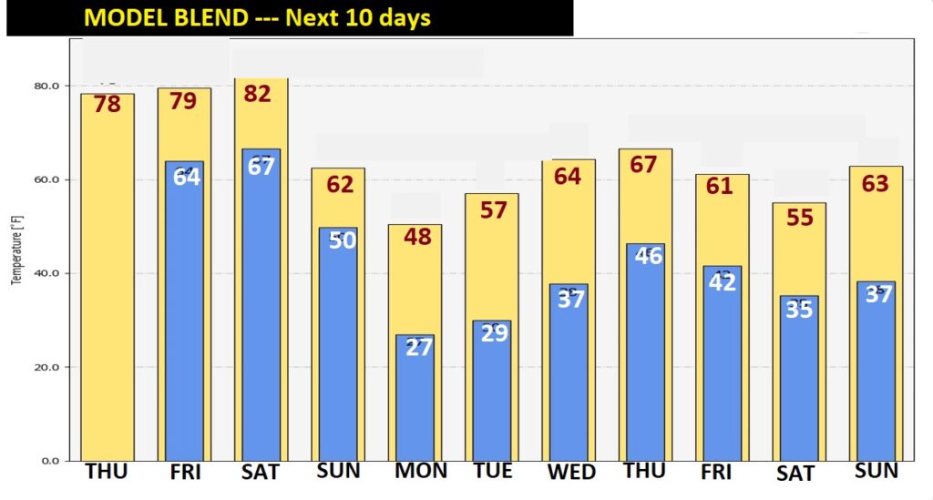
Good Morning! It was busy night across north Alabama with several watches & warnings and a few tornadoes. Today, the threat for strong storms will continue for much of the state. There is a Marginal Severe weather risk. Meanwhile, the unusually warm temperatures are locked in through Saturday. It looks we’ll be dealing with another, more significant Severe Weather Threat by Saturday night. Damaging wind and tornadoes are possible. Get ready for drastically colder air, which will funnel into the state Sunday and Sunday night. There’s much to tell you on today’s video.
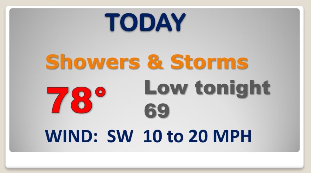
Thunderstorms are likely today. A few could be severe with Damaging wind gusts. Very warm again today.
Level 1 Marginal Severe weather risk today. Damaging wind gusts are the main threat. Spin up tornadoes can’t be ruled out.
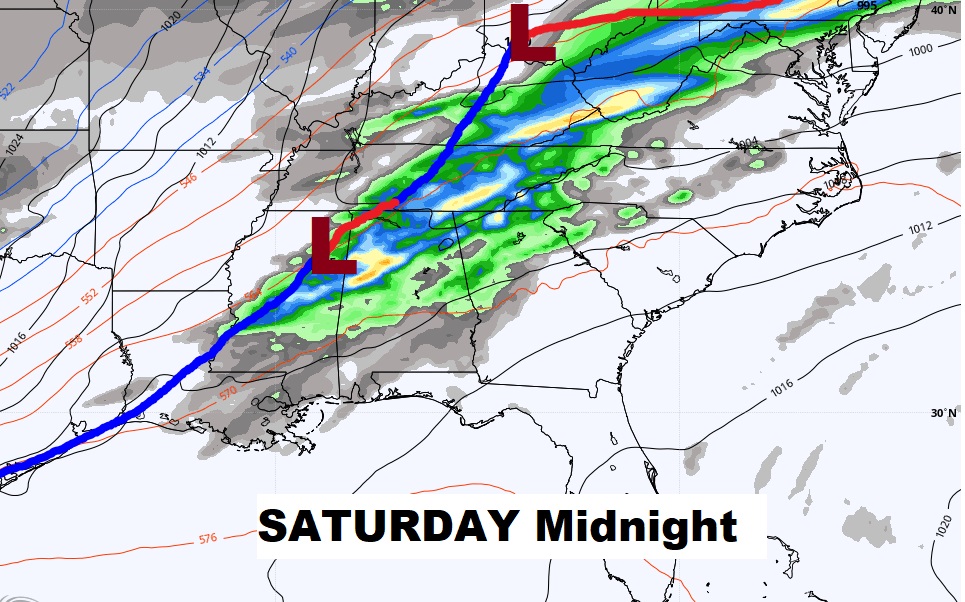
A band of shower’s & storms will shift slowly southward during the day.
Saturday will be very warm, and, as cold front approaches, that will set the stage for what could be significant severe weather threat Saturday night.
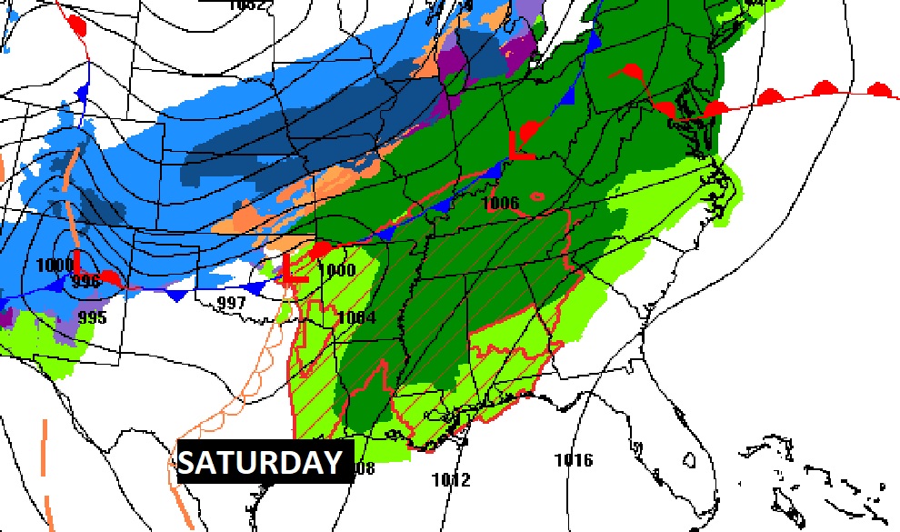
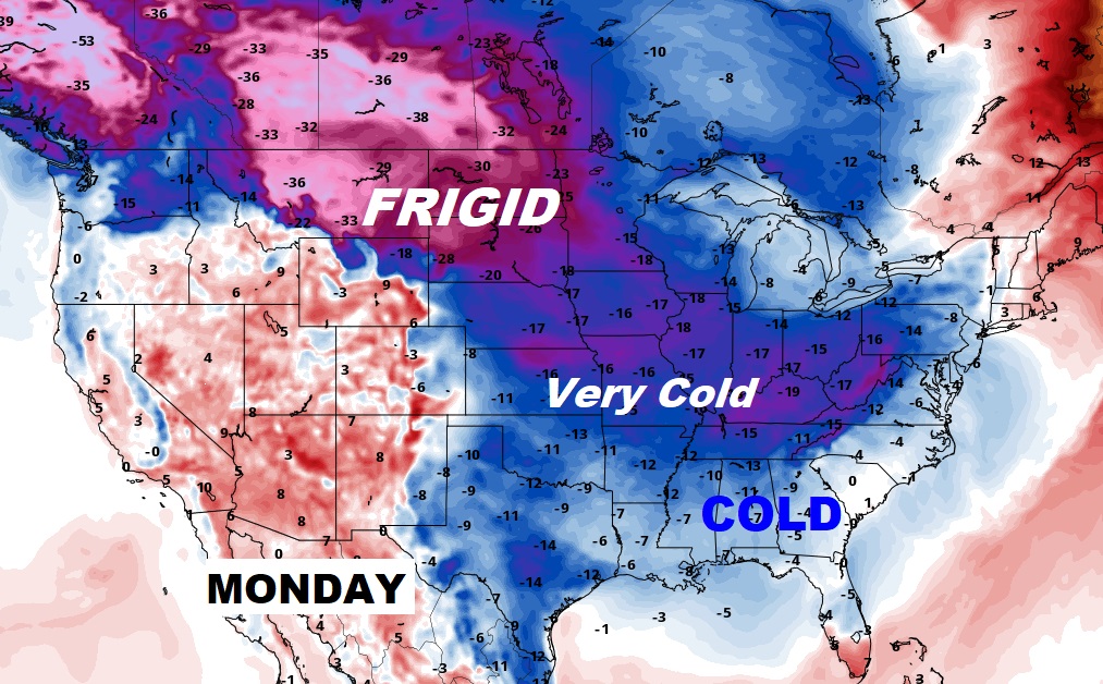
Warm through Saturday, then drastically colder air funnels in Sunday, Sunday night & Monday.
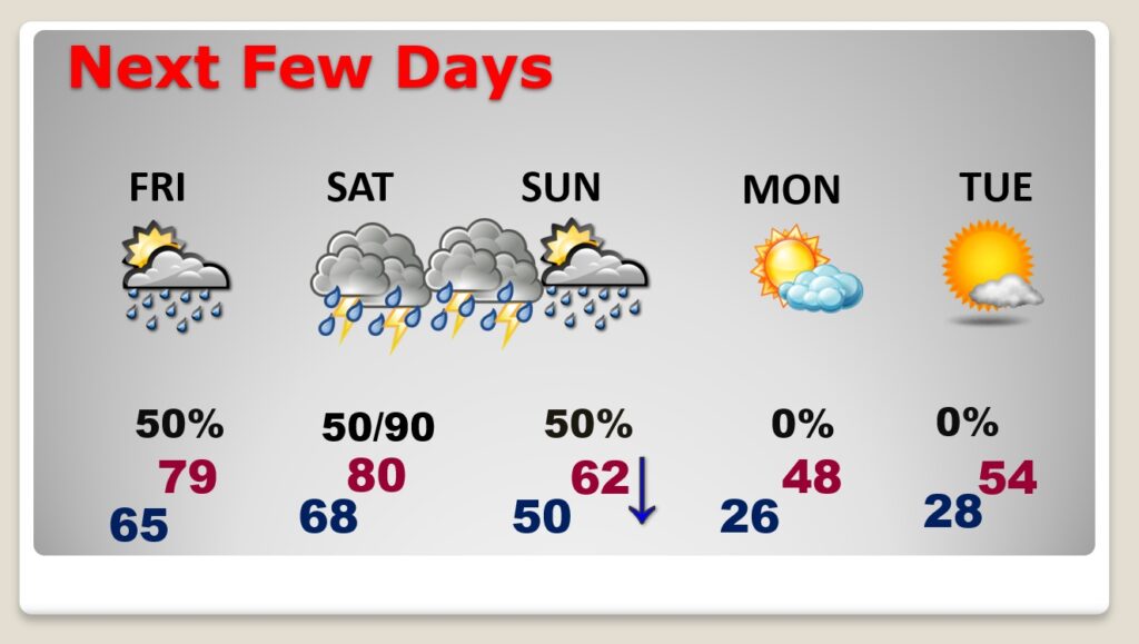
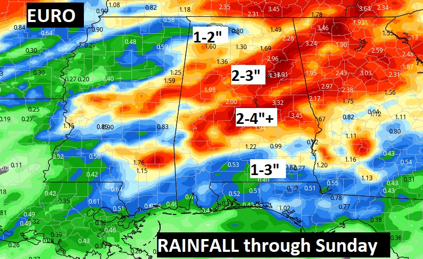
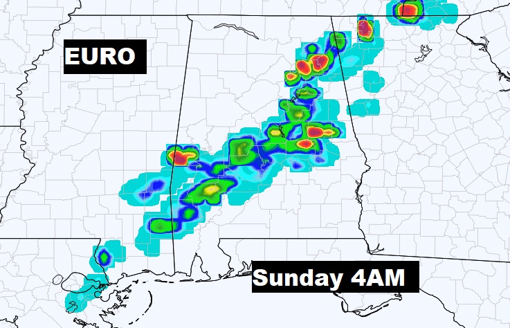
Projected rainfall through Sunday..