
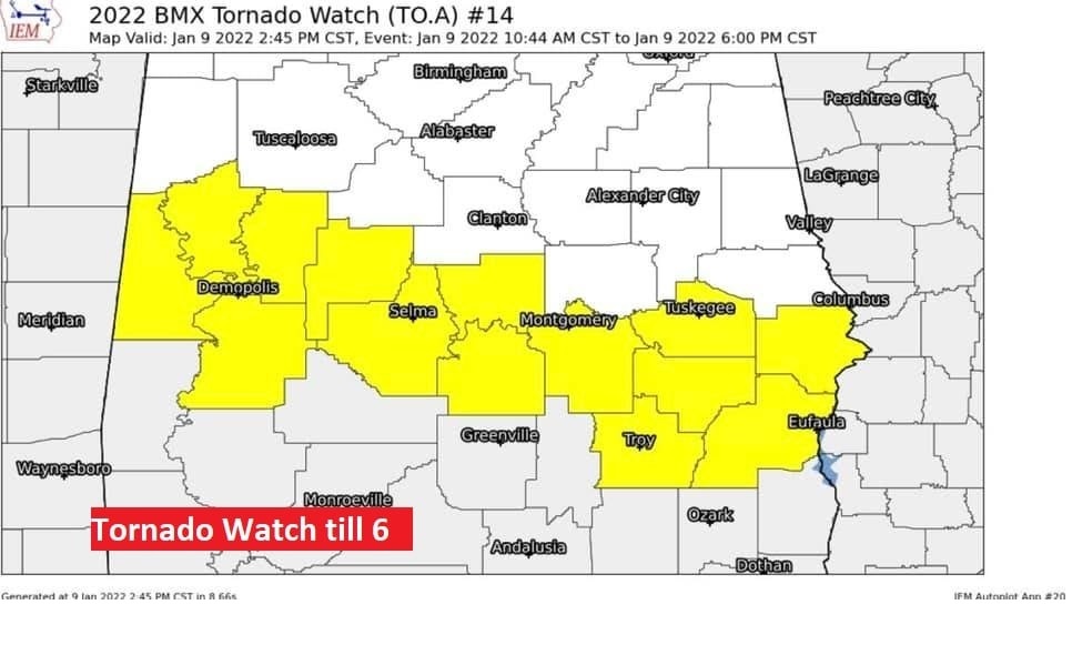
Tornado Watch has now been extended for much of Central and South Alabama until 6PM.
7AM UPDATE:
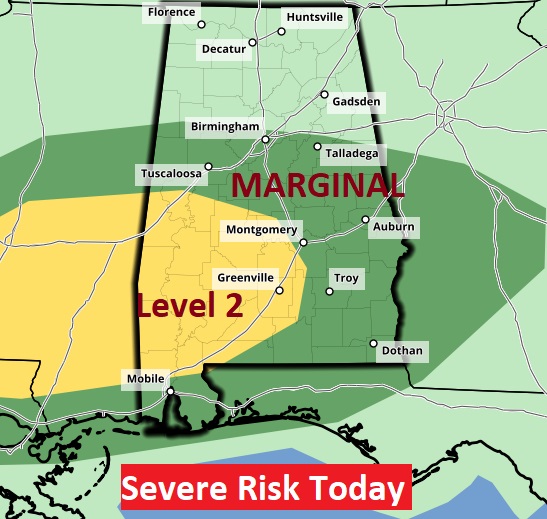
SPC upgrades parts of SW and west AL to a Level 2 risk level today. SPC: “Potential for a few supercells capable of producing damaging winds, a couple of tornadoes, and isolated large hail before vertical shear weakens and the threat diminishes by this evening.”
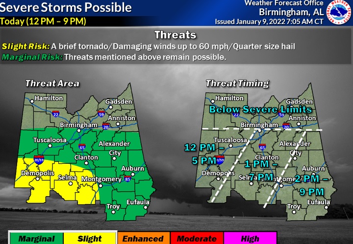
This graphic from NWS Birmingham will help give a general idea on the Threat Timeline today and this evening.
EARLY MORNING UPDATE:
Good Morning! Our modest weekend warm-up continues today. Yesterday’s high was 63. Today we should tack on 10 more degrees. But, get ready for more changes as a cold front approaches.
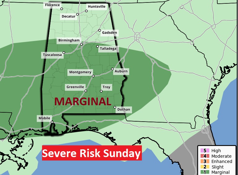
Showers and thunderstorms become likely by this afternoon and this evening. Some of the storms will be strong. We are in a Marginal Severe risk. Damaging wind gusts are possible. A tornado can’t be ruled out. The tornado risk is small.
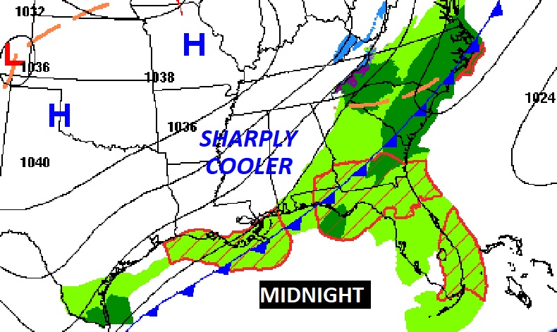
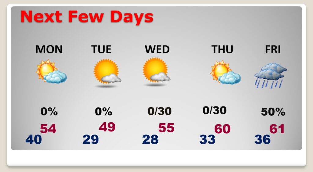
Much cooler/colder air overspreads the area tonight. The first few days of this week will be quite chilly. The next chance of showers holds off until about Friday night into Saturday.
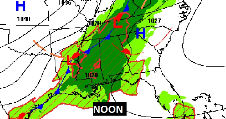
Here’s the set-up at Noon today.. And, midnight tonight.
TODAY: Breezy and warm for January. High 73. SE wind 10 to 15 gusting to 20. Showers and thunderstorms become likely by this afternoon & this evening, ending before Midnight. Colder tonight. Low near 40.
The Storm Prediction Center has a Level 1, Marginal Severe Risk for about 2/3 of the state of Alabama today. A few strong/severe storms are possible. Damaging wind gusts to 60 mph are possible. A tornado can’t be ruled out. The tornado risk is small.
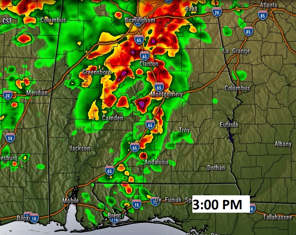
Future Radar suggests a few individual ‘discrete’ thunderstorms this afternoon, well ahead of the main cold front. These have the greatest severe potential. A tornado is possible.
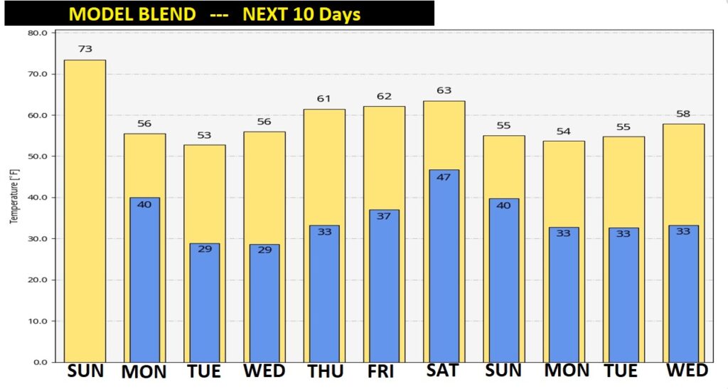
NEXT FEW DAYS: The first few days of this week will be quite chilly. The next chance of showers holds off until about Friday night into Saturday. Expect a freeze on Tuesday and Wednesday morning…and close to a freeze Thursday morning. Back to 60 or above Thursday & Friday.
The 10 day model blend still shows nothing shocking…thank God.
I’ll have a complete video in the morning, online by 4:45 AM. I hope you have a nice Sunday.
–Rich