
8:55 AM UPDATE:
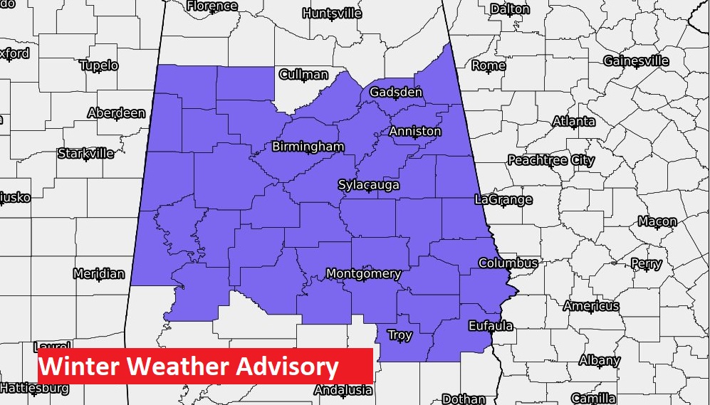
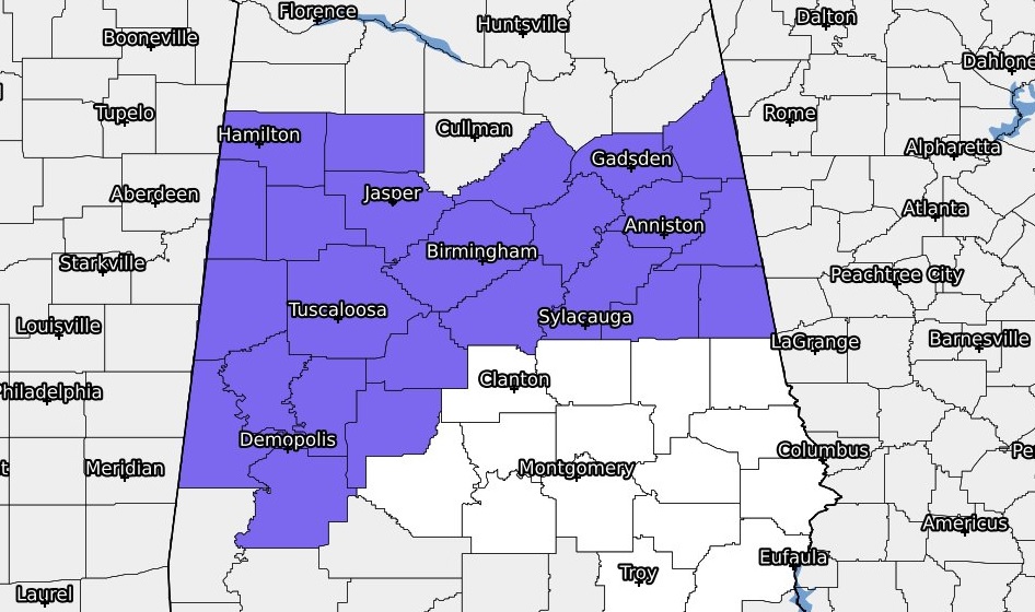
Winter Weather Advisory has been expanded to include all of central Alabama until 3PM. Rain mixed with snow, will occasionally change over to all snow. Little or no accumulation expected. Perhaps a brief whitening of the ground in spots. Roads mostly just wet. Temperatures will stay above freezing.
Good Morning! Old man Winter has come to town. A significant winter storm, effecting multiple Southern states will dominate our weather today. Temperatures will hover in the mid 30’s for the rest of the day, with wind chill in the 20’s. Winds will gust as high as 30 mph. Expect rain to be mixed with or change to snow at times. You won’t bee able to build a snowman. Most snow will melt on contact. There could be some whitening of the ground in a few spots, especially north of a Rockford/Alex City line.
The mixed precipitation should begin to taper off by mid-afternoon. It will be cloudy windy & cold tonight. Morning wind chill could reach the teens.
TODAY: Early this morning, as of 7AM the Montgomery airport reported Light Snow, 36°, Wind SW at 24 gusting to 34 mph. Wind Chill Factor. Rain and snow will mix at times. Sometimes it will change over to snow completely, briefly. Most of the snow will melt on contact. There could be some whitening of the ground in a few spots, especially north of a Rockford/Alex City line. Windy today. West wind could gust to 30 mph at times. Temperatures were warmest at Midnight, when it was 50 degrees. Temperatures will hover in the mid 30’s for the rest of the day, with wind chill in the 20’s. The mixed precipitation should begin to taper off by mid-afternoon. It will be cloudy windy & cold tonight. Low in the upper 20’s. Wind chill could reach the upper teens by morning.
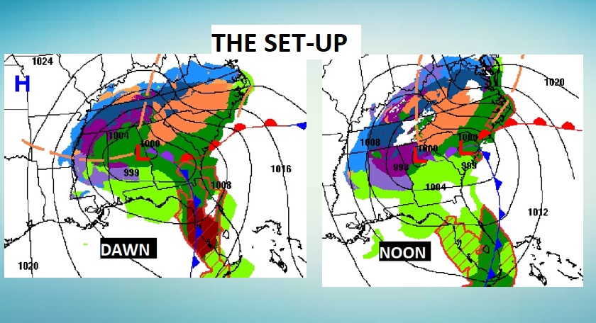
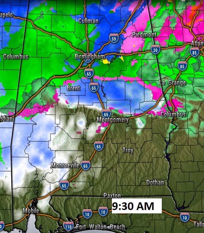
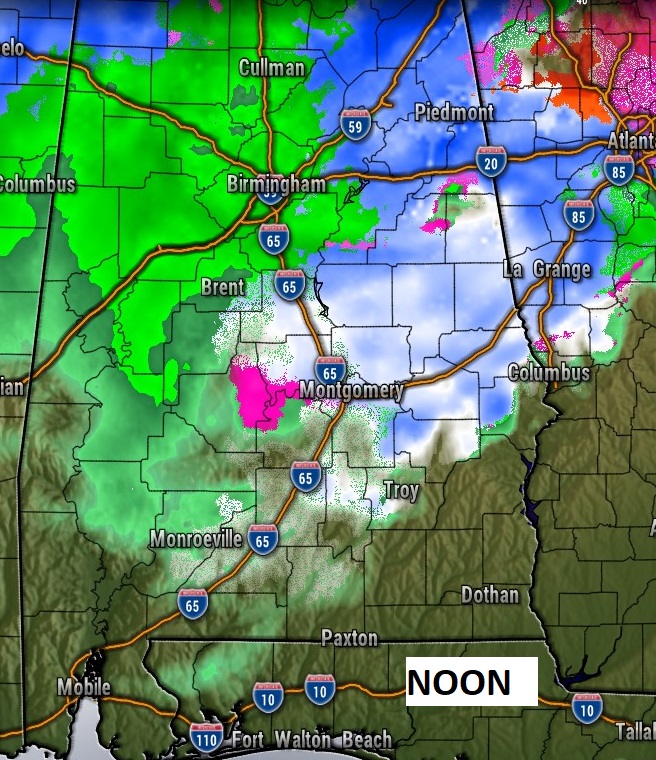
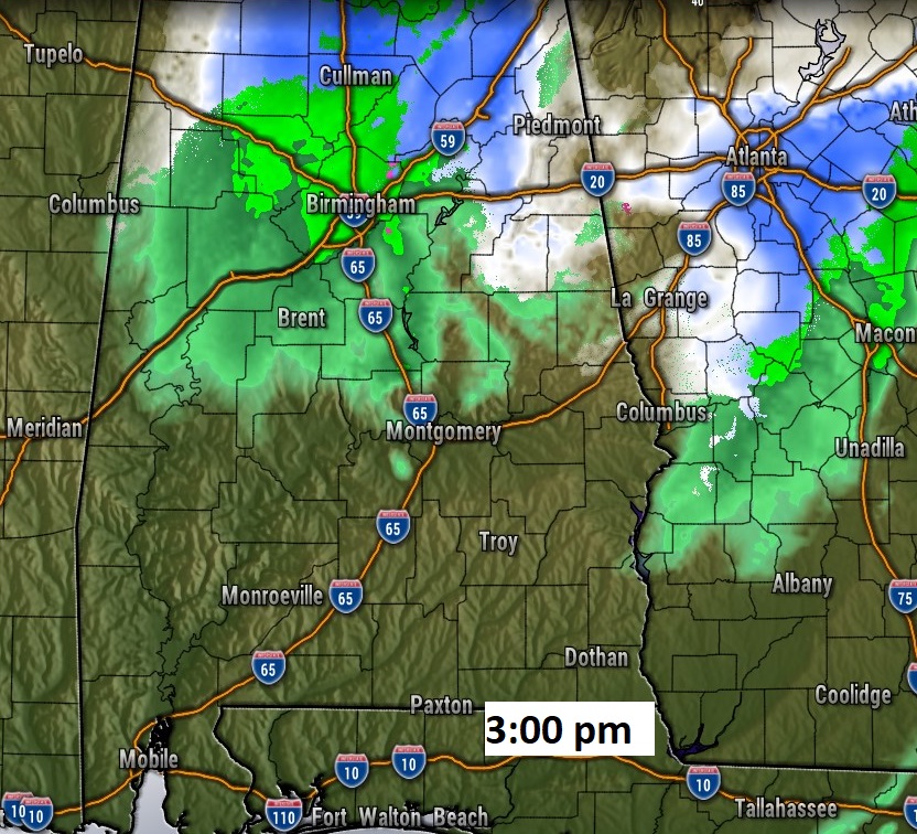
Here are some Future Radar snapshots. (HRRR model). Notice by mid-morning the model shows ran mixed with snow. Then, closer to lunchtime, some tows could see all snow. The precipitation tends to taper off in most areas by about 3, but it will continue until late afternoon in the far eastern counties.
NWS has extended the Winter Weather Advisory to west central Alabama from Tuscaloosa and Perry county, as far south as Marengo counties. Expect some slick roads in spots, especially on bridges and overpasses.
ICE ON THE ROADS TONGHT?: Temperatures will fall below freezing after Midnight. Any puddles or moisture on the road could freeze, making driving potentially hazardous, especially on bridges and overpasses on Monday morning. Temperatures should rise above freezing by about 9AM.
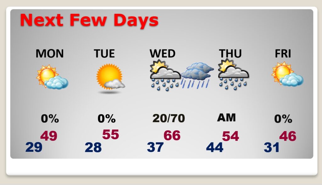
NEXT FEW DAYS: Cold MLK day. High may not make it out of the 40’s. Sunshine will return. Upper 20’s Tuesday morning. High in the 50’s. Risk of rain returns by Wednesday and especially Wednesday night, ending Thursday.
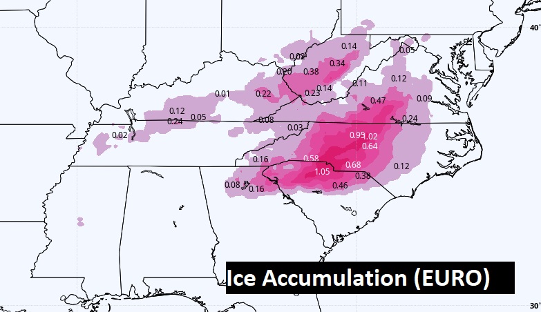
MAJOR WINTER STORM: This storm will cause many High Impact problems. Significant snow totals of 8 to 12 to 24” in spots in east Tennessee and the mountains of western North Carolina. The significant snow band continues northward through mush of the eastern seaboard.
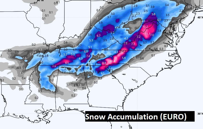
A dangerous, crippling Ice Storm is likely in parts of the Carolinas. Travel will be impossible. Power failures will be widespread. Some spots could see more than 1” accumulation. A CRIPPLING Ice storm is defined as any accumulation of .25” or more. Thank God we will not have to deal with any of the snow or ice hazards with this massive winter storm.
TECHNICAL WEATHER DISCUSSION: Weather geeks will like this. This is the Area Forecast discussion (AFD) issued by the National Weather Service in Birmingham (BMX) at 3:52 this morning. Complicated, challenging forecast. Click here. https://nwschat.weather.gov/p.php?pid=202201160952-KBMX-FXUS64-AFDBMX
I’ll have a complete video in the morning, online by 4:45 AM. Stay warm. Enjoy the snowflakes.
–Rich