Good Morning! It’s a very cold, sub-freezing Tuesday morning. Today will be not quite as harsh as yesterday, with highs in the 50’s. We’ll reach the 60’s Wednesday. But, our rain chances will be rather high by Wednesday night through Friday, as a series of disturbances track across the Southeastern U.S. Is there any potential for frozen precipitation in Alabama this week? On this video, I’ll fill you in. We’ll look ahead to more Arctic Intrusions before this month is over. If you like cold air, you’ll love this video.
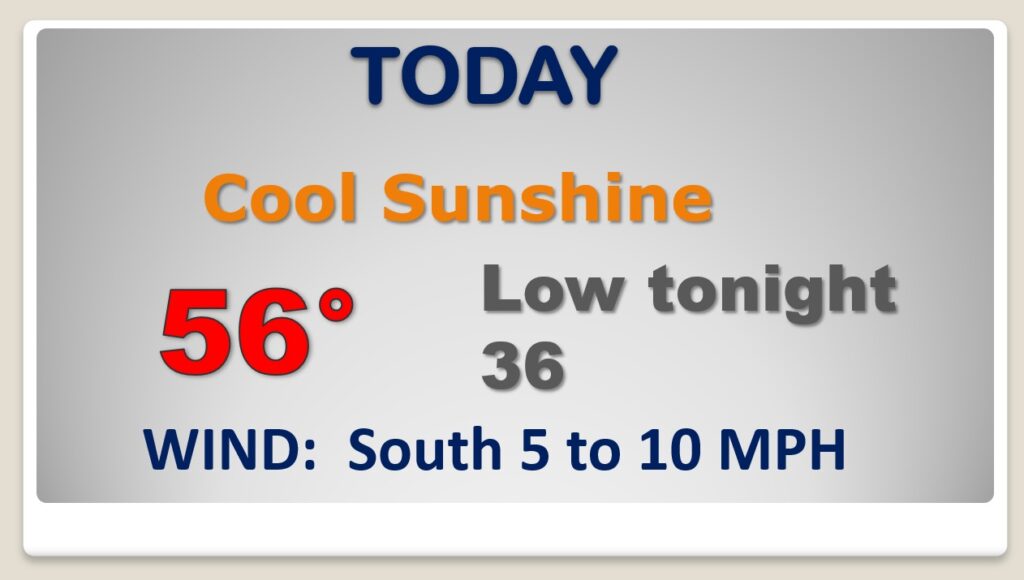
COLD Morning…and a cool day ahead, but at least we’ll be about 12 degrees warmer than yesterday. Not quite as cold overnight tonight.

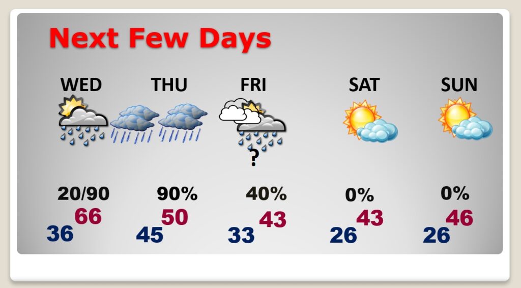
Rain returns Wednesday night into Thursday as another cold front moves into the state.

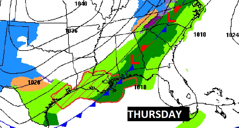
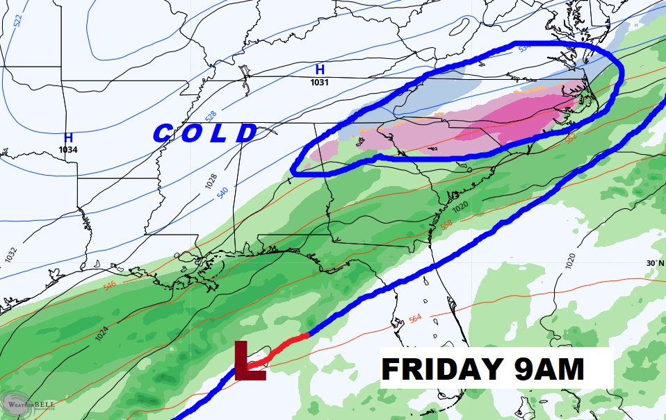
A series of disturbances will ride along the front in the Gulf. Alabama will be engulfed in cold air. Could parts of our state see any mixed frozen precipitation on Friday? The models do not agree. Stay tuned.

Wednesday will be the warmest day of the week. Mid 60’s. Risk of rain Wednesday and Thursday. Precipitation continues Friday. Very cold Friday through Sunday.
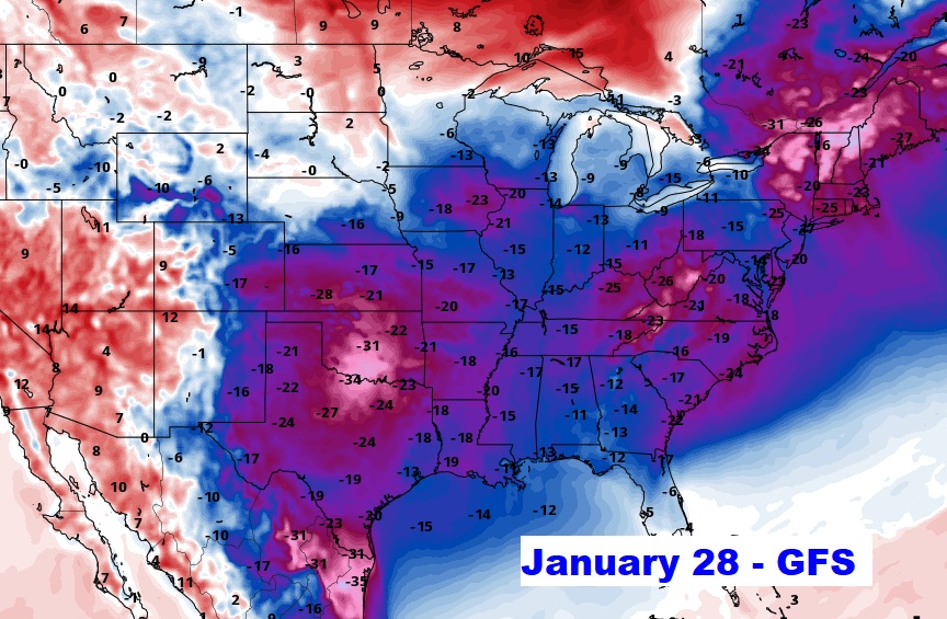
The models are hinting that these Arctic Intrusions will keep happening frequently through the end of this month at least. Here’s the GFS 10 days from now. Not good.