
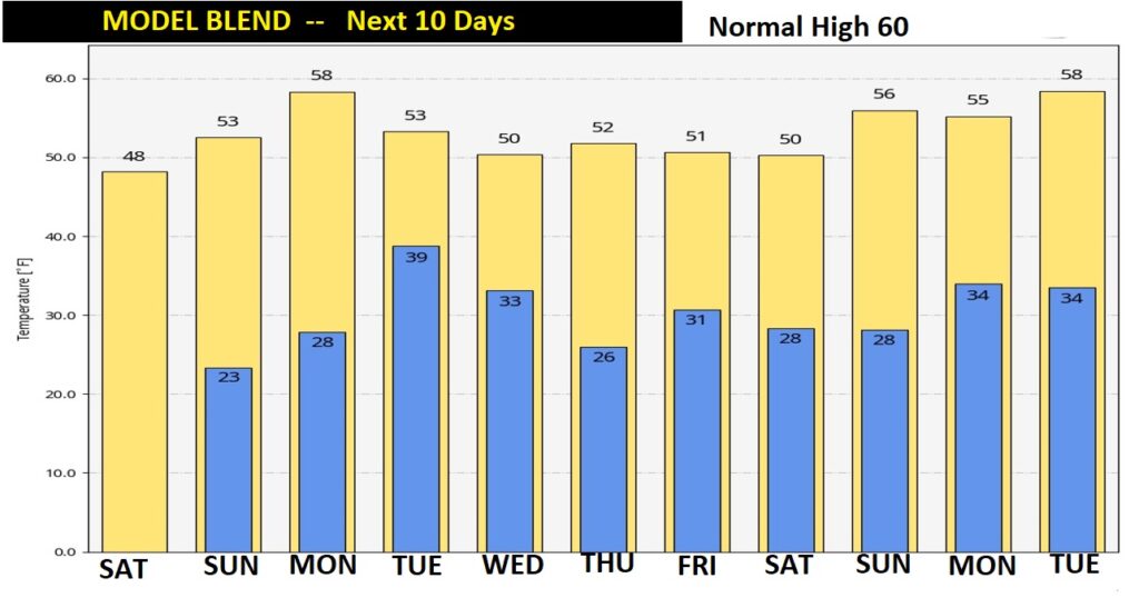
Good Morning! Yesterday was the coldest day of Winter so far. The high was only 38. Today we’ll do better. Afternoon sunshine will help to tack on about 8 to 10 degrees. The normal high is 60. We won’t see normal, probably for the rest of January. Winter cold will be the norm for the next 9 days. Tonight is likely to be the coldest night of the winter so far. Monday will be a little warmer…well into the 50’s.
At least we have a storm-free weekend. The next storm system will bring rain back to the area by Monday night. But, fortunately, just rain. No winter weather concerns and no severe weather.
TODAY: The clouds will hang tough early. Gradually, we’ll work our way into sunshine. Not quite as cold. High today 47. North wind 6 to 12. Clear and very cold tonight. Tonight is likely to be the coldest night of the winter so far. Low 24. (a few towns will be colder)
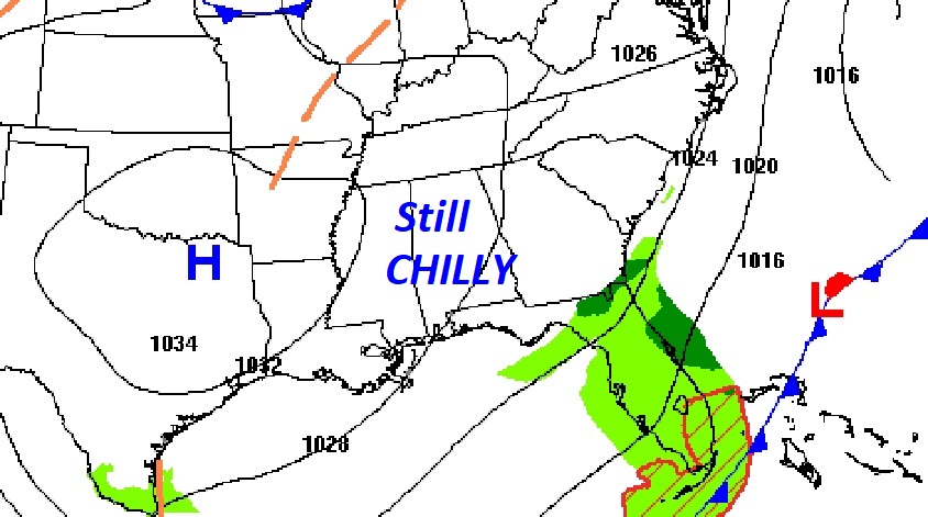
SUNDAY: Very cold at Dawn. Lower 20’s. Sunshine will dominate. Afternoon High will reach the lower 50’s. (about 8 degrees below normal) Northwest wind 5 to 9. Clear and cold Sunday night. Another Freeze. Low 28.
NEXT STORM SYSTEM: A Gulf Low will spread rain back to the area Monday night and Tuesday. But, fortunately, just rain. No winter weather concerns and no severe weather.
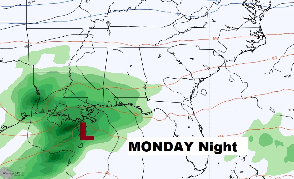
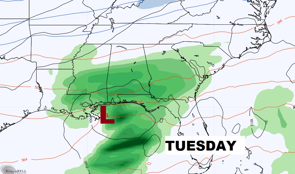
NEXT FEW DAYS: Sunshine on Sunday will help the temperature recover to near 50. Back to the upper 20’s Sunday night. Monday will be the warmest of the next 6 days. High in the mid 50’s. Rain Monday night and Tuesday. Colder again Wednesday.
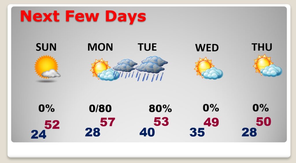
Looking at the Next 10 Days…we’re likely to stay below normal, through the end of January. (Beyond 10 days…I see a little period of recovery during the first week of February.
I’ll have another Blog update in the morning. Have a nice weekend!
–Rich