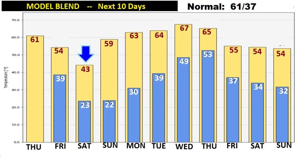
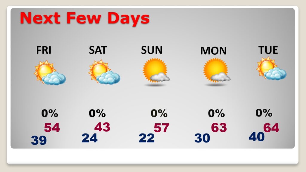
Good Morning! Our up and down rollercoaster ride will continue. Today will be the “warmest” of the next 4 days. We’ll tease 60 degrees this afternoon, with abundant sunshine. But, stand-by, for another quick Arctic Plunge. We will sample some very chilly Arctic Air Friday night through Sunday morning. Wind chill by early Saturday morning will range from 9 to 14 in many towns in central Alabama. Saturday will be quite brisk. The cold won’t last long. Recovery begins Sunday afternoon, and continues next week. On this video, I’ll walk you through the details. Plus, we’ll look ahead to the next storm system next week.
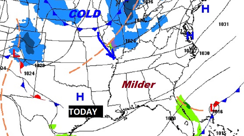
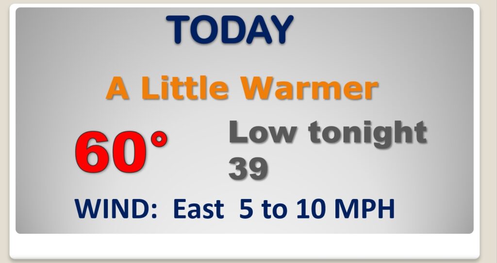
The morning chill will fade quickly. Nice day today. Milder. High near 60. (Normal high 61). Not as cold tonight. Increasing clouds.
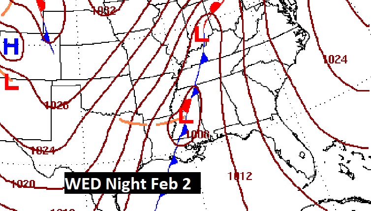
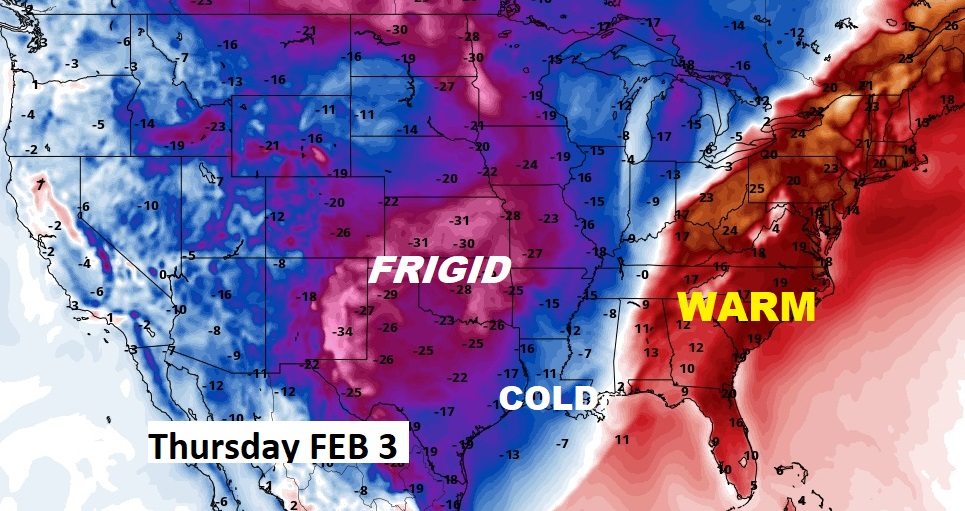
Stand by for another arctic cold front. It will arrive late Friday. Friday night will be sharply colder. Saturday will be a Raw, Brisk Cold Winter’s Day.
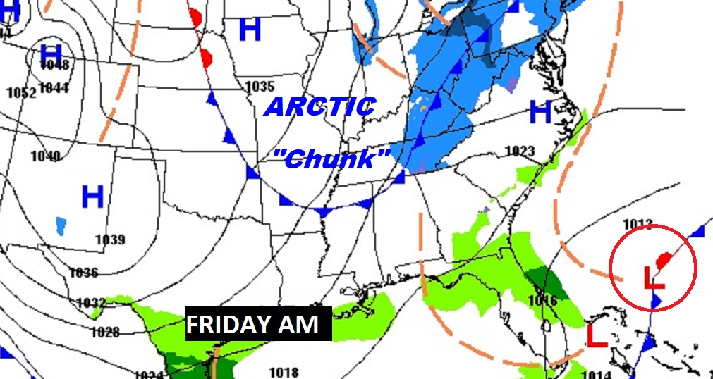
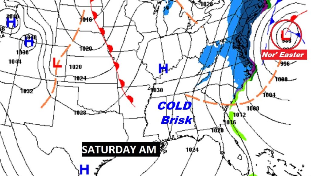
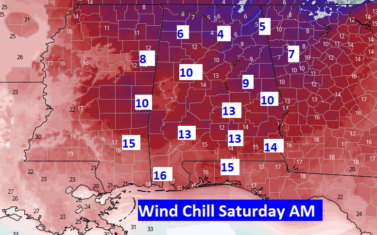
Wind chill values Saturday AM will be coldest of the Winter so far.
The coldest air will effect us Friday night through Sunday morning. Recovery begins Sunday afternoon. Into the 60’s next Monday and Wednesday.
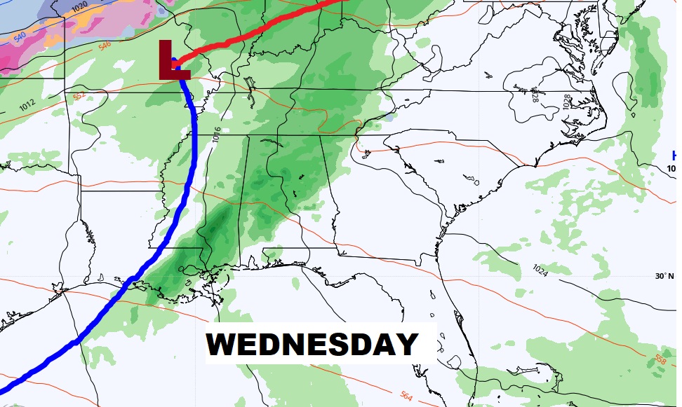
Next Storm system will sweep across the area next week in the Wednesday/Thursday time frame. Could be a big deal.
More dramatic temperature swings over the next 10 days as January ends and February begins.