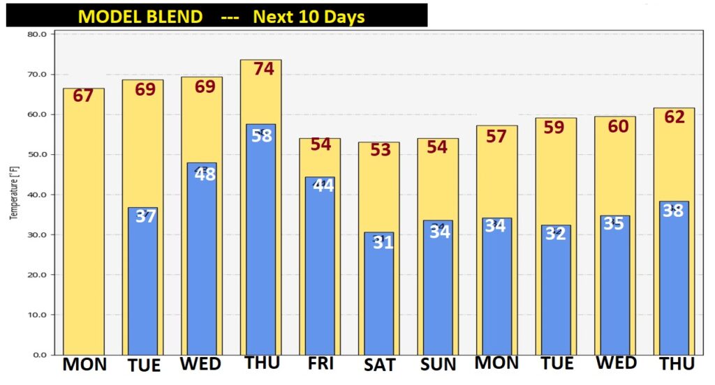
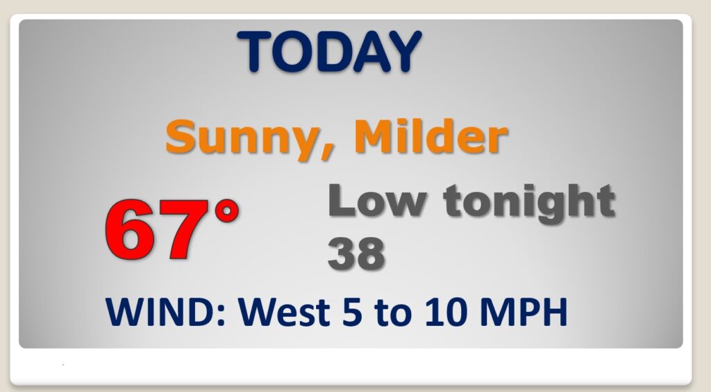
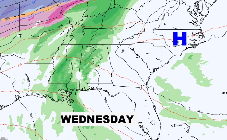
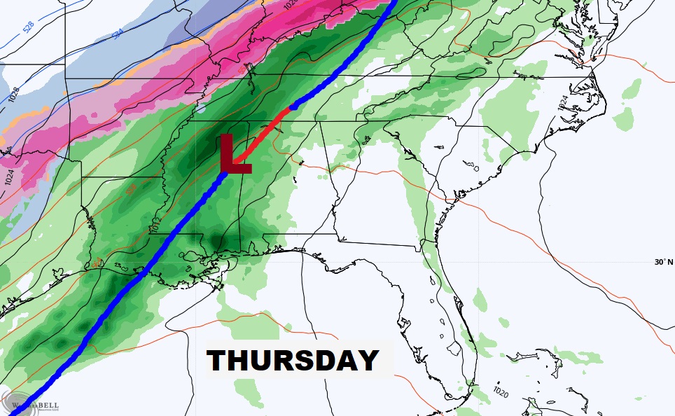
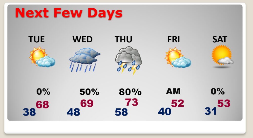
Good Morning! This last day of January will be very mild for “the dead of winter”. The morning chill will fade quickly. Beautiful sunshine. Temperatures will reach the mid to upper 60’s. The first day of February will be nearly perfect, tomorrow. We’ll be in the 70’s Wednesday as a storm system approaches. Rain returns by Wednesday afternoon. It’s a 2-part storm system. The “main event” will be Thursday and Thursday night. Showers and thunderstorms. Behind the storm system, it’ll turn sharply colder by Friday. On this video, I’ll walk you through the day to day details. We’ll look ahead to the weekend and beyond.
If you liked Sunday, you will LOVE today. The morning chill fades quickly. Expect mid to upper 60’s by afternoon. Not as cold tonight. All in all, not a bad last day of January.
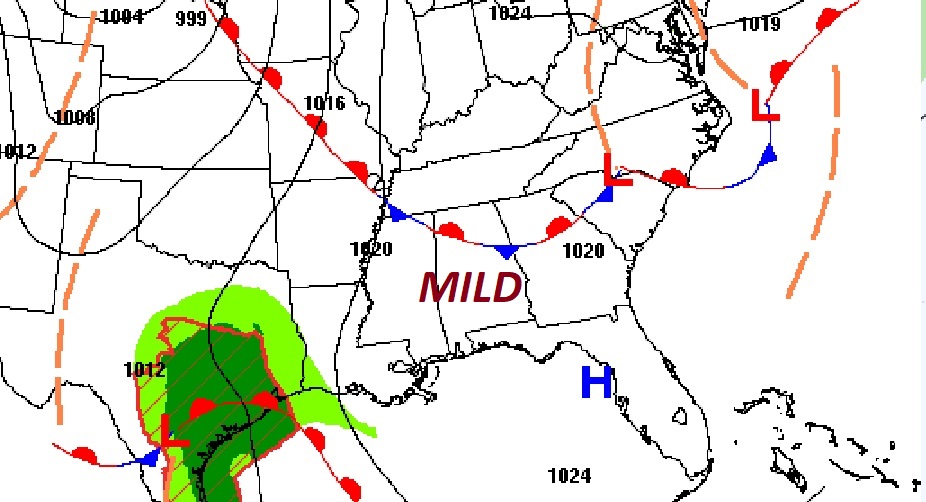
Mid to late week 2-part storm system. Rain returns Wednesday. Showers and thunderstorms Thursday ahead of the next cold front.
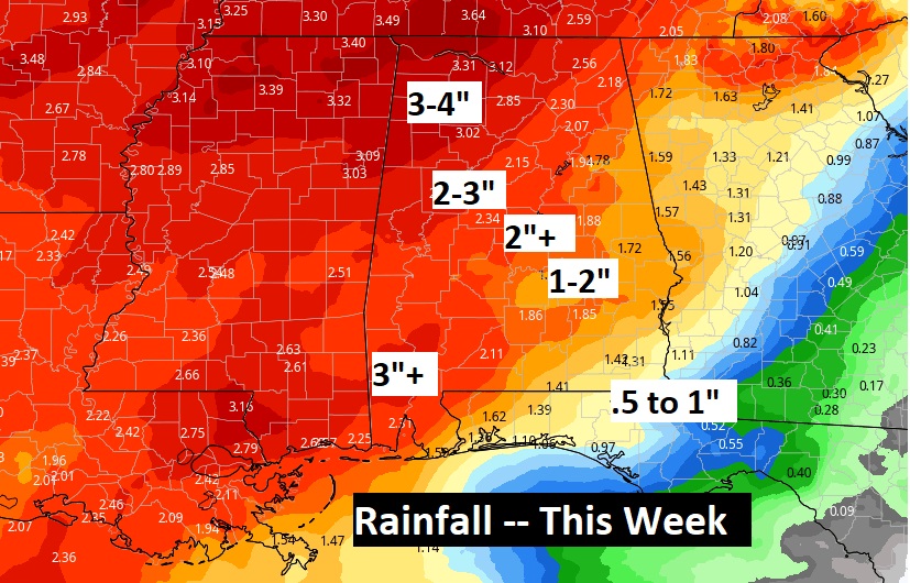
Potential for a lot of rain in spots this week.
Beautiful Tuesday. Dry and mild. Rain returns Wednesday. Showers and thunderstorms Thursday ahead of the next cold front. Sharply colder Friday. Chilly Saturday.
Model Blend for the next 10 days. The warmest days will be today through Thursday.