2:30 PM
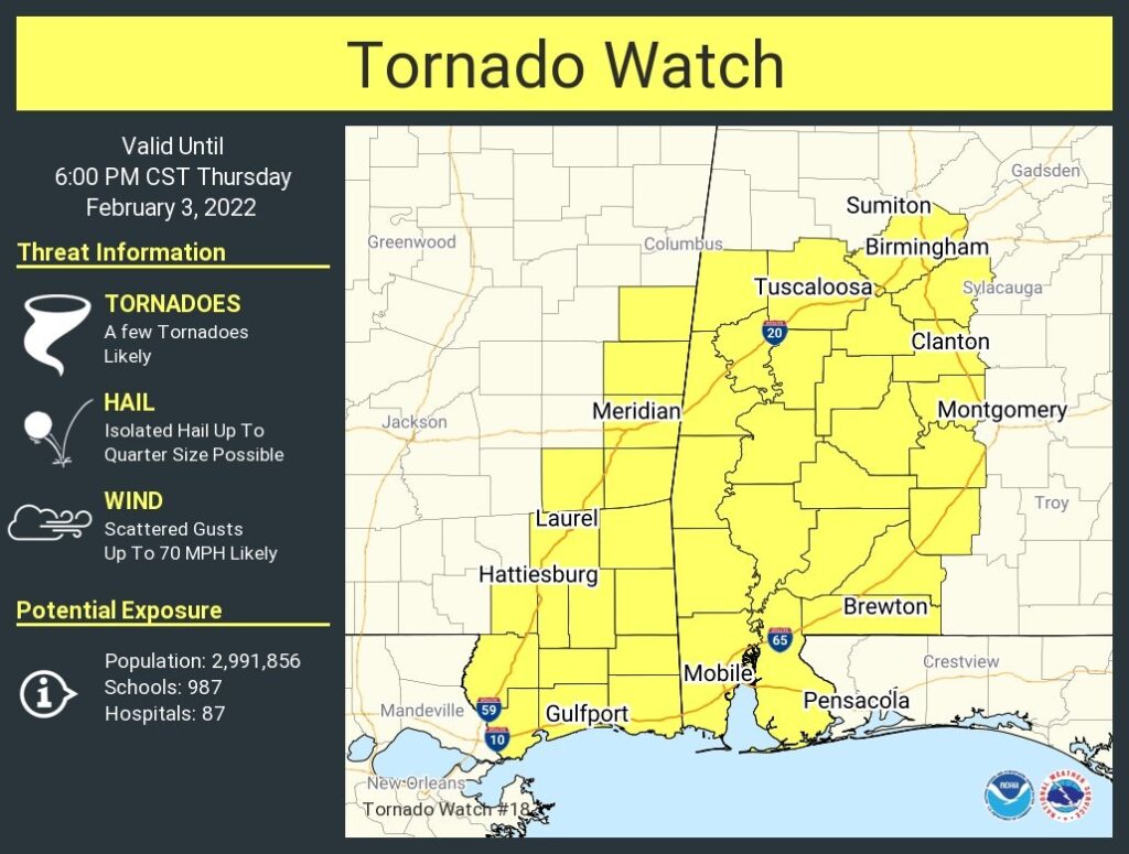
Tornado Watch has been extended eastward to the Georgia line until 6PM. It now includes all of central and much of southern Alabama #alwx
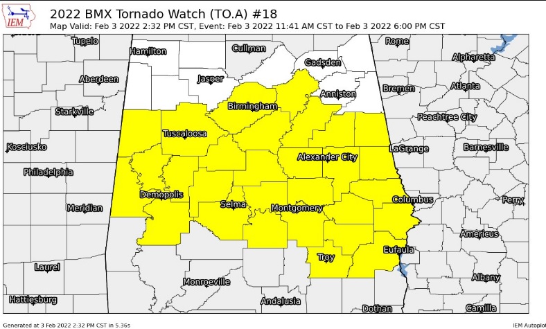
TORNADO WATCH (11:45 AM 2/3/22)Tornado Watch now covers all of the western half of Alabama, primarily from I-65 westward until 6PM. Few tornadoes likely. Damaging wind gusts to 70 mph possible. Hail up to quarter size. Stay weather aware. The watch begins just west of the Montgomery city limits. It includes Chilton, Autauga, Lowndes, and Butler. Here’s a link to the morning update.
9:50 AM Update:
SPC says: Tornado Watch likely coming soon for parts of south & SW Alabama, NW Florida, Mississippi and Louisiana. #alwx
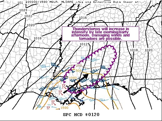
SPC has again expanded the Severe Risk Level 2 ‘Slight Risk’ to include most of the state. Tornado watch coming soon for parts of Southwest, west Alabama, parts of NW Florida, Mississippi and Louisiana. #alwx
EARLY MORNING UPDATE:
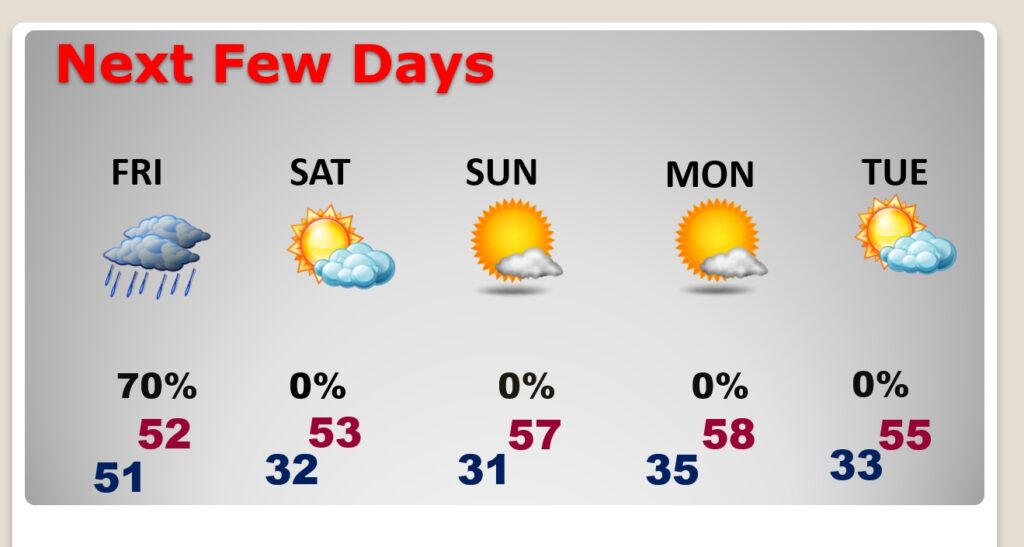
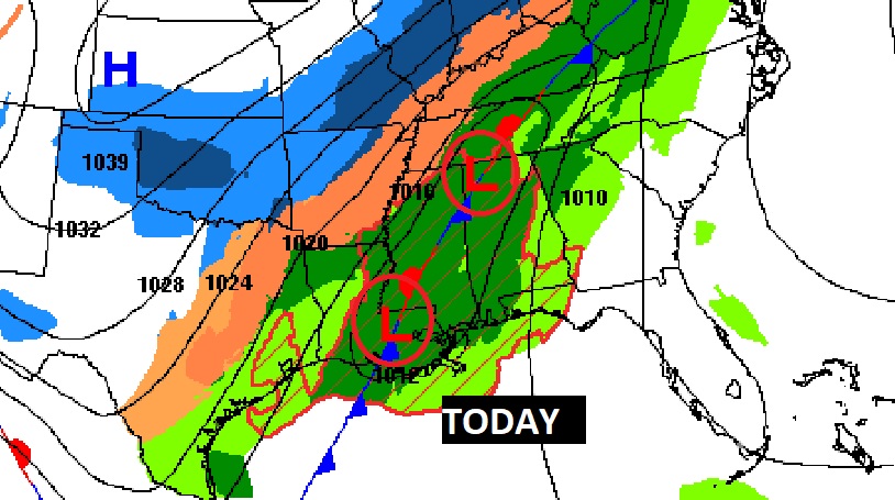
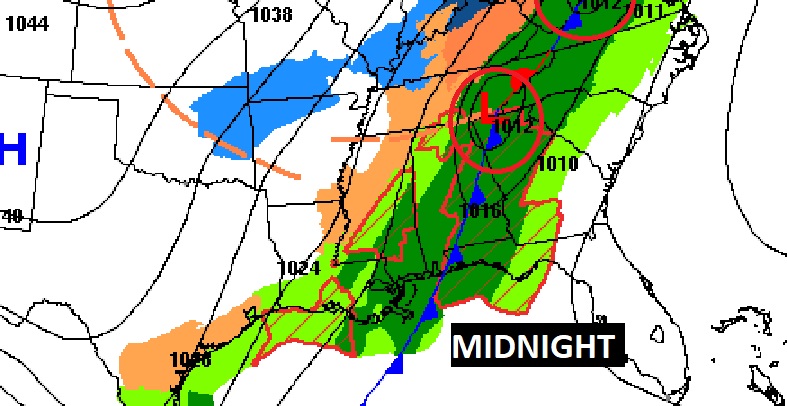
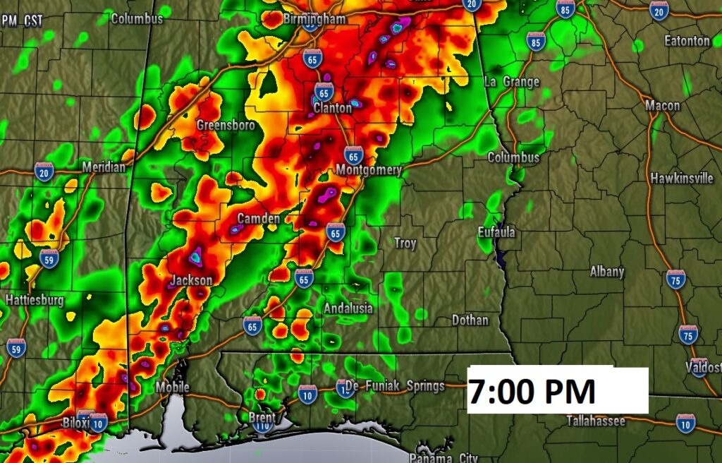
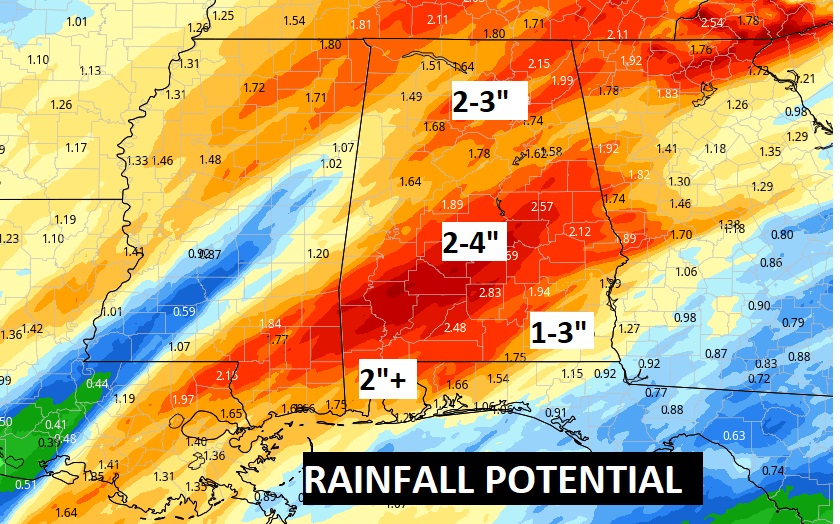
Good Morning! Big weather changes are on the way as another cold front approaches. Showers and thunderstorms are likely this afternoon & tonight. A few storms could be strong or severe. Damaging wind gusts are possible in the stronger storms. Looks like a potential “soaker” with 2 to 4” of rain potentially. Most of the rain moves out by mid-day Friday. Expect falling temperatures as colder air funnels into the state. I have the latest of details and the timeline on this video, We’ll take a look at the weekend and next week.
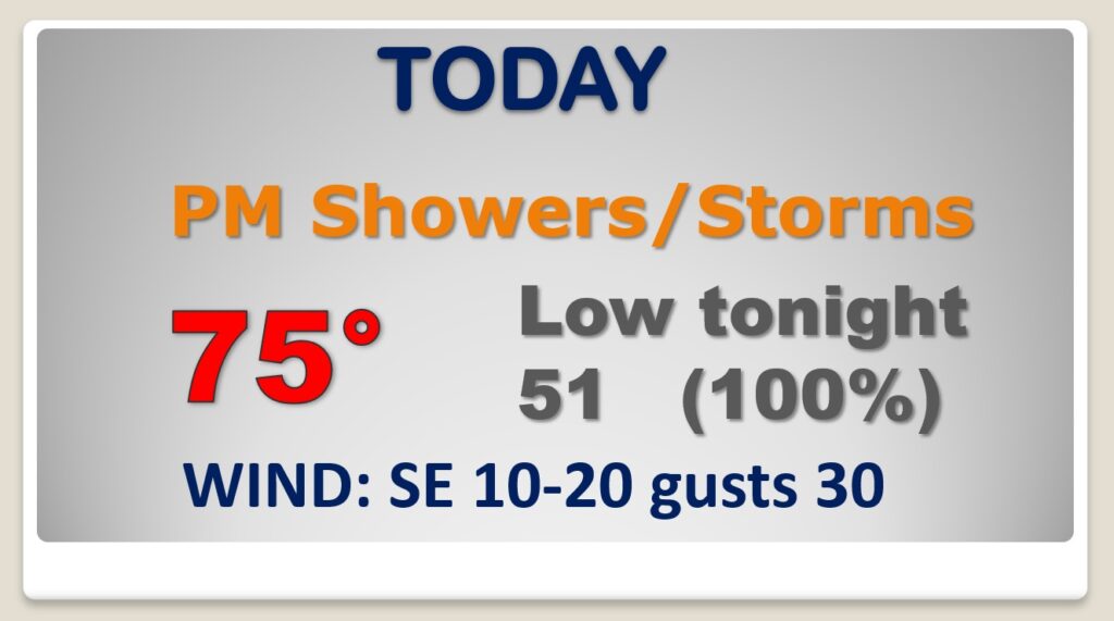
Very mild today. Breezy. High in the mid 70’s. . Showers and thunderstorms are likely this afternoon & tonight. A few storms could be strong or severe. Damaging wind gusts are possible in the stronger storms.
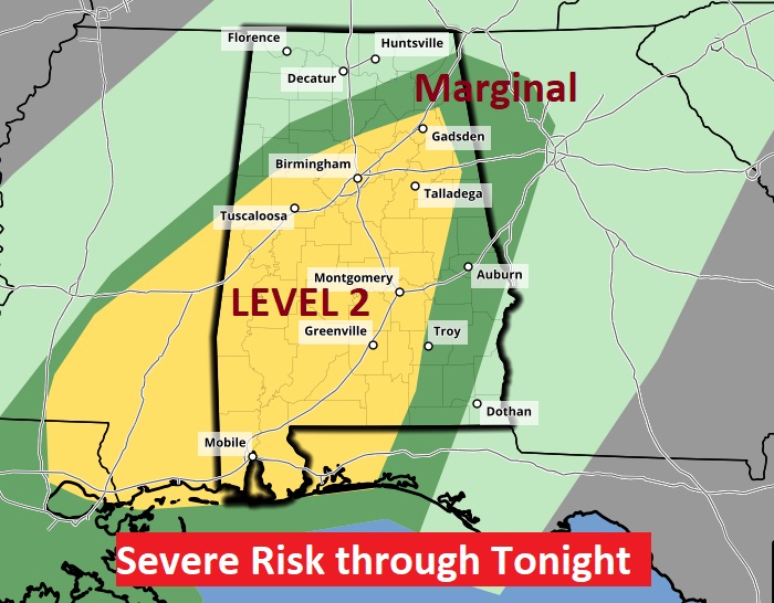
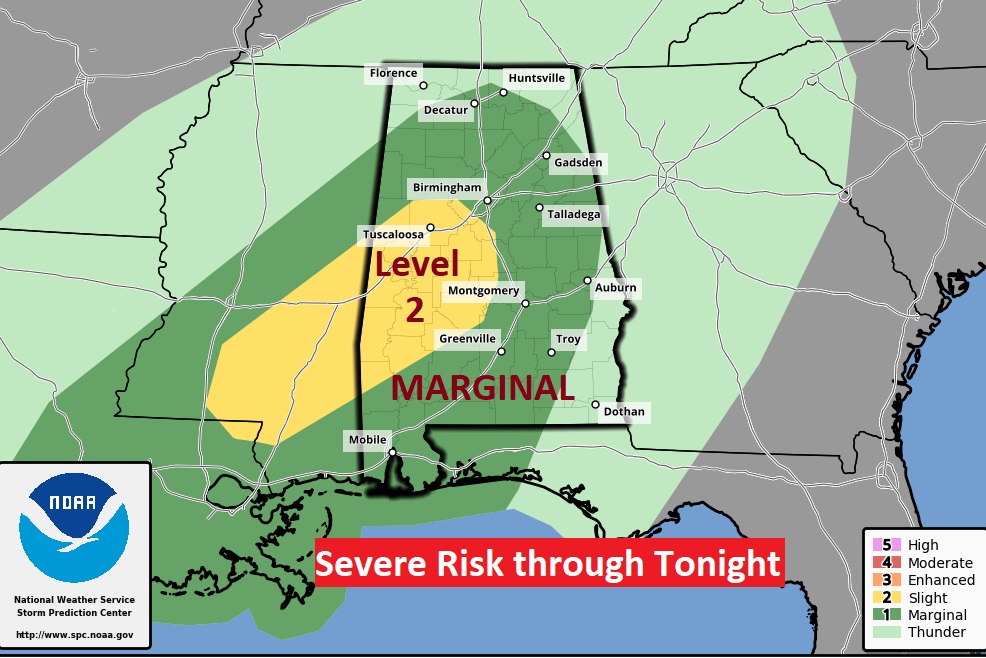
Much of the state is in a Marginal Severe Weather Risk today & Tonight. The western half of the state is in a Level 2 ‘slight’ risk. Damaging wind gusts are the main threat, but a couple of spin up tornadoes can’t be rued out, especially in the western and southwestern counties.
Flash Flood Watch. Rainfall could be excessive in spots.
The risk of rain continues at least through mid-day Friday. Colder air funnels in behind the cold front.
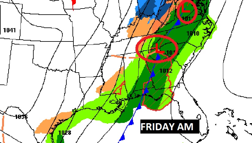
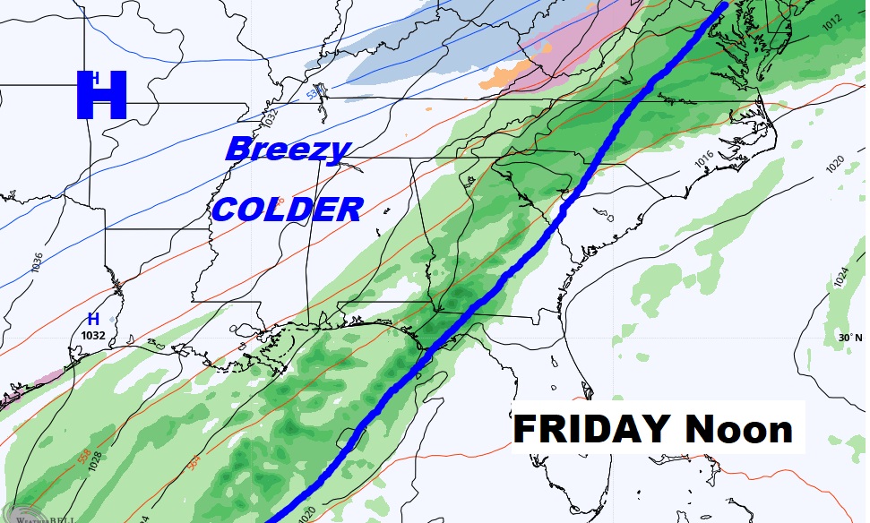
Rain and thunderstorms today end by mid day Friday. Breezy and colder. Chilly weekend. Below normal temperatures through the middle of next week.