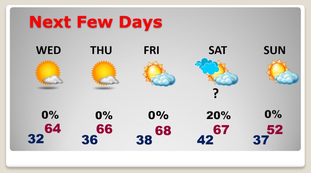
Good Morning! The news is good, and it’s getting better. The chill is fading. Today will be a milder day. A nice warming trend will continue Wednesday through Friday. Looks like some really nice weather. Dry, with abundant sunshine. This will be a very nice week in the heart of winter! There are major model discrepancies on what may unfold this weekend. We do know a cold front will be approaching. There will be another big temperature set-back by Sunday. But, will there be any precipitation with the front? On this video, I’ll tell what we do know.
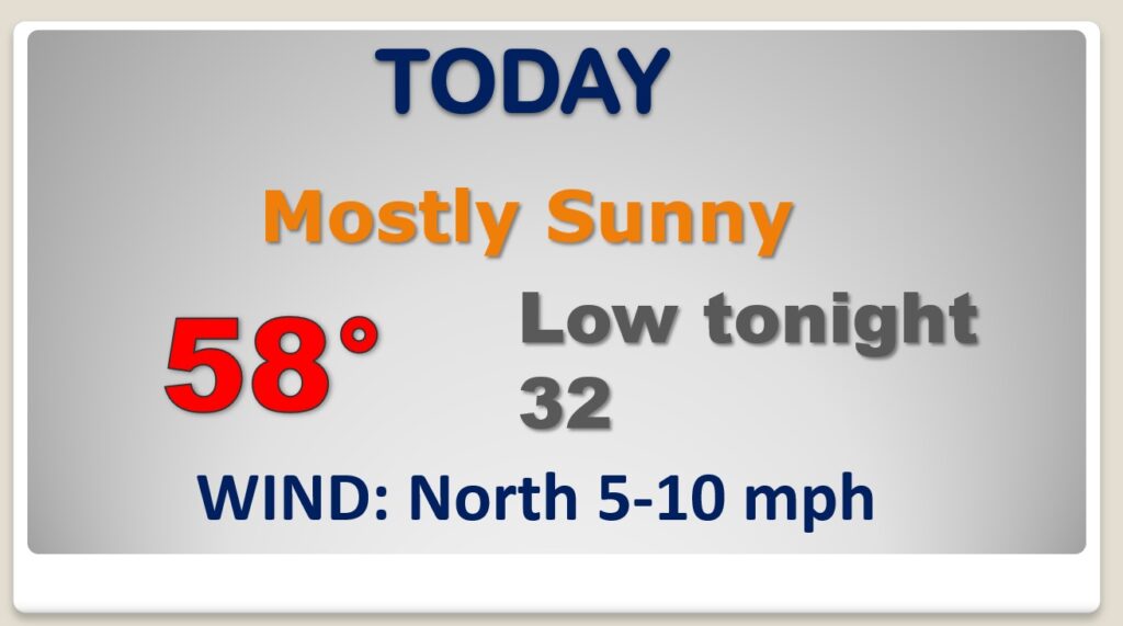
Chilly start. The chill fades quickly. We’re headed for the upper 50’s today. That’s still too cool, compared to the normal of 63, but we are moving in the right direction. Sunshine. Clear cold tonight. We’re headed for another freeze.
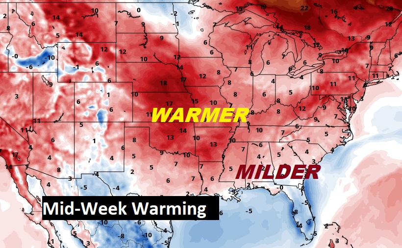
Nice warming is in the cards Wednesday through Friday, with strong high pressure anchored near the northern Gulf coast. We’ll be in the mid to upper 60’s. Not bad for the Dead of Winter.
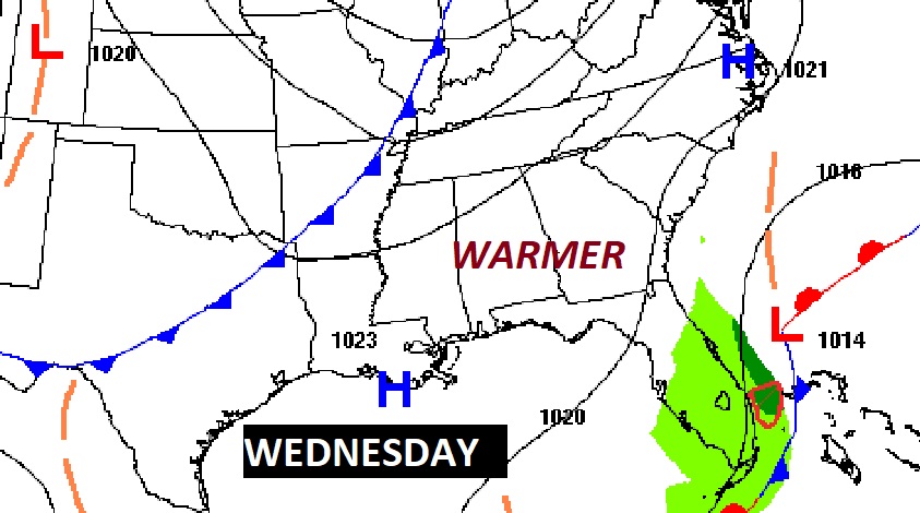
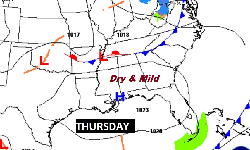
We should be dry/storm-free at least through Friday. Warming continues. Very nice pattern. There are big model question marks on how the weekend forecast will unfold. We do know a cold front is on the way. Right now I’ll go with a 20% chance of showers ahead of the front. We’ll ignore the crazy GFS solution. Expect much colder air by Sunday.