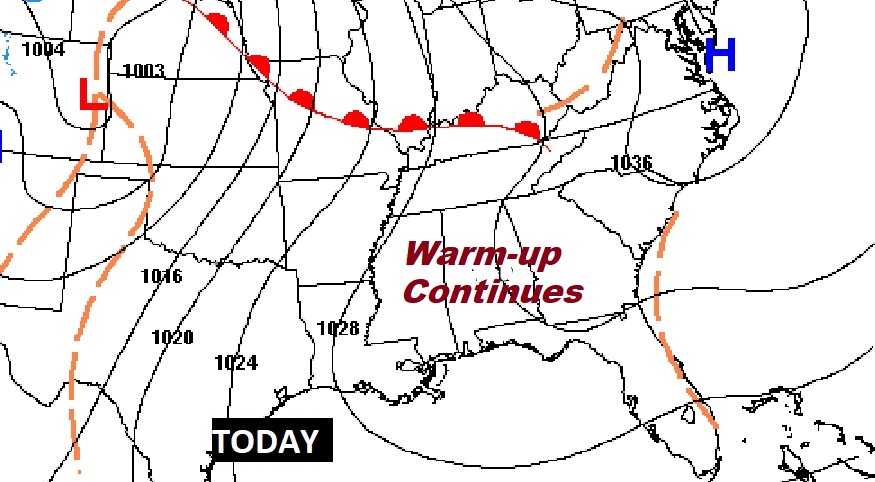
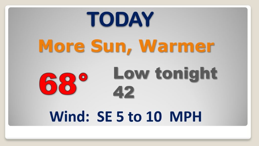
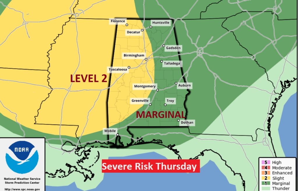
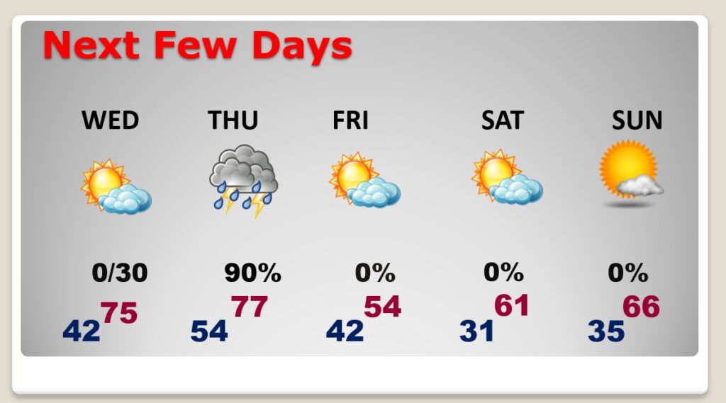
Good Morning! The morning chill will fade quickly. Our remarkable warming trend continues today. More sunshine is on the menu today and tomorrow. Upper 60’s today. Mid 70’s Wednesday. But, all of this comes with a price. A significant storm system will bring a round of strong to severe storms to the state Thursday & Thursday night. Damaging wind gusts are the main threat, but a couple of tornadoes can’t be ruled out. On this video, I’ll bring you up to date on the updated risk level and timeline. What happens after the storm system? I’ll update you on the weekend and beyond.
Yesterday’s high was 63. Today we should tack on at least 5 more degrees. Nice day! Not as cold tonight.
A major storm system will affect the state Thursday and Thursday night. Strong to severe storms are a good bet.
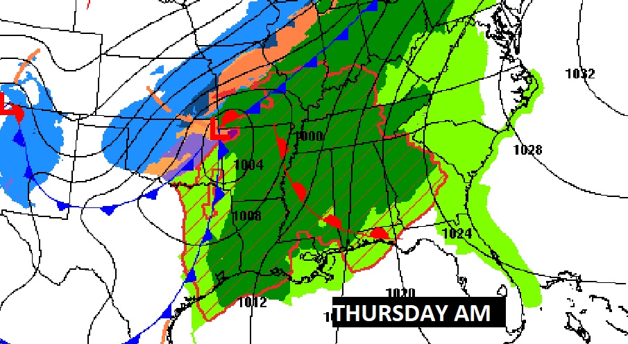
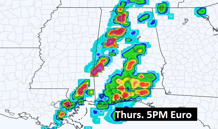
The storm prediction center has expanded and upgraded the Thursday Severe Weather Risk. The main threat will be damaging wind gusts, but there is also a small tornado risk. We’ll know more as we get closer and closer to this event.
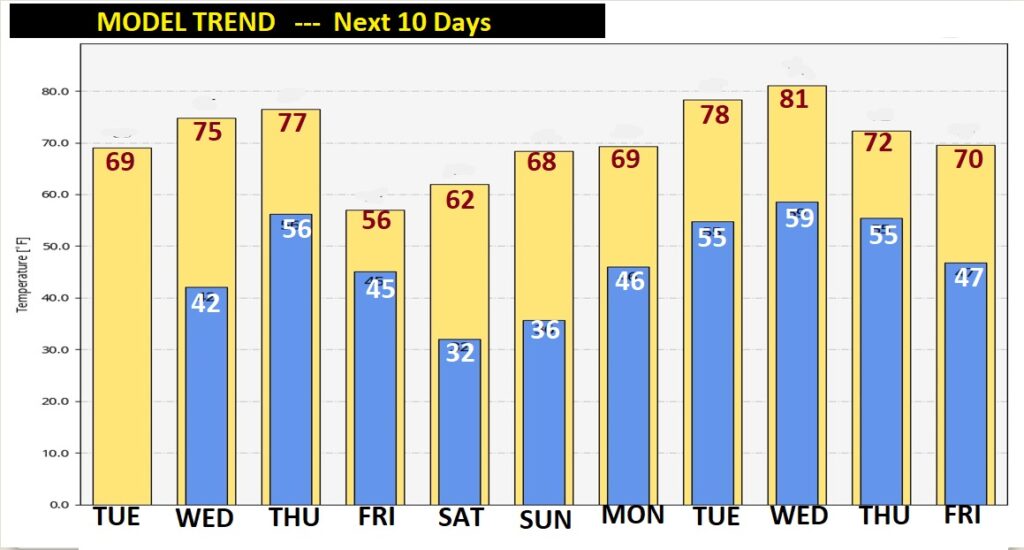
Warm & dry Wednesday. Strong to severe storms Thursday & Thursday night. Much cooler Friday. Down to freezing Saturday morning. We’ll start to warm up again over the weekend.
The ups and downs will continue. Look at the big warm-up next week! Another significant storm system is expected by Wednesday or Thursday.