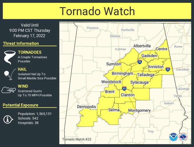
4:00PM UPDATE:
New Tornado Watch extended farther to the southeast and east. Now extends as far east as Coosa, Chilton, Autauga and Dallas until 9PM. It does include the city of Montgomery. A couple of tornadoes area possible. Damaging wind gusts to 70 mph possible. #alwx
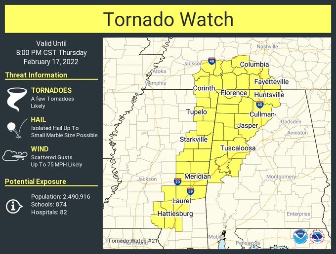
1:45 PM UPDATE:
New Tornado Watch covers far west and northwest Alabama, and east Mississippi until 8PM. A few tornadoes likely. Scattered wind gusts to 75 mph possible. #Alwx #Mswx
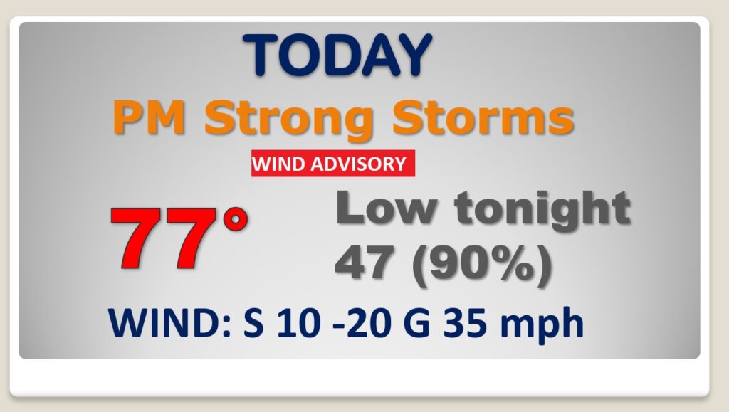
Good Morning! We have an active weather day/night ahead as a significant storm system approaches. Winds ahead of the storm will be strong today & tonight, gusting to 35 mph. A wind advisory is in effect. Temperatures will soar well into the 70’s. Scattered thunderstorms are possible as early as this afternoon. But, the main event will be a line strong/severe storms that will sweep across the state this evening and tonight. All if the state is in a severe weather risk. But, the greatest threat of severe storms and tornadoes will be across west and northwest Alabama. On this video, I have the updated Severe Risk from SPC, and an update on the timeline, as the Cold Front cuts across the state. It’ll be windy & colder behind the front Friday. I have an update on the weekend. Plus, I’ll show you a very active weather pattern next week.
A major storm system is approaching. Much of today will be dry. Showers and storms are possible by this afternoon. It’ll be windy & warm for February. Winds could gust to 35 mph. A line of strong to severe storms will cross the state tonight. Some of the storms could produce damaging wind gusts. Colder late tonight behind the Cold Front.
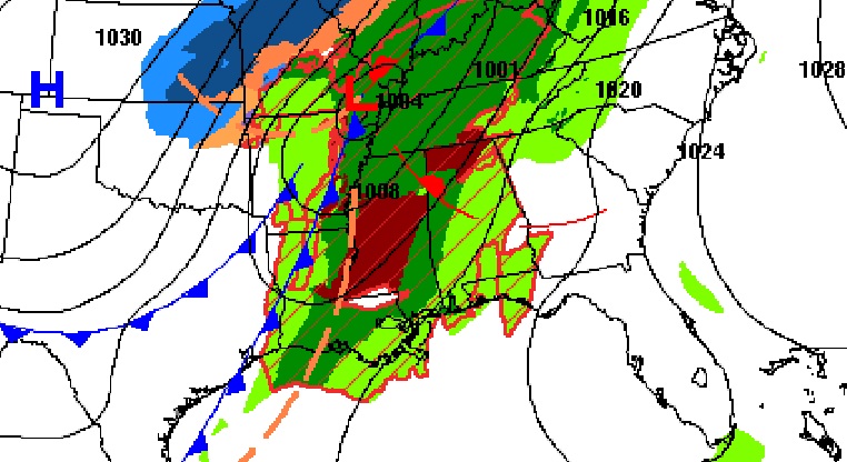
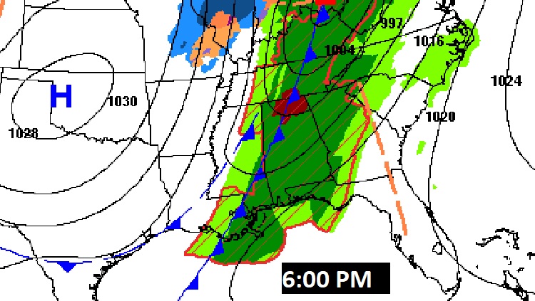
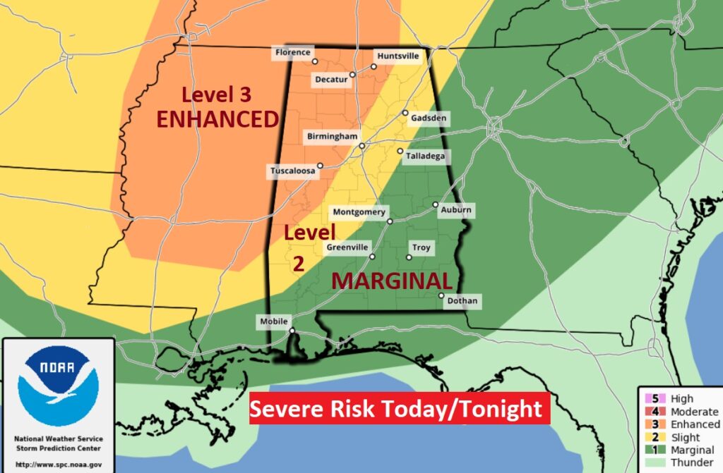
Storm Prediction Center has all of the state in a Severe Weather Risk. By far the greatest risk of severe thunderstorms and tornadoes will be across west and northwest Alabama where there is ENHANCED, Level 3 severe risk.
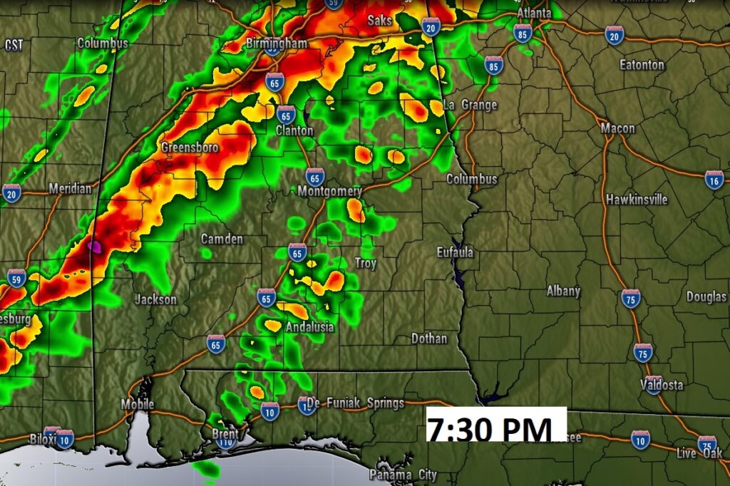
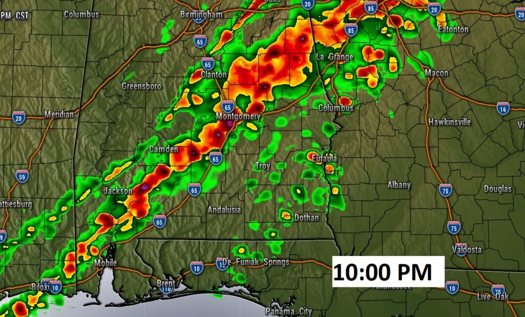
A line of strong/severe storms will sweep across the state tonight ahead of a strong cold front.
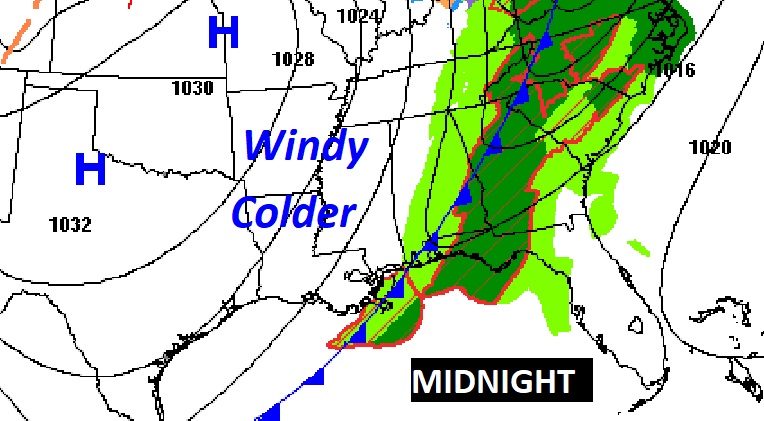
Much colder air will funnel into the state late tonight behind the cold front.
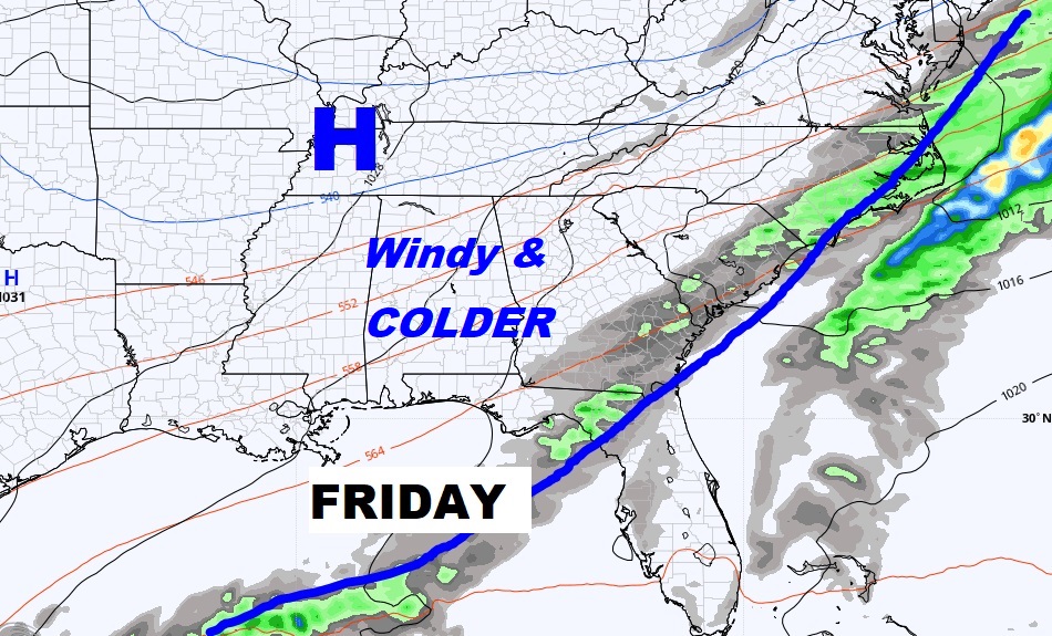
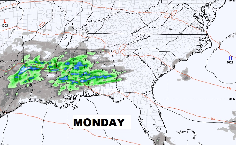
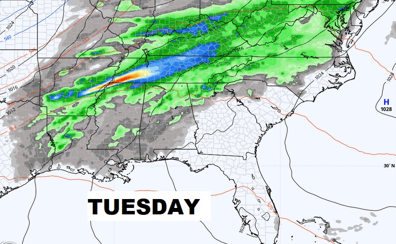
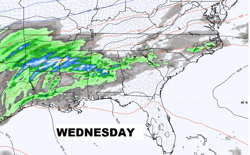
Friday will be windy & colder. Expect yet another freeze Friday night/Saturday AM. Warmer Sunday. Risk of rain returns Monday through Wednesday. MUCH warmer.
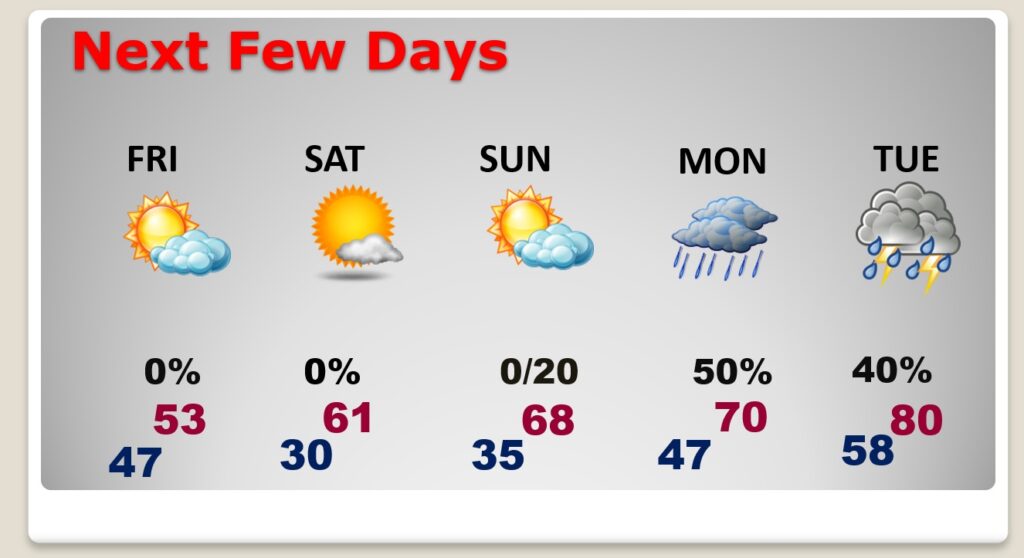
Active weather week next week…through Wednesday and beyond.