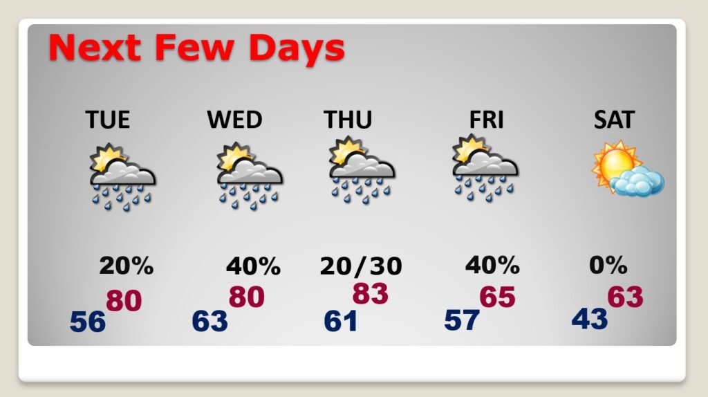
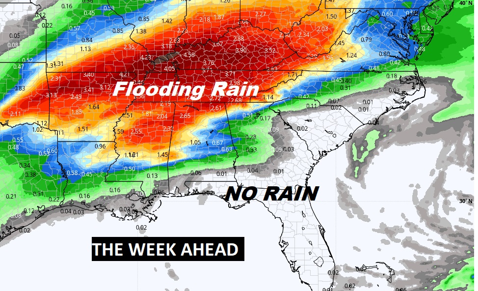
Good Morning! Rain is a good bet across much of the area today, as tropical moisture overspreads the area. After today, we will be living on “The Edge of Wetness” for much of the week ahead. There will be a shower risk at times, but a huge upper ridge in the Gulf will keep most of the action weather northwest of us. Temperatures for much of the week will feel more like April than February. On this video, I’ll try to explain a complex story. Parts of the south will see flooding rainfall. Other places will see very little rain at all. I break down the details through Saturday.
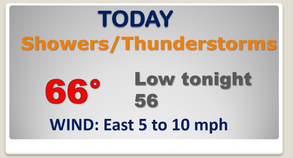
Showers and a few storms are likely today. Decreasing by evening.
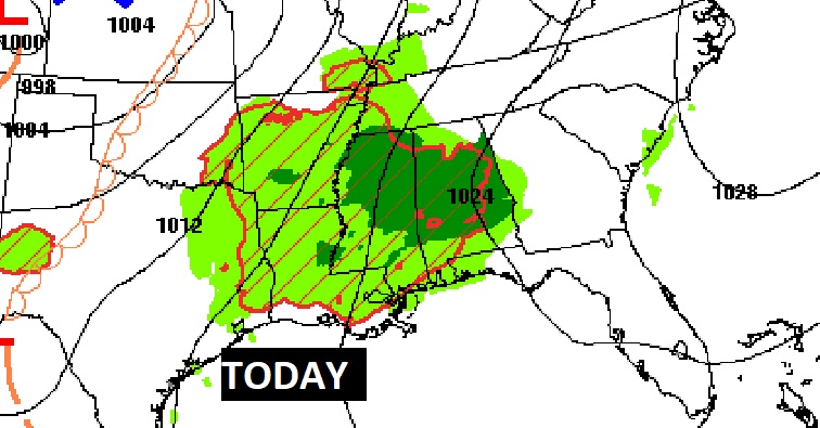
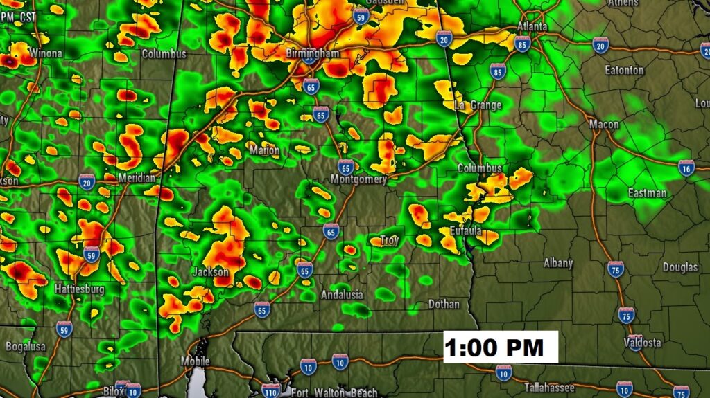
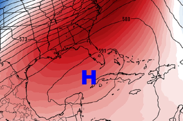
Most of the active weather and flooding rainfall will stay well north and northwest of us this week. A strong upper high pressure ridge from the Gulf of Mexico to the Bahamas will keep us on drier side for most of the week. The rain chance will be relatively small while temperatures will soar to 80 or above Tuesday through Thursday. The upper ridge will be the biggest weather player of the week for most of us.
This projected rainfall map speaks volumes on how the upper ridge will influence the forecast this week.
Tuesday will be mostly dry and warm. Scattered thunderstorms Wednesday, as a front to the north teases us. Thursday is likely to be the warmest day of the week. Cold front moves southward Thursday night and Friday. Much cooler behind the front.
