
Good Morning! We have been 80 or above for the last three days. All of that is about to abruptly change. Much cooler air is streaming in behind a Cold Front. Today will be a day of falling temperatures. There could be a few showers early in the day. We’ll will hover in the upper 50’s to near 60 all day, and we’re headed for the low 40’s tonight.
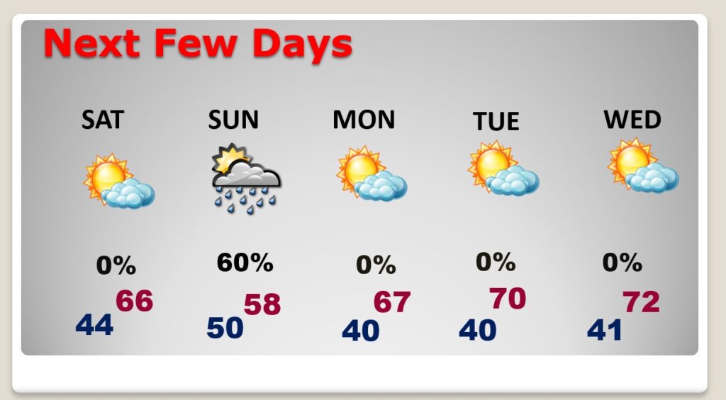
Saturday should be cool, but nicer. A chilly rain is likely on Sunday. Sunday high will not make it out of the 60’s. But, nicer weather will return as February ends and March begins. The news is pretty good for next week.
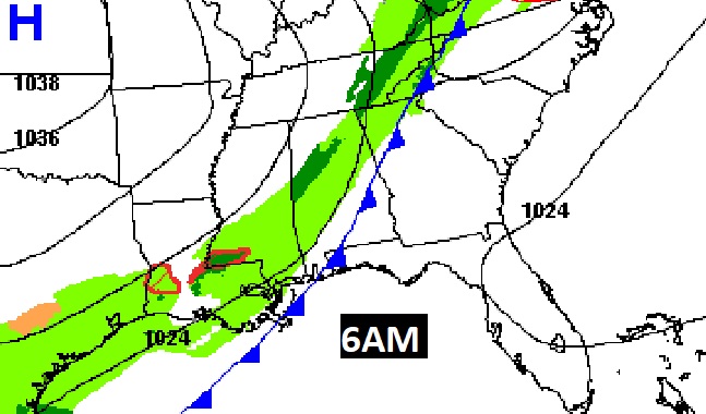
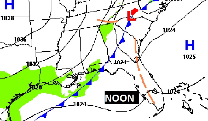
Early this morning, the cool front will move in between Montgomery and Troy by 6AM, and to beyond Dothan at Noon.
TODAY: Risk of some leftover showers in the morning, early. Mostly cloudy. A bit breezy. Temperatures will hover in the upper 50’s to near 60 all day. Quite chilly tonight. Low 44.
NEXT FEW DAYS: Nicer Saturday. A good bit of sun. Hi mid 60’s. A pretty nasty Sunday. Rain likely. The high may not reach 60 degrees. Monday is nicer, on the last day of February. Lots of sun. High 67. We return to 70+ degree weather by Tuesday through Thursday, and beyond.
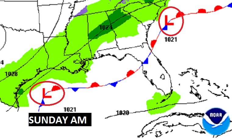
Sunday will NOT be a Chamber of Commerce Day. Periods of rain. A Chilly rain, as waves of low pressure move along the front in the Gulf.
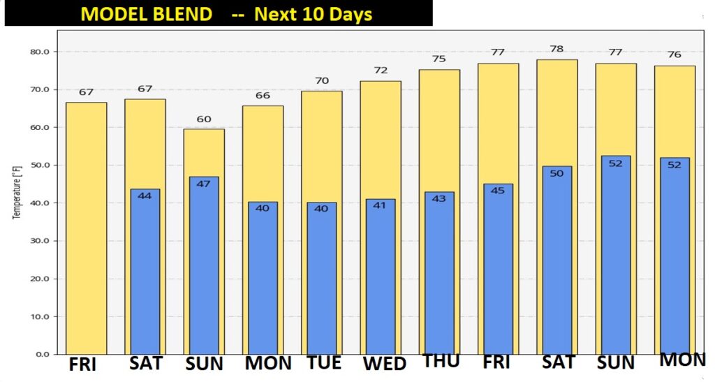
Are we done with Arctic Air for rest of the Winter. It’s too early to say. But, for the next 10 days, we’re looking good. Take a look at the Blend of all the long-range models.
—
Chase and I are enjoying a very brief getaway to the coast.
Thanks for reading the Blog this morning.
I will have another complete blog update in the morning, and Sunday morning. Have a great weekend!
–Rich