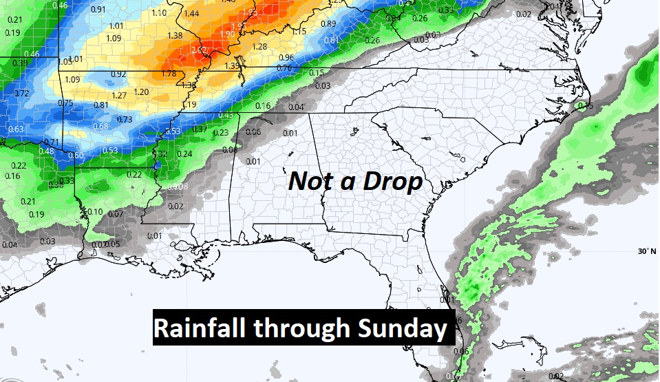
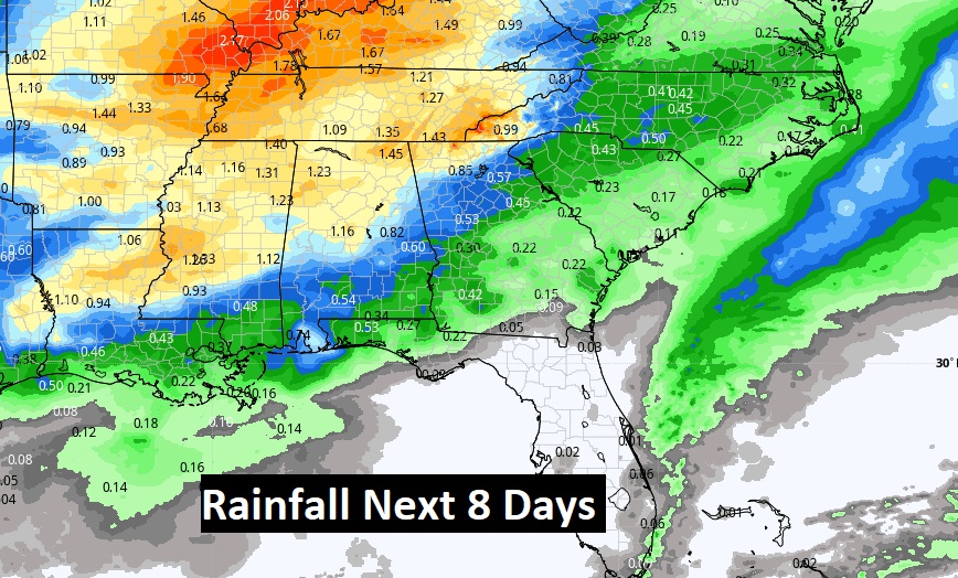
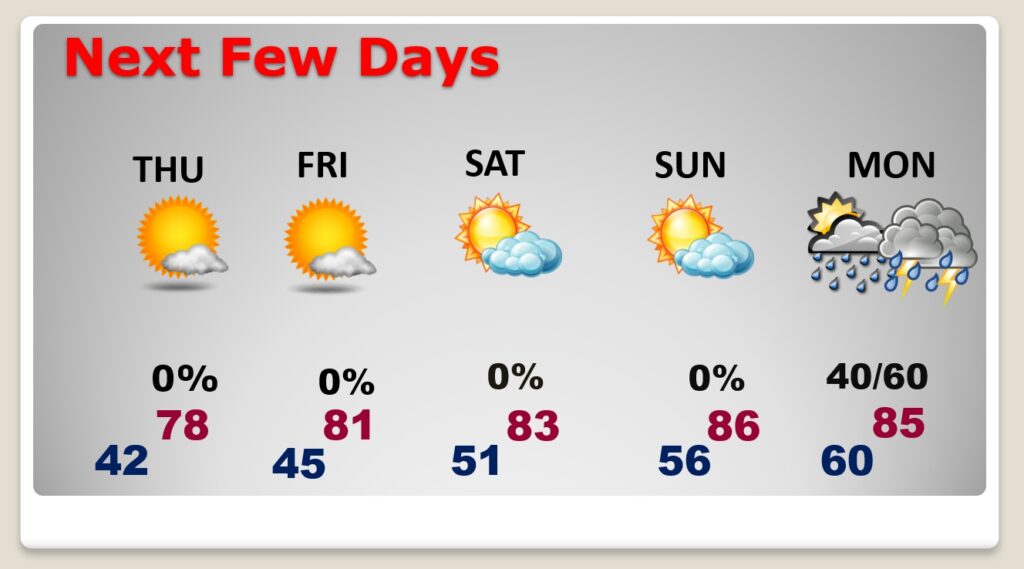
Good Morning! What a great start to the month of March. Monday’s high was 72. We’ll do better than that today. And, each day will get warmer through the weekend. In fact, Friday through Monday we’ll be in potential record high territory. Meanwhile, this string of storm-free, nice days will continue through the weekend. But, we all know can’t last. On this video, we’ll look ahead to the next storm system. Next week is likely to me much more active.
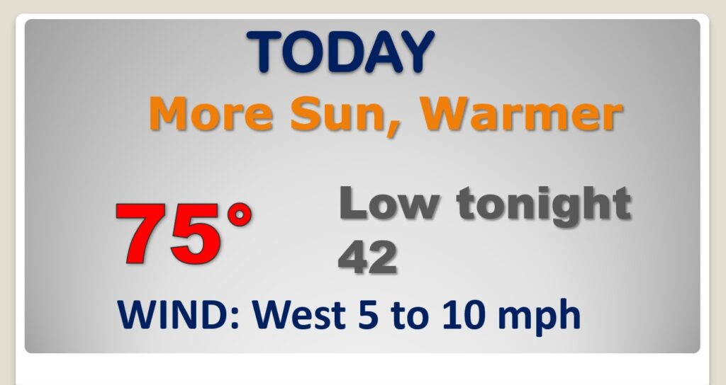
How do you like March so far? What a great start. We’re headed for the mid 70’s today. Beautiful forecast.
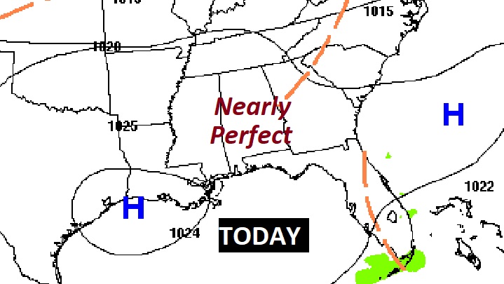
The big strong Upper High surging northward through the Nation’s heartland will promote an extended string of very nice weather with a pronounced warming trend.
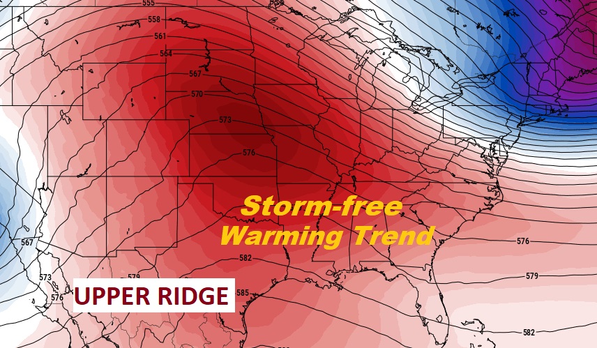
The extended string of storm-free, beautiful days continues, like through the weekend. Amazing warming trend. Near record highs Friday through Monday. Risk of showers & Thunderstorms returns Monday and becomes more likely Monday night & Tuesday.
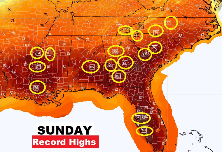
Record highs will be widespread across the South by Sunday.
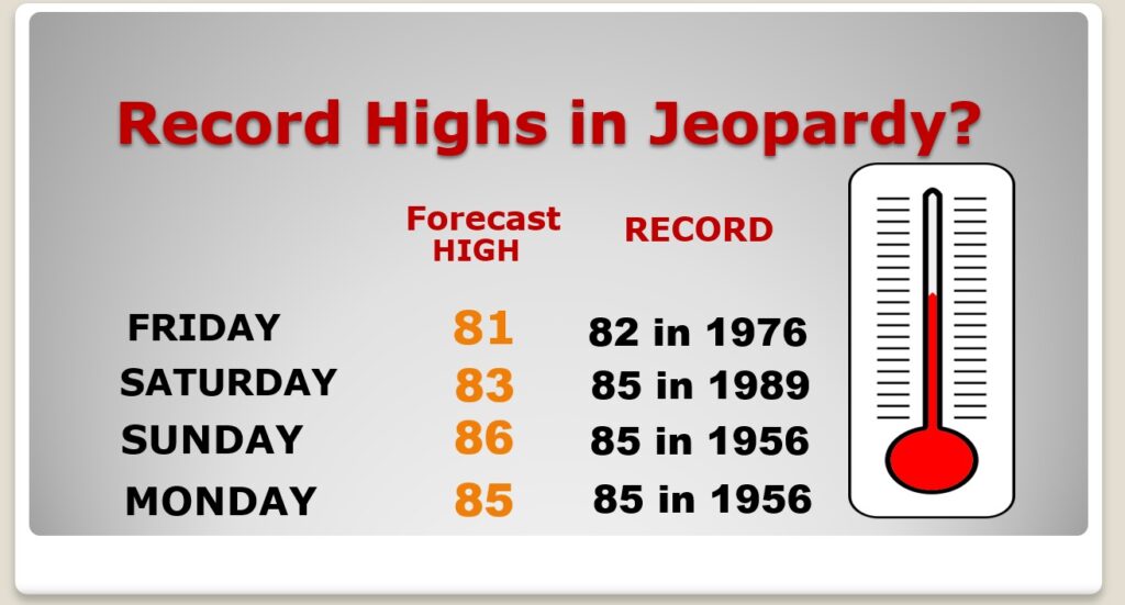
In fact, we’ll be in record high territory Friday through Monday.
Risk of showers & Thunderstorms returns Monday and becomes more likely Monday night & Tuesday.
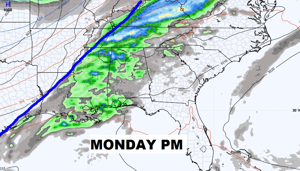
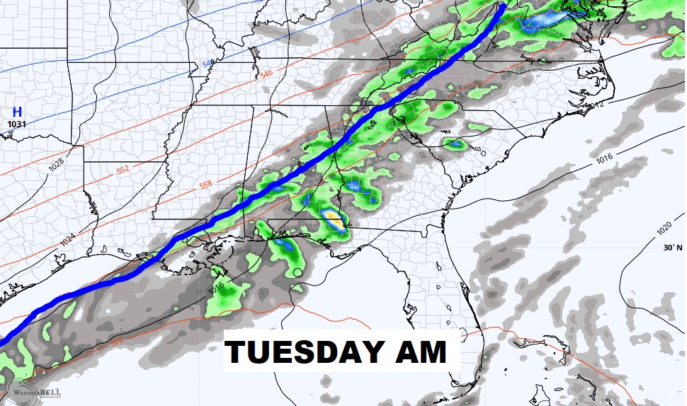
Not a drop of rain through Sunday. But, rain returns by Monday night and Tuesday.
