
Good Morning! Montgomery broke a record high yesterday with 85. (Old Record 82 from 1955 and 1880). More records are likely today and tomorrow as we head for the mid 80’s both days. Saturday’s record is 85 (from 1989 and 1880). Sunday’s Record is 85 (from 1956). Normal high is 69. Our string of incredibly beautiful, storm-free days continues through Sunday. Then it’s all over. Next week is very different. Spring-fever is about to end.
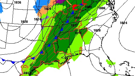
A significant storm system will bring showers and storms by Monday afternoon and Monday night. Some of the storms will be strong. Much of the state is in a Severe Weather Risk.
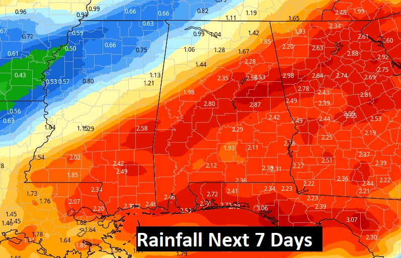
Next week will be very wet and active. There is a risk of rain in the forecast each day through Friday from a series of disturbances which will drift through the northern Gulf. Rainfall amounts could be significant.
ATTENTION ALABAMA GROWERS: A cold front arrives Friday. Expect a late season “Cold-Snap” next weekend. We could see at least one morning of freezing temperatures, maybe two. The First freeze would probably come Sunday morning. (3/13)
RECORDS THIS WEEKEND: The record book will be re-written across the south this weekend. Enjoy it. It will be a thing of the past soon.
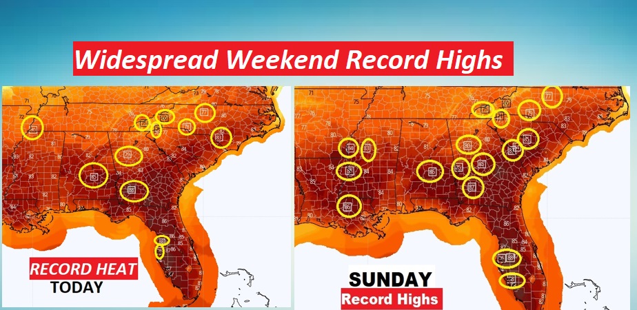
TODAY: Mostly sunny. Record Warmth…high 85. Breezy. South wind 10 to 15. Milder tonight. Mostly clear. Low 54.
SUNDAY: Mostly sunny. Record Warmth…high 86. Breezy. South wind 10 to 15 gusting to 20. Mild Sunday night. Partly cloudy. Low 62.
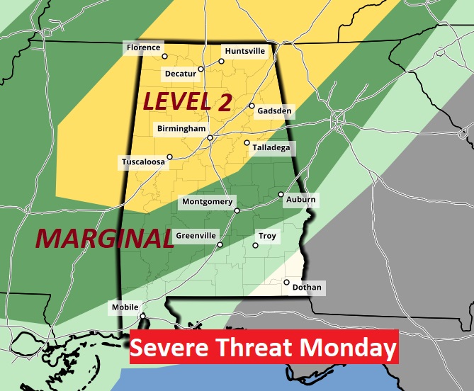
MONDAY STORM THREAT: A significant storm system will bring showers and thunderstorms to the state by Monday afternoon and Monday night.
Some of the storms could be strong to severe. Much of the state is in a Sever Risk from SPC. The greater risk of severe storms will be in the yellow Level 2 area across northwest Alabama. Damaging wind gusts are the main threat. The tornado risk appears to be low but not zero.
NEXT FEW DAYS: Sunday is the last day of this incredibly nice pattern. Showers and storms by Monday and Monday night. Cooler Tuesday. Wet at times every day next week through Friday.
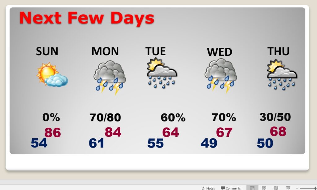
Excessive rainfall is possible in spots.
COLD SNAP NEXT WEEKEND – FREEZE LIKELY: ATTENTION ALABAMA GROWERS: A cold front arrives Friday. Expect a late season “Cold-Snap” next weekend. We could see at least one morning of freezing temperatures, maybe two. First freeze would probably come Sunday morning. (maybe Monday morning, too.)
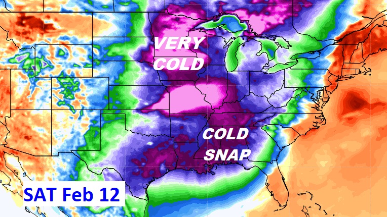
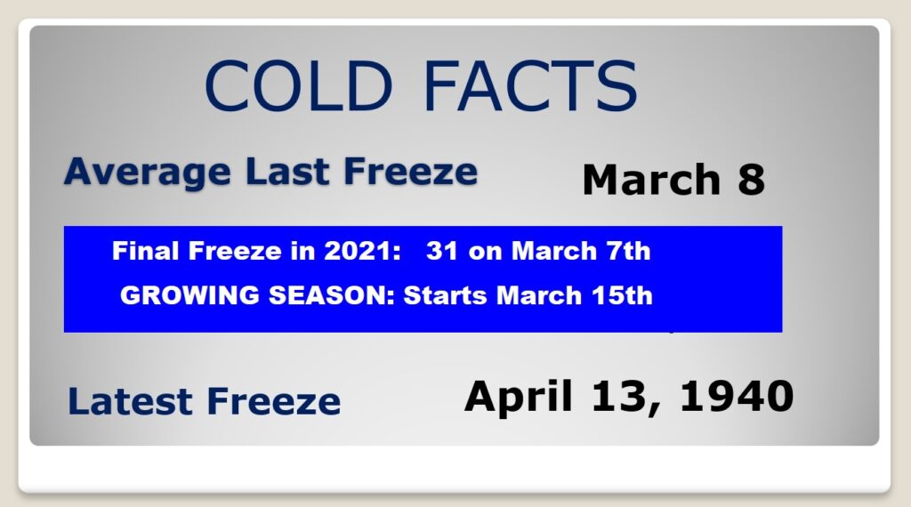
Average date of the last freeze is March 8th. Last year the final freeze was Match 7th.
.
I’ll have another Blog update in the morning. Enjoy this nice day, today. Have a nice weekend!
–Rich