
Good Morning! Our record warmth continues today. Today’s Record high is 85 , from 1955, is very much in jeopardy. Normal high is 69. Our string of incredibly beautiful, storm-free days continues through today. Then it’s all over. Next week is very different. A significant storms system will bring showers and storms by Monday afternoon and Monday night. Some of the storms will be strong. Much of the state is in a Severe Weather Risk.
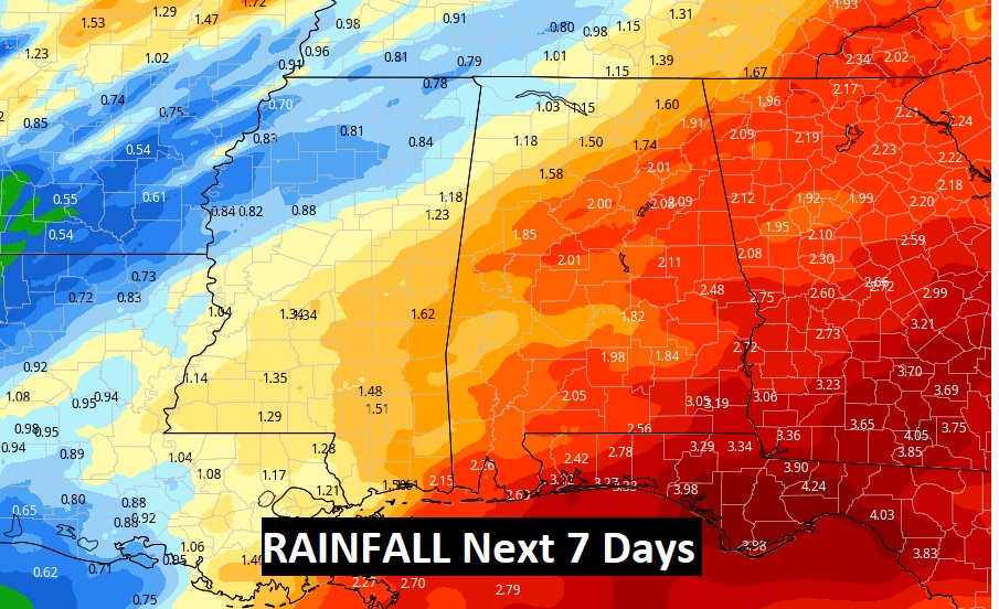
Next week will be very wet and active. There is a risk of rain in the forecast each day through Friday from a series of disturbances which will drift through the northern Gulf. Rainfall amounts could be significant.
It looks like some much colder air arrives Friday. There’s a good chance of a late season freeze over the weekend. Most likely by Sunday morning. And, perhaps close to a freeze Monday morning.
TODAY: Mostly sunny. Record Warmth…high 86. Breezy. South wind 10 to 15 gusting to 20. Mild tonight. Partly cloudy. Low 62.
MODAY STORM THREAT: A significant storm system will bring showers and thunderstorms to the state by Monday afternoon and Monday night.
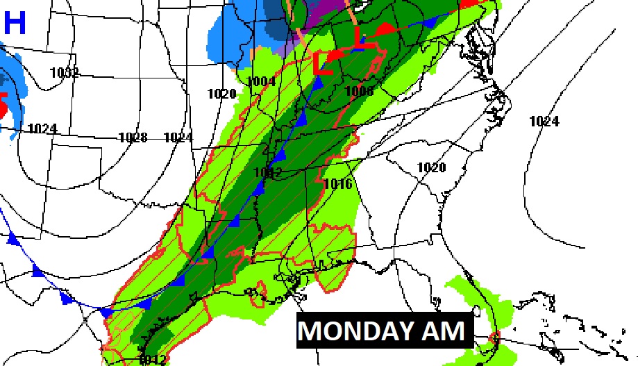
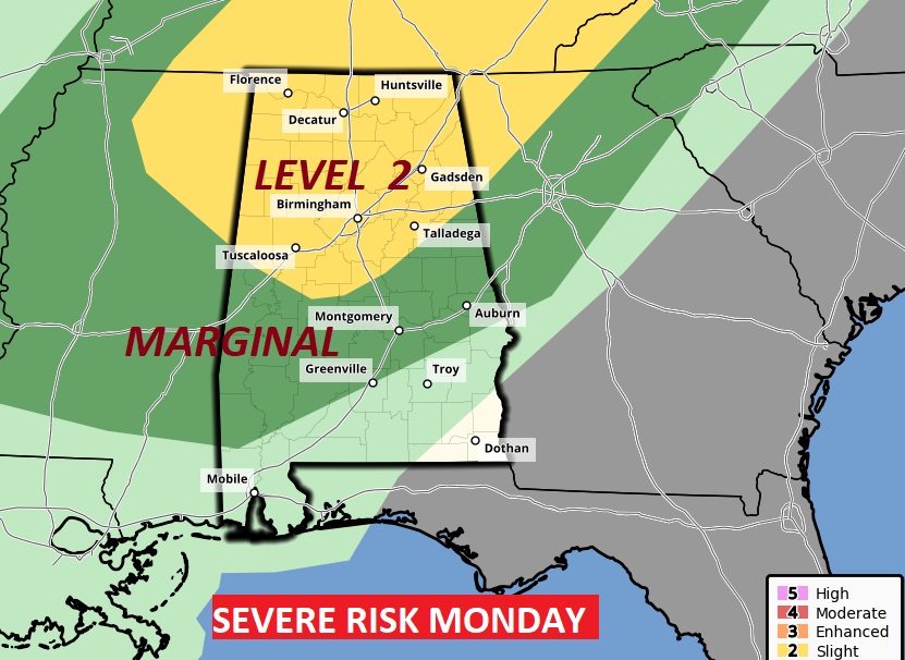
Some of the storms could be strong to severe. Much of the state is in a Severe Risk from SPC. The greater risk of severe storms will be in the yellow Level 2 area across northwest Alabama. Damaging wind gusts are the main threat. The tornado risk appears to be low but not zero.
NEXT FEW DAYS: Today is the last day of this incredibly nice pattern. Showers and storms by Monday and Monday night. Cooler Tuesday. Wet at times every day next week through Friday.
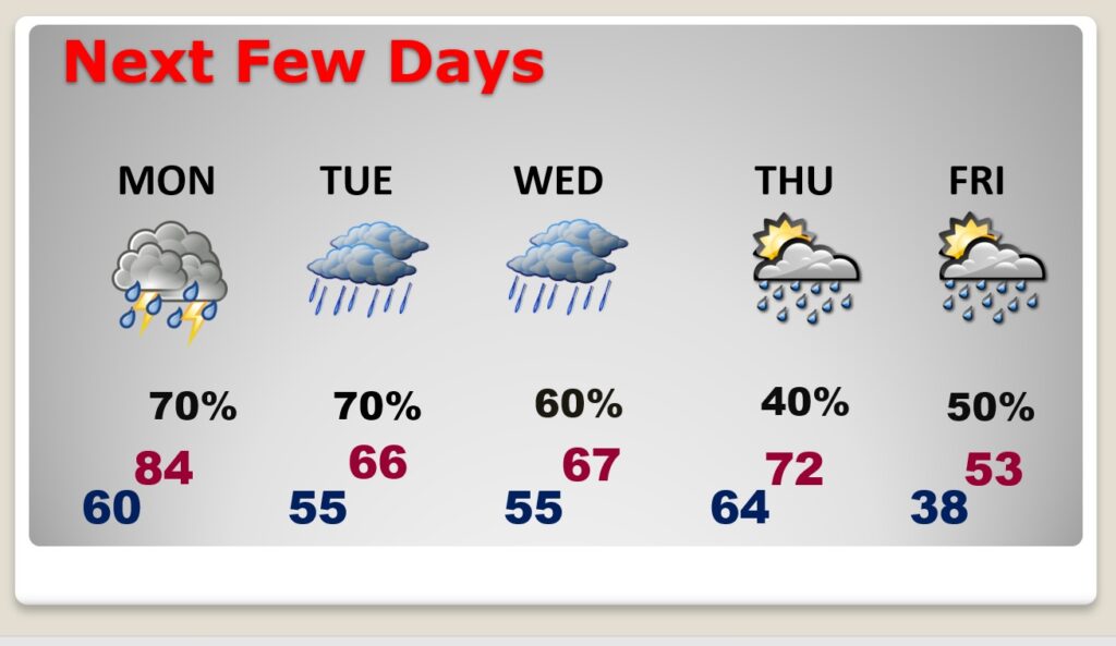
Excessive rainfall is possible in spots.
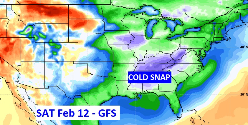
LATE SEASON COLD SNAP:
COLD SNAP NEXT WEEKEND – FREEZE LIKELY: ATTENTION ALABAMA GROWERS: A cold front arrives Friday. Expect a late season “Cold-Snap” next weekend. We could see at least one morning of freezing temperatures, maybe two. First freeze would probably come Sunday morning. (maybe Monday morning, too.)
.
Have a Great Sunday! I’ll have a complete video in the morning, online by 4:45 AM.
–Rich