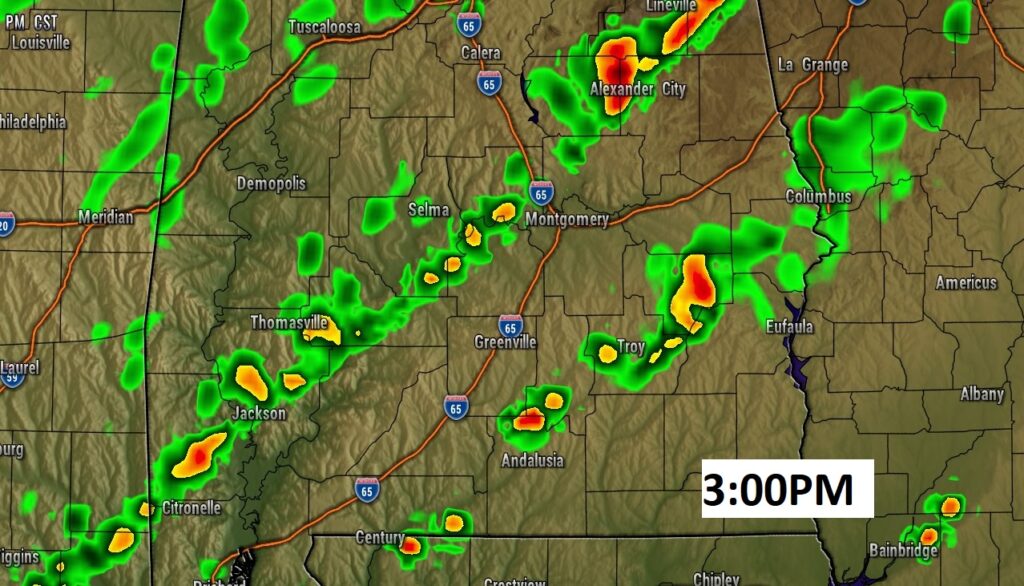
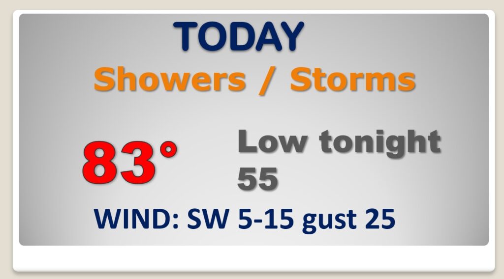
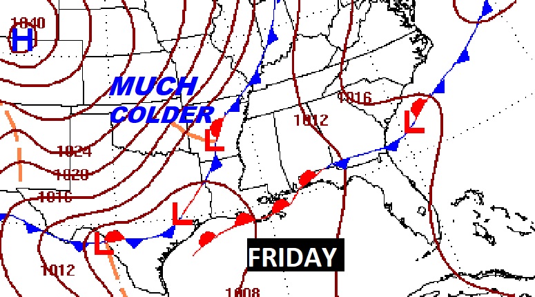
Good Morning! A band of showers & storms will march across the state today ahead of a frontal system. Some of the storms could be strong/severe. Most of us are in a Marginal Severe Risk. The front will stall in the Gulf. Wave after wave of low pressure will move along the front through the rest of the week, bringing in surge after surge of moisture. It will be wet at times for the week ahead. The “kicker” arrives Friday with a strong cold front. Behind that front, MUCH colder will funnel into the state. Saturday will be windy, cold and raw. Expect a late season freeze Saturday night/Sunday morning. We’re headed for the upper 20’s. On this video, I’ll bring you the day to day details, and I’ll show you how much rain could fall.
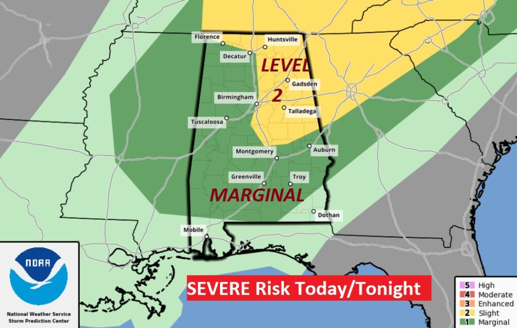
A band of showers & storms will march across the state today ahead of a frontal system. Some of the storms could be strong/severe.
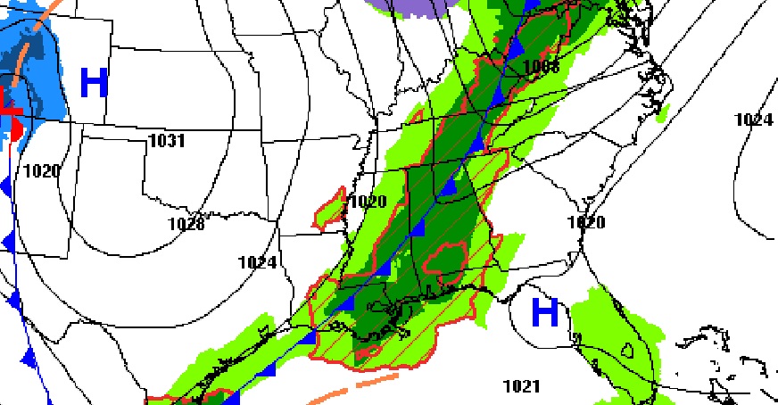
Most of us are in a Marginal Severe Risk. The level 2 risk zone cover northeast and east Alabama. Damaging wind gusts are the main threat. A tornado can not be ruled out.
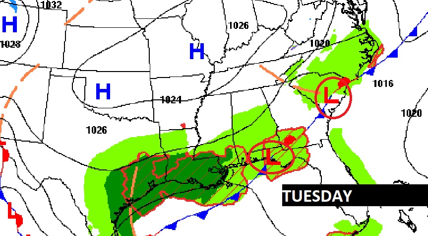
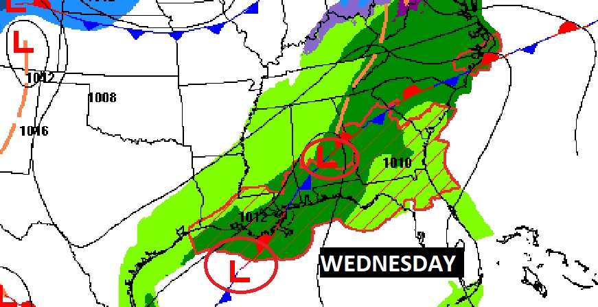
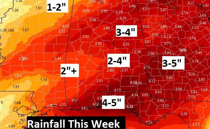
The front will stall in the Gulf. Wave after wave of low pressure will move along the front through the rest of the week, bringing in surge after surge of moisture. It will be wet at times for the week ahead. Total rainfall totals for the week could be excessive in spots.
Good Morning! A band of showers & storms will march across the state today ahead of a frontal system. Some of the storms could be strong/severe. Most of us are in a Marginal Severe Risk. The front will stall in the Gulf. Wave after wave of low pressure will move along the front through the rest of the week, bringing in surge after surge of moisture. It will be wet at times for the week ahead. The “kicker” arrives Friday with a strong cold front. Behind that front, MUCH colder will funnel into the state. Saturday will be windy, cold and raw. Expect a late season freeze Saturday night/Sunday morning. We’re headed for the upper 20’s. On this video, I’ll bring you the day to day details, and I’ll show you how much rain could fall.
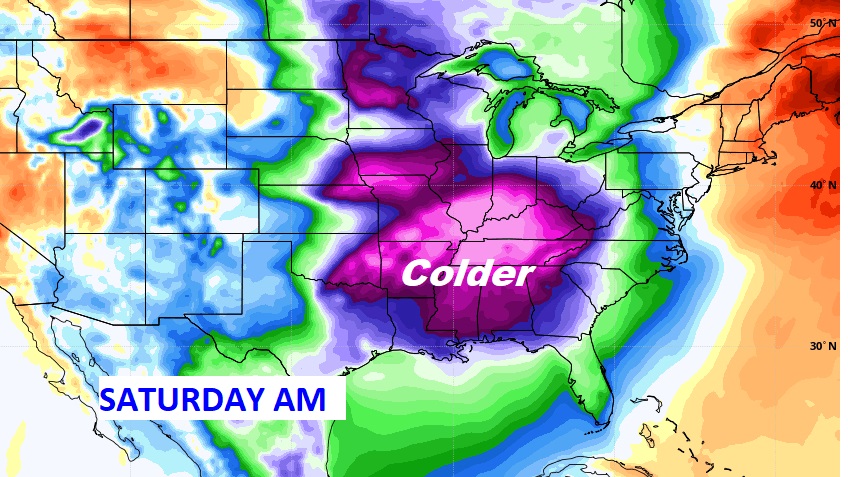
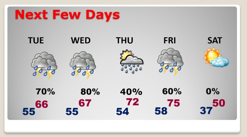
Wet at times in the week ahead. Much cooler Tuesday & Wednesday. Warmer late week, before a Friday night cold front. Temperature crash by Saturday. We may not reach 50 degrees Saturday. Upper 20’s by Dawn Sunday.