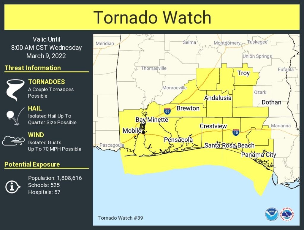
Good Morning! It’s been very active overnight with a Tornado Watch and some Tornado Warnings for parts of south Alabama. Our active weather pattern will continue. It will be wet at times through Friday night. A strong Cold front could bring more Severe Weather to the state by late Friday and Friday night. Expect a rather dramatic Temperature crash Saturday. A late season Cold Snap will bring a killing freeze to the Gulf south. Expect mid 20’s by Sunday Dawn. There’s much to talk about on this morning’s video.
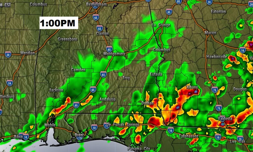
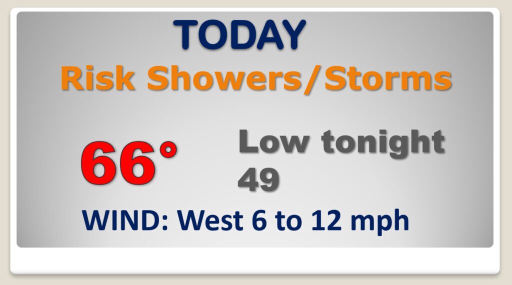
Risk of more showers and storms today…and times.
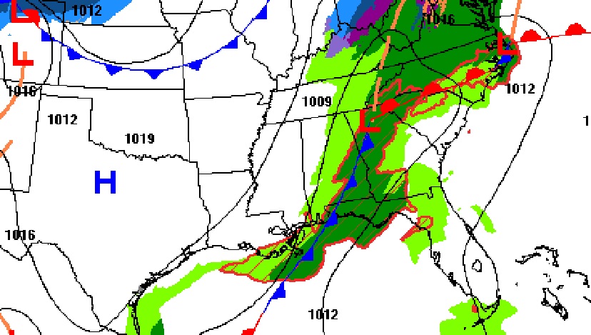
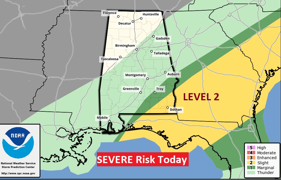
Pre-dawn…very early this morning the SEVERE risk continues across south Alabama.
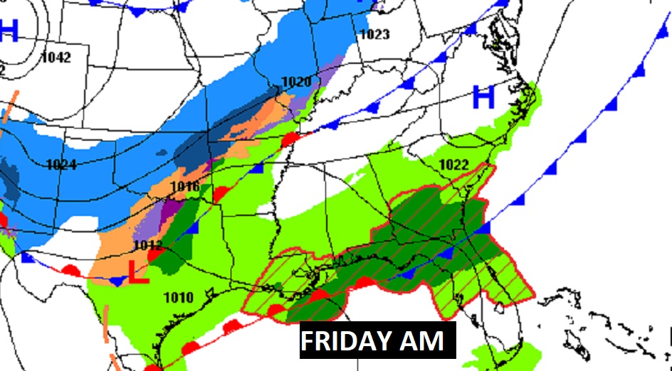
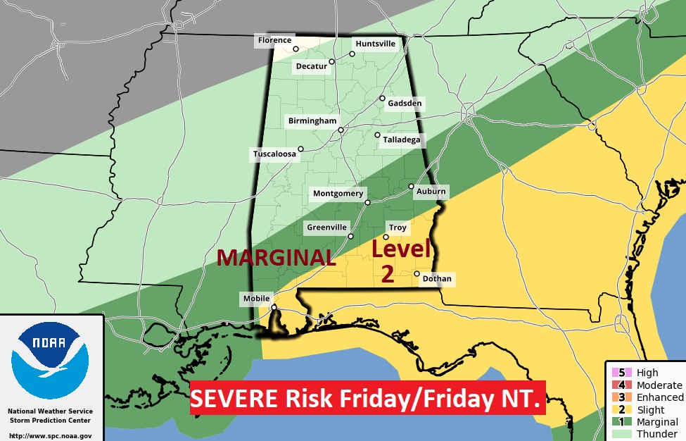
A Strong Cold Front will approach the state Friday with yet another Severe Weather Risk.
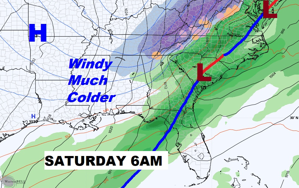
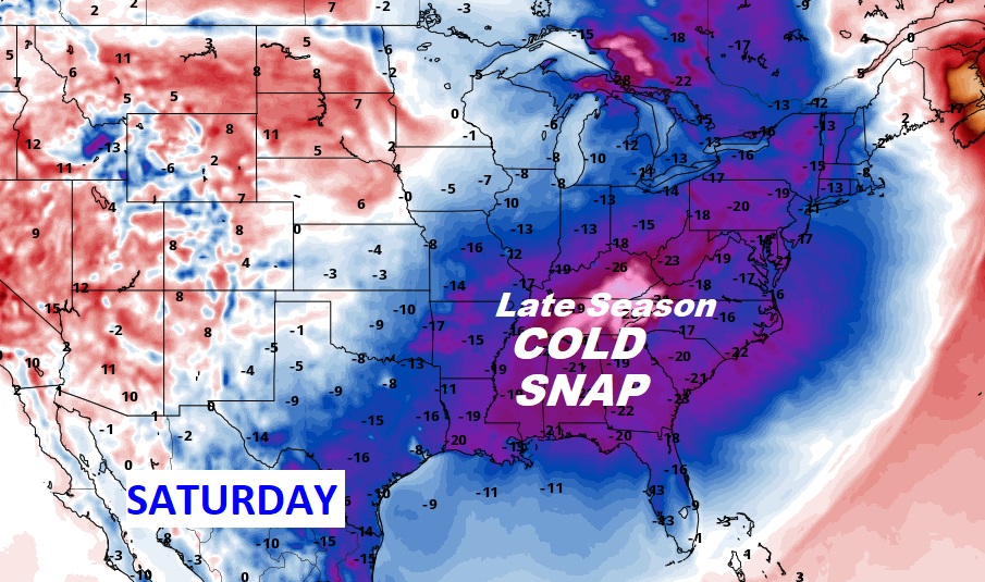
It will turn dramatically MUCH COLDER and windy Saturday. Temperatures will only be in the 40’s.
Expect a Killing Hard Freeze Saturday night. Here’s Dawn Sunday.
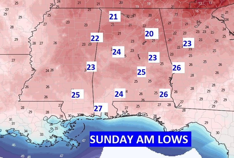
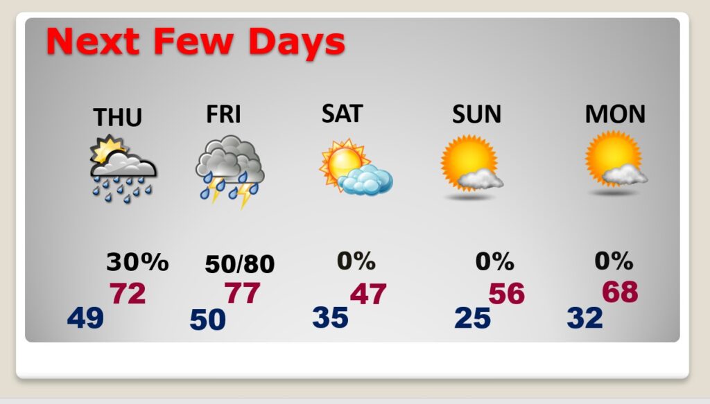
Wet at times through Friday night. Dramatically colder Saturday. Killing Hard Freeze Sunday morning. A little warmer Monday afternoon after a freeze Monday morning.
Spring forward this weekend.