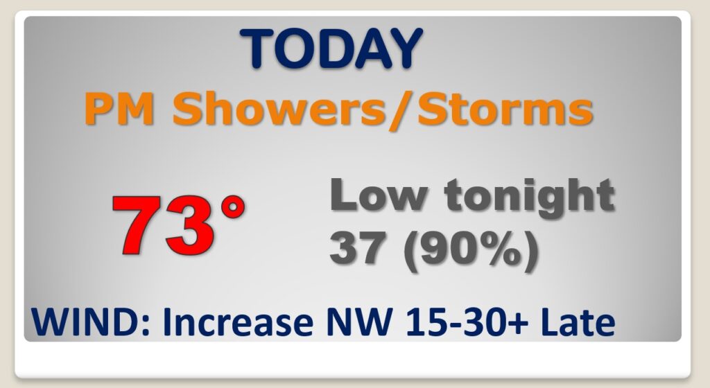
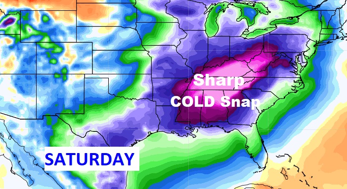
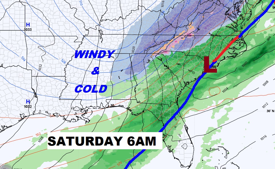
Good Morning! You’ve probably have heard by now. There are drastic weather changes ahead as a strong cold front moves across the state tonight. Showers and a few strong, possibly severe storms are possible ahead of the frontal passage, especially across south and southeast Alabama. Behind the front, it will turn drastically colder and windy. There could even be a brief flurry or two early Saturday, before the precipitation ends. Saturday will be a windy, raw Winter’s day. The big news involves a Killing Hard Freeze Saturday night. Some towns will reach the low 20’s by Dawn Sunday. On this video, I will fill you in on the details of this rather radical Temperature Crash, and we’ll look ahead into next week.
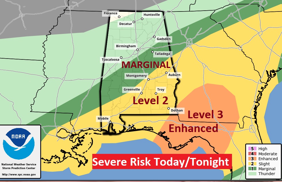
The wild card tonight will be that warm front along the northern Gulf Coast. How far north the warm front is able to migrate tonight will determine the northward extent of the Severe Weather Threat. Late tonight the Cold Front reaches SE Alabama.
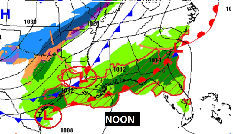
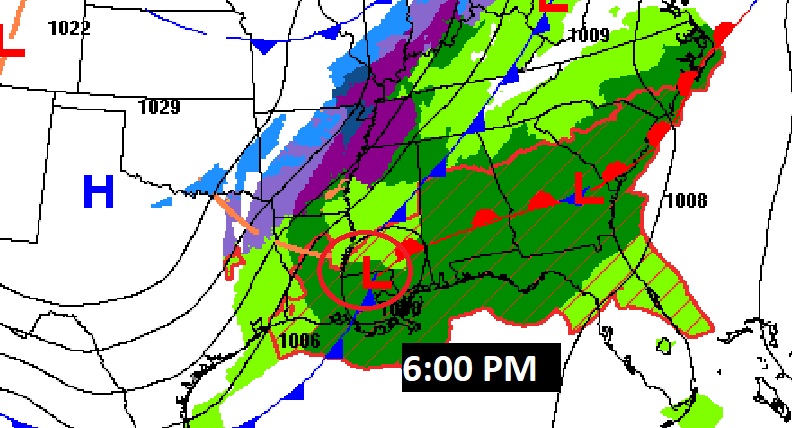
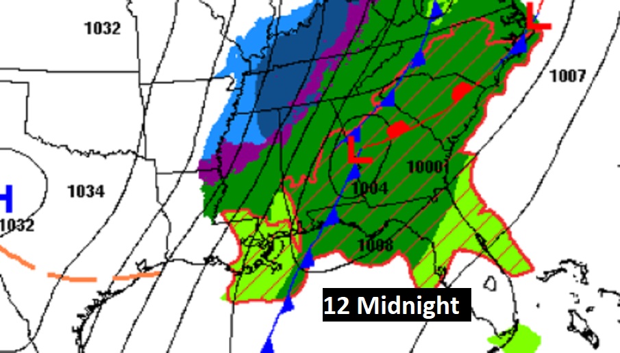
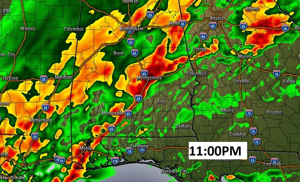
A Level 2 Severe Threat extends as far north as Montgomery this evening and tonight. Damaging wind gusts and possibly a few tornadoes are possible. An even stronger Level 3 risk, covers areas just east of Alabama. That’s where the tornado threat is even higher.
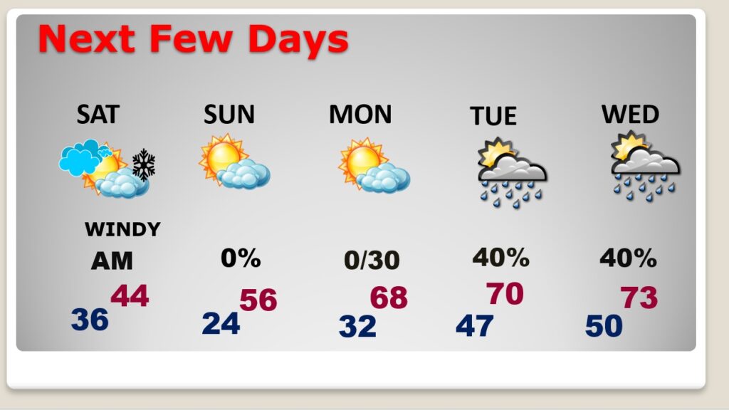
Drastically Colder air will funnel in behind the Cold Front. There could be a brief snow flurry early in the morning. Saturday will be windy and very cold.
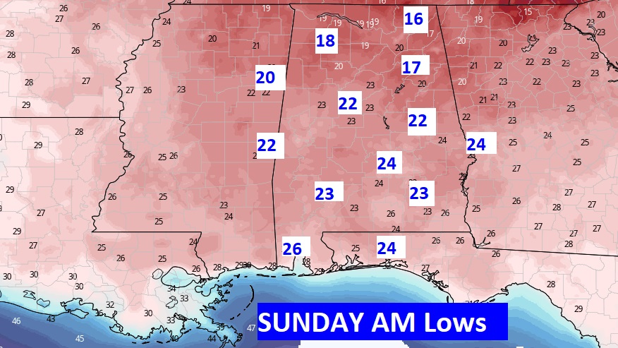
The big news involves a Killing Hard Freeze Saturday night. Some towns will reach the low 20’s by Dawn Sunday.
We’ll be back to the 50’s Sunday afternoon. Another freeze Monday morning. 60’s Monday afternoon. More rain Tuesday.
Don’t forget…this is the time change weekend….

