
Good Morning! Welcome to Daylight Saving Time, on an unusually cold, sub-freezing Sunday morning. It’s a killing freeze, unfortunately. By Dawn, we should be at or around 23. That would break the record of 24 from 1998. Fortunately, this drastic Arctic Blast will depart almost as quickly as it arrived. But, perhaps, not before another “near freeze” tonight. Freeze Warning tonight.
After our frigid start this morning, look for sunshine to push us into the 50’s this afternoon and the 60’s by Monday afternoon. The next storm system will deliver another round of rain and maybe some thunderstorms by Tuesday. The best news involves a nice warming trend Wednesday through Friday.
With any luck, we probably won’t have to deal with freezing temperatures anymore until the Fall. Fingers crossed.
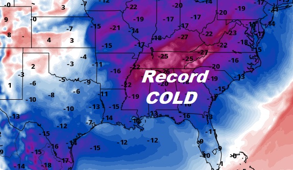
Frigid, historic Sunday morning across the Southeast US. Record cold.
TODAY: After a frigid start in the low 20’s, we should see a nice afternoon turn-around. Sunshine. High 57. (Normal high 71, Low 46) Mostly clear tonight. Low near 32 by Dawn Monday. Freeze warning again tonight.
NEXT FEW DAYS: Nice warm-up Monday after a cold start. Showers and thunderstorms Tuesday. Right now, it does not appear to be a severe weather situation. We’ll see. Warmer late week. Mid to upper 70’s. Risk of more showers & storms Friday
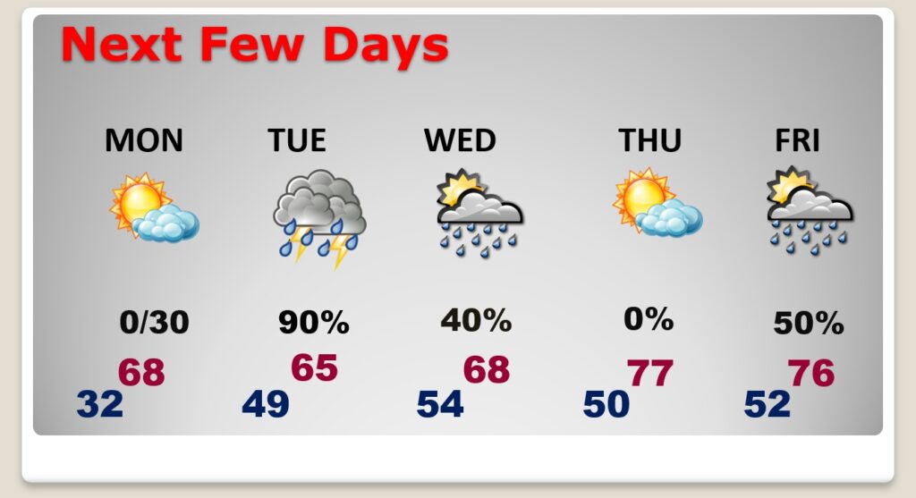
.
Have a nice Sunday! I’ll have a complete video in the morning, online by 4:45 AM.
–Rich