
Good Morning! Welcome to the First Day of Spring. The Vernal Equinox occurs at 10:33 AM. Today will be nearly perfect. Beautiful. In fact, Monday will be another remarkable weather day. Enjoy, because we will be dealing with a rather ominous storm system by Tuesday night. Concern is growing. This could be a significant severe weather threat, through the overnight hours Tuesday night into Wednesday morning.
It will turn cooler late week behind the storm system.
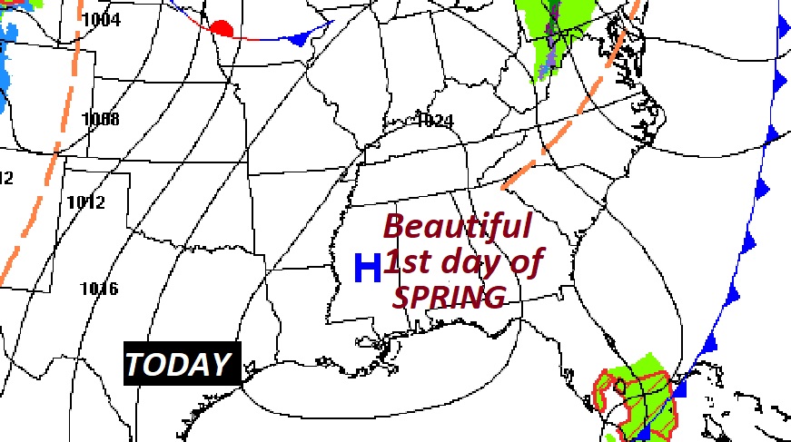
TODAY: Nice Day! Abundant sunshine. Warmer. Comfortable. High 74. Northwest wind 5 to 10 mph. Mainly clear, chilly tonight. Low 43.
Nice day across the southern U.S.
MONDAY: Sunny and nice. High 76. A great start to the week. Not as cool Monday night. Low 53.
TUESDAY STORM SYSTEM: The ingredients are coming together for a potentially significant severe weather event – starting in Texas and the Plains states Monday, and then tracking eastward through the lower Mississippi valley Tuesday…and into Alabama by late Tuesday and Tuesday night. The system will track eastward through Southeast Alabama and into Georgia and Florida on Wednesday. Here’s the set up on Tuesday morning. This is a very large storm system with many different aspects.
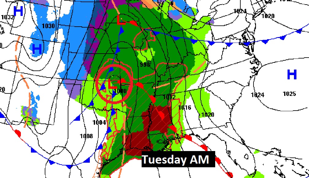
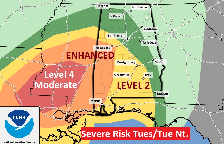
The Storm Prediction Center Outlook for Tuesday (through 7AM Wednesday) includes a Level 2 Risk for most of us. An Enhanced Level 3 risk noses into west Alabama, and an ominous Level 4 Moderate risk covers a big chunk of Mississippi. Unfortunately, all modes of severe weather are on the table, including a potential Tornado Outbreak. I’m also a little concerned that supercell thunderstorms could form ahead of the main mass of rain as early as Tuesday afternoon. That would include a tornado risk. We’ll see.
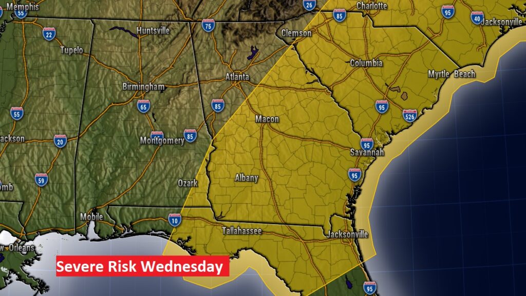
On Wednesday, the severe weather threat shifts eastward.
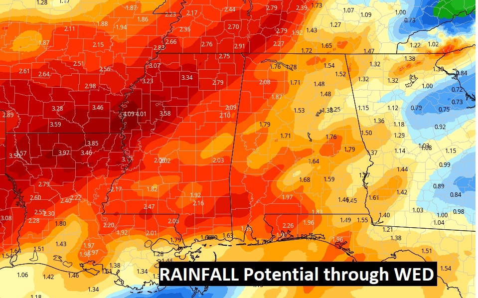
Locally heavy rainfall amounts are possible.
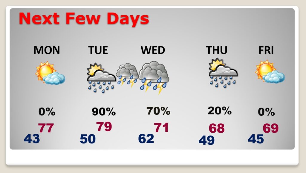
NEXT FEW DAYS: Beautiful Monday. Warmer. High in the mid 70’s. Showers & storms could begin late Tuesday. Severe storms Tuesday night into Wednesday morning. Cooler Thursday & Friday.
Obviously, we’ll know more details of this Severe Weather Threat tomorrow. We’ll start to focus on a timeline. “Tis the season for severe weather in Alabama.
Have a nice Sunday! I’ll have a complete video in the morning, online by 4:45 AM.
–Rich