4:00PM Update:
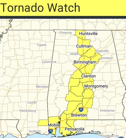
A Tornado Watch has been extended eastward to include much of central and south Alabama until 11PM. It goes as far east as Chilton, Elmore, Lowndes and Butler county. A few tornadoes are possible. Scattered damaging wind gusts to 70 mph. Hail also possible. Stay weather aware tonight. If you live in a Mobile home or Manufactured home, you can go to a “safe place” or “safer Place” in counties under the watch. Check your local county EMA social media post for the SAFER place near you.
130PM Update:
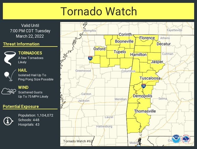
Latest tornado watch now covers the western strip of Alabama counties until 7PM. A few tornadoes are likely. Scattered wind gusts to 75 mph. Stay Weather Aware. #alwx
If you live in a Mobile home or manufactured home, many local counties have SAFER place locations that will be open IF and WHEN a Tornado Watch is issued. In Autauga county, you can go to FEMA rated shelters at the Boone’s Chapel Baptist Church, 2301 County Road 66. Also, Posey’s Road Crossroads Baptist Church, County road 40. In the City of Montgomery, The Montgomery Crisis Center, 3446 LeBron Road. There are many “SAFER” places in Elmore county, too. https://www.google.com/maps/d/viewer…
10:30 AM UPDATE:
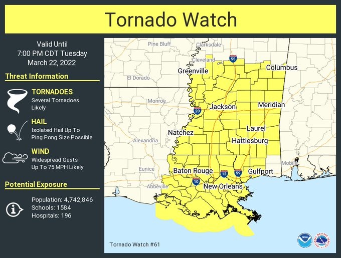
Latest tornado watch goes as far east at the Mississippi/Alabama line until 7PM. SPC says “Several tornadoes are likely”. Widespread wind gusts to 75 mph. Ping pong size hail. #mswx#alwx
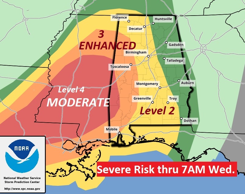
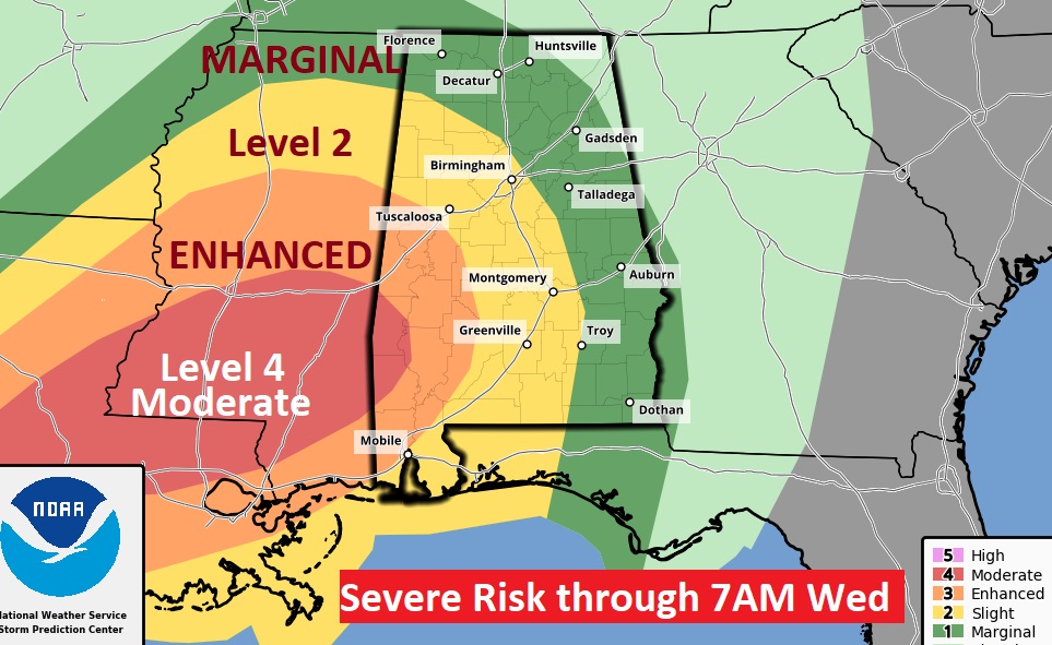
Updated outlook from the Storm Prediction Center. Main change on this update was the extension of the Level 2 risk area a little father east. Enhanced Risk covers west Alabama. Large level 4 Moderate risk over a large chunk of Mississippi. #alwx
EARLY MORNING UPDATE:
Good Morning! A large and rather dynamic storm system approaches. Strong to severe storms will spread into the state this afternoon, and move across the state tonight. All modes of severe weather are on the table including tornadoes. The greatest threat for severe weather will be across the western half of the state, but all of us are included in a severe risk. On this video, I have the latest of the threat level and the timeline. We’ll look at wind speeds & rainfall potential, too. Plus, a look ahead to the weekend.
Showers and storms will overspread the state late today into tonight. Some of the storms will be severe. All modes of severe weather are on the table including tornadoes.
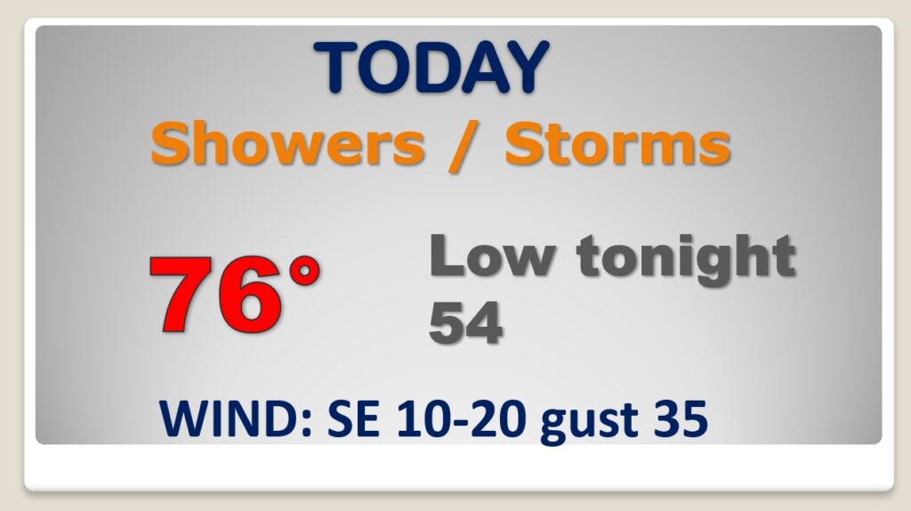
The greatest Severe Weather Threat will be across the western half of the state.
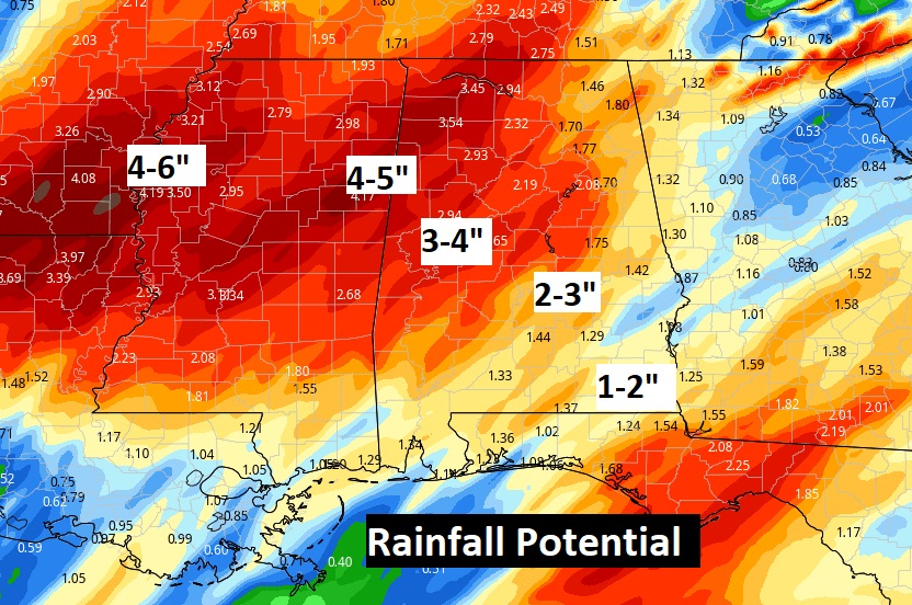
Locally heavy rainfall in spots, especially in west and northwest Alabama.
Wind advisory is in effect. Wind gusts could easily reach 35 to 40 mph.

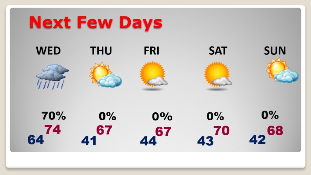
Storm-free weather Thursday through Sunday.